
Just for fun...
34 posts
13 users
13k+ views
13 users
13k+ views


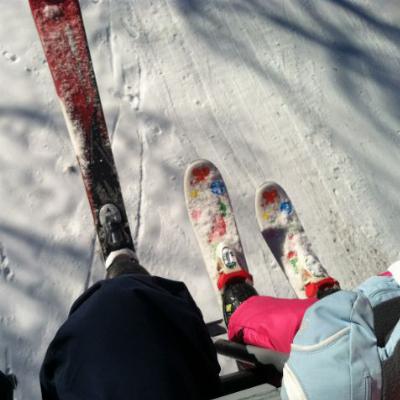
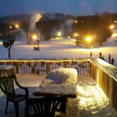
Been watching the Grand finale model maps for at least 12 days now & they have been pretty consistent with a cold/snow snap starting the end of this week..into the weekend & into early April.
I have tried like hell to swing some things around but I will not be able to see winters last gasp ...that is why I didn't post any weather stuff...leave that to the guys actually still skiing!..Well..at least i got another life..(fishn...)(Felt nice to be out on the Boat last weekend)...Anyway..Enjoy it you all!
PS..& chaga & crew..please post some apre lift skiing stuff for us shlubs!
I have tried like hell to swing some things around but I will not be able to see winters last gasp
...that is why I didn't post any weather stuff...leave that to the guys actually still skiing!..Well..at least i got another life..(fishn...)(Felt nice to be out on the Boat last weekend)...Anyway..Enjoy it you all!PS..& chaga & crew..please post some apre lift skiing stuff for us shlubs!
Just for fun...& I can post it because...SNOW IN THE CAROLINAS THE END OF APRIL????
http://www.met.sjsu.edu/weather/models/gfsone-12/sfc5f276.gif
& then up the coast to DC??...Fun stuff!
http://www.met.sjsu.edu/weather/models/gfsone-12/sfc5f276.gif
& then up the coast to DC??...Fun stuff!
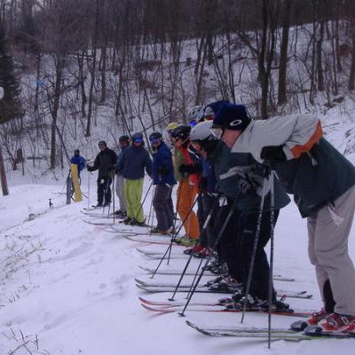
This maybe a pattern that I hate the most: warm March followed by a cold April.
Here is another insult to injury if it were to happen now that TL closes early...remember a storm that dropped about 15 or so inches around the 5th of april a few years back..when TL was still up & running?..ck this map out..
http://www.met.sjsu.edu/weather/models/gfsone-18/sfc5f348.gif
that shows the begining of a strong backside snow event to the Alpps on the 5th..HMMMmmmm...
& this next bout..
Wednesday Night: Rain showers before midnight, then a chance of rain and snow showers. Some thunder is also possible. Low around 30. Breezy, with a west wind 17 to 20 mph decreasing to between 9 and 12 mph. Winds could gust as high as 31 mph. Chance of precipitation is 80%. New precipitation amounts between a tenth and quarter of an inch possible.
Thursday: Snow showers likely, mainly after 2pm. Cloudy, with a high near 33. Chance of precipitation is 70%.
Thursday Night: A chance of snow showers before midnight. Mostly cloudy, with a low around 20. Chance of precipitation is 30%.
Friday: Mostly sunny, with a high near 35.
Friday Night: A chance of snow. Mostly cloudy, with a low around 28. Chance of precipitation is 30%.
Saturday: A chance of rain and snow. Mostly cloudy, with a high near 34. Chance of precipitation is 40%.
Saturday Night: A chance of snow. Mostly cloudy, with a low around 27. Chance of precipitation is 50%.
Sunday: A chance of rain and snow showers. Mostly cloudy, with a high near 37. Chance of precipitation is 50%.
Sunday Night: A chance of rain and snow showers. Mostly cloudy, with a low around 24. Chance of precipitation is 50%.
Monday: A chance of rain and snow showers. Mostly cloudy, with a high near
http://www.met.sjsu.edu/weather/models/gfsone-18/sfc5f348.gif
that shows the begining of a strong backside snow event to the Alpps on the 5th..HMMMmmmm...
& this next bout..
Wednesday Night: Rain showers before midnight, then a chance of rain and snow showers. Some thunder is also possible. Low around 30. Breezy, with a west wind 17 to 20 mph decreasing to between 9 and 12 mph. Winds could gust as high as 31 mph. Chance of precipitation is 80%. New precipitation amounts between a tenth and quarter of an inch possible.
Thursday: Snow showers likely, mainly after 2pm. Cloudy, with a high near 33. Chance of precipitation is 70%.
Thursday Night: A chance of snow showers before midnight. Mostly cloudy, with a low around 20. Chance of precipitation is 30%.
Friday: Mostly sunny, with a high near 35.
Friday Night: A chance of snow. Mostly cloudy, with a low around 28. Chance of precipitation is 30%.
Saturday: A chance of rain and snow. Mostly cloudy, with a high near 34. Chance of precipitation is 40%.
Saturday Night: A chance of snow. Mostly cloudy, with a low around 27. Chance of precipitation is 50%.
Sunday: A chance of rain and snow showers. Mostly cloudy, with a high near 37. Chance of precipitation is 50%.
Sunday Night: A chance of rain and snow showers. Mostly cloudy, with a low around 24. Chance of precipitation is 50%.
Monday: A chance of rain and snow showers. Mostly cloudy, with a high near
Taken from the White Grass website:

Quote:
Not in agreement with forecasts calling for chance of rain and snow showers Thursday and over the weekend for the Canaan area. I see occasional snow showers and colder temps from Thursday morning through Saturday evening with Friday (daylight hours) being the most settled. I believe colder air will work into the WV high country by early Thursday morning changing any light rain to light snow showers. Accumulations of 1 to 2 inches are possible by Thursday afternoon before ending. Over the weekend, another disturbances may affect the area by Friday eveing. With cold air in place, additional accumulations of 2 to 4 inches are possible by Saturday evening. Below normal temperatures should dominate from Thursday through the following mid-week. The Canaan Weatherman

DS Webcam is looking pretty good right now. Although their weather info is about a day behind.
Hope we do get some snow. With highs now forecast ~35, could be "fast loud powder" unless we get some freshies. Over two inches of rain has fallen this week.
WINTER STORM WATCH for the Shenandoah Valley!
Bring it on!
Quote:
Statement as of 1:58 PM EDT on March 25, 2011
... Winter Storm Watch in effect from Saturday evening through
Sunday afternoon...
The National Weather Service in Baltimore MD/Washington has
issued a Winter Storm Watch... which is in effect from Saturday
evening through Sunday afternoon.
* Precipitation type... snow
* accumulations... potential for five inches of snow... especially
across high elevations above 2000 feet.
* Timing... Saturday night through Sunday.
* Temperatures... lows Saturday night ranging from the lower 20s
along the high elevations to near 30 in the valleys. Highs
Sunday ranging from the lower 30s in the high elevations to the
upper 30s in the valleys.
* Winds... northeast 5 to 10 mph.
Precautionary/preparedness actions...
A Winter Storm Watch means there is a potential for significant
snow accumulations that may impact travel. Continue to monitor the
latest forecasts.
... Winter Storm Watch in effect from Saturday evening through
Sunday afternoon...
The National Weather Service in Baltimore MD/Washington has
issued a Winter Storm Watch... which is in effect from Saturday
evening through Sunday afternoon.
* Precipitation type... snow
* accumulations... potential for five inches of snow... especially
across high elevations above 2000 feet.
* Timing... Saturday night through Sunday.
* Temperatures... lows Saturday night ranging from the lower 20s
along the high elevations to near 30 in the valleys. Highs
Sunday ranging from the lower 30s in the high elevations to the
upper 30s in the valleys.
* Winds... northeast 5 to 10 mph.
Precautionary/preparedness actions...
A Winter Storm Watch means there is a potential for significant
snow accumulations that may impact travel. Continue to monitor the
latest forecasts.
Bring it on!
Where did you get that one Abe? I normally put a lot of trust in this site,
http://forecast.weather.gov/MapClick.php...nit=0&lg=en and they are not saying that, at least not yet.
http://forecast.weather.gov/MapClick.php...nit=0&lg=en and they are not saying that, at least not yet.
Yeah... the Winter Storm Watch is for Shenandoah Valley, Virginia (link). I'm surprised there aren't any advisories or watches for CV yet...
Interesting. For what it's worth I once skinned to the summit of Hawksbill from the skyline drive and skied down in early Apr. after a late storm left 1" in Fairfax and a foot up there. The Park service plows from Thornton Gap to Big Meadows. I believe it is kept open all winter.

http://forecast.weather.gov/MapClick.php...nit=0&lg=en
National Weather Service calling for 2-4" Sat night, with snow continuing through 4pm Sunday.
The Colonel
National Weather Service calling for 2-4" Sat night, with snow continuing through 4pm Sunday.
The Colonel
And the SS site says: "Plus, we have 3-7" of SNOW headed our way beginning during the overnight hours tonight..." That weather seems like it'll stretch all the way across DC. (we'll see). Guess there'll be no bathing suit skiing for Closing like last year! LOL That drive can be so treacherous I sorta abandoned my condo there and quit going. No matter how much $$$ they put into it on top...the 2 lane mountain switchback roads stay the same...and in a freezing rain/ice/snow mix ...
Well... the storm this last weekend didn't lay down quite as much snow as they were calling for, but there's another storm on tap for April 1st!
http://www.accuweather.com/blogs/meteoma...y-snowstorm.asp

Maybe another shot for some wet-powder skiing at White Grass?
http://www.accuweather.com/blogs/meteoma...y-snowstorm.asp
Maybe another shot for some wet-powder skiing at White Grass?
I know. And SS is notorious for closing with all trails open...because there are NO people!
Really wish I could have gotten out last week but things were crazy busy so no dice. It's irritating that SS is not open this week with all the coverage they have but I guess I can't blame them if no one is showing up.

I was there (SS) the past 2 weekends. Skied Sat and Sun. Ballhooter had small lines on Sat and maybe a 2 minute wait on Sun. Western Exp and Soaring Eagle had little or no lines all weekend.
I agree - too bad they are closed but I can see why.
No one on the slopes this Sunday. $26 lift tickets to the public and homeowners skied free all weekend. 39 slopes were open.
I agree - too bad they are closed but I can see why.
No one on the slopes this Sunday. $26 lift tickets to the public and homeowners skied free all weekend. 39 slopes were open.
Originally Posted By: fishnski
Here is another insult to injury if it were to happen now that TL closes early...remember a storm that dropped about 15 or so inches around the 5th of april a few years back..when TL was still up & running?..ck this map out..
http://www.met.sjsu.edu/weather/models/gfsone-18/sfc5f348.gif
that shows the begining of a strong backside snow event to the Alpps on the 5th..HMMMmmmm...
http://www.met.sjsu.edu/weather/models/gfsone-18/sfc5f348.gif
that shows the begining of a strong backside snow event to the Alpps on the 5th..HMMMmmmm...
& a week later its still on the Map...
http://www.met.sjsu.edu/weather/models/gfsone-18/sfc5f192.gif
Looks like a mid-winter forecast for CV over the next few days!
Quote:
Today: Snow. High near 34. Calm wind becoming southeast between 13 and 16 mph. Chance of precipitation is 90%. Total daytime snow accumulation of 1 to 2 inches possible.
Tonight: Snow. Low around 26. Southeast wind between 3 and 9 mph. Chance of precipitation is 90%. New snow accumulation of 1 to 2 inches possible.
Thursday: A chance of snow. Cloudy, with a high near 35. North wind at 5 mph becoming east. Chance of precipitation is 50%. New snow accumulation of less than one inch possible.
Thursday Night: Snow. Low around 26. East wind around 5 mph becoming calm. Chance of precipitation is 80%.
Friday: A chance of snow. Mostly cloudy, with a high near 34. West wind between 6 and 14 mph. Chance of precipitation is 40%.
Friday Night: A chance of snow. Cloudy, with a low around 24. Chance of precipitation is 50%.
Saturday: A chance of snow showers. Mostly cloudy and breezy, with a high near 35. Chance of precipitation is 40%
Tonight: Snow. Low around 26. Southeast wind between 3 and 9 mph. Chance of precipitation is 90%. New snow accumulation of 1 to 2 inches possible.
Thursday: A chance of snow. Cloudy, with a high near 35. North wind at 5 mph becoming east. Chance of precipitation is 50%. New snow accumulation of less than one inch possible.
Thursday Night: Snow. Low around 26. East wind around 5 mph becoming calm. Chance of precipitation is 80%.
Friday: A chance of snow. Mostly cloudy, with a high near 34. West wind between 6 and 14 mph. Chance of precipitation is 40%.
Friday Night: A chance of snow. Cloudy, with a low around 24. Chance of precipitation is 50%.
Saturday: A chance of snow showers. Mostly cloudy and breezy, with a high near 35. Chance of precipitation is 40%
Quote:
Looks like a mid-winter forecast for CV over the next few days!
Too bad we didn't get more of that forecast in March.


Originally Posted By: JohnL
Quote:
Looks like a mid-winter forecast for CV over the next few days!
Too bad we didn't get more of that forecast in March.
yeah but we got it now! April powder on base! You know what needs to be done
I think the Valley could hit the 200 inch mark by Sun eve..The 5 & 10 year averages are way up..Go..Go..GW!
Snowing hard per CV Cams..
Snowing hard per CV Cams..
From the WG page:
Quote:
Forecasting 6-to-12 for the 4-day total as measured at 3,700 feet NWS station Canaan Weatherman
Looking good right now. Dolly Sods webcam at Canaan Heights
http://www.fsvisimages.com/images/photos-large/doso1_large.jpg
http://www.fsvisimages.com/images/photos-large/doso1_large.jpg
looks like Afternoon sun enhanced Snow squalls right now with some steadier snow later this eve...Who is this Canaan weatherman with another Lame Spread predict like that...6 to 12?..I laugh at that  ..
..
With the snow & cold totals the canaan area has put on the board in the last 10 years & if the economy had been better we might have had a NE class resort up by now.. but then again with the Flack that was brought up over MPC & Almost heaven here at DCSKI of all places, then maybe not....Oh well..Wild-n-wunderful without the Couger,Wolfs,Elk..& even the Bisen that used to roam the area & a couple of allright but not right ski areas will have to do.
I remember a few lift tickets with April stamped on them in the Past...The good ole Days!
..With the snow & cold totals the canaan area has put on the board in the last 10 years & if the economy had been better we might have had a NE class resort up by now.. but then again with the Flack that was brought up over MPC & Almost heaven here at DCSKI of all places, then maybe not....Oh well..Wild-n-wunderful without the Couger,Wolfs,Elk..& even the Bisen that used to roam the area & a couple of allright but not right ski areas will have to do.
I remember a few lift tickets with April stamped on them in the Past...The good ole Days!
Is it cool to ski Canaan/Timberline after they've closed or would I need to hide from the authorities? Would Whitegrass be a better choice if I could get out there for Sunday?
I'm sure the only people you would have to worry about at Timberline this weekend are those who will get mad if you steal their line...
Originally Posted By: RodSmith
Is it cool to ski Canaan/Timberline after they've closed or would I need to hide from the authorities? Would Whitegrass be a better choice if I could get out there for Sunday?
Rod,
Ski away! You're in WV, not MD.
Per Management, the only requirement to ski Tline when the lifts aren't running is that you have to visit the Pub when you're done.

I'm a fan of the Amber Ale.
When ya heading up?
David are you done??
Canaan is not friendly to people climbing for turns when the lifts aren't running. I believe this is the policy of new management that took over in the last 2 yrs. or so. I have been asked to leave several times since this happened. Timberline has no problem with it.
Scott, no I've still got a few more weeks of classwork. Then I'll be in and out around Lewisburg until about mid-May.
DRUM ROLL PLEASE!!!
Apr 01 2.6 (new snow) 193.9
Apr 02 6.3 (new snow...8.9 storm total so far) 200.2!!!!
200 inches so far which will be bringing Canaans ave to about 165 at Valley floor level on up to about 200 inches for places like weiss knob & MPC...
Apr 01 2.6 (new snow) 193.9
Apr 02 6.3 (new snow...8.9 storm total so far) 200.2!!!!
200 inches so far which will be bringing Canaans ave to about 165 at Valley floor level on up to about 200 inches for places like weiss knob & MPC...
Originally Posted By: SCWVA
Originally Posted By: RodSmith
Is it cool to ski Canaan/Timberline after they've closed or would I need to hide from the authorities? Would Whitegrass be a better choice if I could get out there for Sunday?
Rod,
Ski away! You're in WV, not MD.
Per Management, the only requirement to ski Tline when the lifts aren't running is that you have to visit the Pub when you're done.
I'm a fan of the Amber Ale.
When ya heading up?
David are you done??
The bar stays open after the ski area closes!? Sounds fun. If I had a car, I would. Unless someone reading this offers me a ride, but I don't think anyone in this part of Maryland either reads this site or has skis that go uphill. I'll check back anyway on the off chance. I might have a car next weekend...