DCSki’s Editor is in the midst of a road trip through western states, in search of snow and adventure. After skiing in Idaho, Wyoming, and Colorado, he is now heading into Utah, where he has temporarily swapped his skis for hiking boots to hike one of his favorite trails in the United States.
After wrapping up a week in Colorado, it was time to head west into Utah to see what the skiing there is like. One of my favorite towns in Utah is Moab. It wasn’t directly on the way from Glenwood Springs, Colorado to Salt Lake City, but it was close enough that I decided to take a slight detour and spend a couple nights there.
I’ve been to Moab multiple times before, in every season. Located in the central Eastern part of Utah, Moab is at the doorstep of Arches National Park, which is home to over 2,000 natural sandstone arches. One of those arches — Delicate Arch — is so extraordinary that its image is placed right on Utah license tags.
But Arches isn’t the only National Park located near Moab. Canyonlands National Park is just across Route 191 from Arches, and offers its own magical landscape. Canyonlands itself is divided into three distinct sections: Island in the Sky, which is closest to Moab and offers expansive views; The Needles, which is off the beaten path and provides more of a backcountry experience; and The Maze, which is so far off the beaten path that few visitors ever make it there without the assistance of a capable Jeep, donkey, or perhaps as the result of an enormous geographic skydiving miscalculation. Although the three areas of the park touch each other, getting from one area to the other can require driving a full day or more. Canyonlands is one of the most rugged and remote National Parks in the lower 48, and particularly in the winter, you might have tens of thousands of acres all to yourself.

On a past visit to Moab one summer, I made a day trip to the Needles District and discovered a hiking trail that left an imprint on me. I’ve hiked many trails all across the country, but the Needles District offered a trail unlike any I had experienced, providing a fantastic mix of beauty and variety. Around every corner, the landscape reset to a stunning new otherworldly-display of rocks, canyons, and meadows. I expected to see Wile E. Coyote in rapid pursuit of the Road Runner, with a “meep meep!” echoing throughout the vast landscape.
On that summer visit, I made a rookie mistake: I brought more water and Gatorade than I thought I would need, but severely underestimated how much was required during a day of rigorous hiking in 105+ degree temperatures. I ran out of water before I ran out of trail. Thankfully, I made it back OK, but I had to turn around before I wanted to. By the time I reached my car, I was parched, dizzy, and may have had a conversation with a cactus.
I vowed I would return during the winter to explore more of the trail when heat exhaustion would be less of a risk.
And I did, a year or two later; but snow and ice had made the Needles District completely inaccessible, so my efforts to further explore the trail were once again scuttled during that second visit.
But not this time. Late on Thursday, February 22, I arrived in Moab. I set an alarm clock for an unreasonably (to my body) early time because snow was forecast to arrive late the next day, and I wanted to be off the trail before that hit.
The next day, I woke up to light snow falling. What? It wasn’t supposed to start snowing until the evening! This put a wrinkle in my plans. The Needles District is in a remote part of Utah, and the paved road going there wasn’t likely to be plowed.
Even if I made it into the Park, that would still leave me a few miles away from the trailhead; the trailhead could only be reached via a several-mile-long dirt road that became impassable during rain or snow. And, the hiking trail — which goes over a lot of three-dimensional slickrock — could become extremely treacherous if covered by snow or water. They don’t call it slickrock for nothin’, and while some errant slides down slickrock can be fun, the wrong slide or slip could lead to Certain Doom. I didn’t want to become food for buzzards.
So as I watched snow falling, all of my better judgment told me to punt on the idea of visiting Needles. Live to fight another day and all of that.
But I was already in Moab. And I had woken up early — I don’t like doing that! It makes me fussy and impairs my judgment, exacerbated by the fact that I also don’t drink coffee. And I knew that precipitation in the high desert could disappear quickly — although temperatures were well below freezing, the arid air combined with sunshine meant that snow didn’t stick around long on the desert floor. And maybe it wasn’t snowing in the Needles.
After gasing up the car, I cautiously headed south on Route 191 towards the Needles. The snow only picked up as I went along. At first, the snow blew around and danced on the pavement like sublimating dry ice. It was a neat effect. But as I drove further, it began to collect on the ground. Things were starting to look dicey.

Soon, the snow became heavier, and I couldn’t see more than 10 or 15 feet in front of the car.
“It’s not too late to turn around,” said good-judgment-Scott on my left shoulder.
“You’re almost there,” countered bad-judgment-Scott on my right shoulder, adding “This Hertz SUV has four wheel drive, pansy!”
I reached Route 211 and turned off 191. I vaguely remembered this stretch being mostly straight and flat, forgetting the canyon you have to weave through about a 1/3 of the way through. That canyon was the scariest part of the ride — my tires struggled to grip the virgin snow, while my eyes noticed there were no guardrails and steep drops to the sides.
But taking it slow, I was fine. And shortly after exiting the canyon, the skies began to clear. The snow stopped, some blue sky elbowed its way through gray storm clouds, and the sun even poked its head through the blue sky.
I arrived at the Needles District Visitor Center, which like many National Park visitor centers in remote places completely shuts down for the winter. No interpretive slide shows for me, although the outside restrooms were still open. Rangers had placed helpful information outside including winter hiking tips (essentially admonishing you not to do them unless you really know what you’re doing), park maps, and even little portable bathroom kits for backcountry hikers braving some winter camping.
I packed up my backpack and considered my layers. It was biting cold and windy. When I hike alone in places like this, I always assume that Something Might Go Wrong and I might be forced to spend an unexpected night (or two) in the backcountry. So I bring enough gear to survive a frigid night in the backcountry. Although it was cold, I was still in a desert, and that meant bringing a lot of hydration. And I have a lot of heavy camera gear. So before long, my backpack was weighed down with gear. I had several layers of clothing underneath my ski pants and ski jacket.
There was one slight problem. Upon reading this sign, I remembered that I was smart enough to bring my slip-over-the-boot crampons all the way from Maryland on this trip, just for hiking on snow or ice:

While I was smart enough to haul them across the country, I was stupid enough to leave them back in my hotel room in Moab, some 2 hours away.
“Don’t worry, it’ll be OK, you worry wart!” said bad-judgment Scott on my right shoulder.
I shrugged and carried on.

It’s several miles on a rough, unpaved road to reach the trailhead, but while there was snow many places on the ground, thankfully the rougher parts of the road had already received some sun and the snow had (mostly) melted off.
Arriving at the trailhead, there was one other lone car. I never crossed paths with the occupant of that car, although at one point in my hike I thought I heard some voices echoing in the distance.

Within minutes I was hiking, making a short climb up and out a canyon and arriving on a plateau with the first of countless stunning views.
The reward for my poor judgment of heading out into the snow was an extra color weaved into the rich landscape of the high desert: white. A touch of snow adds a nice contrast to the rich reds, browns, and occasional greens of the high desert, making an already stunning landscape even more stunning. The snow typically doesn’t last long in the arid, parched environment, and almost all of the snow I saw hiking out had disappeared by the time I hiked back.

Up until now I haven’t given the name of the trail.
That’s because this entire time, I’ve been debating about sharing it. On the one hand, it would be the nice thing to do. On the other, I really like this trail and part of my fondness is the fact that it’s my trail — I haven’t witnessed more than a few other human souls on it. If I share the name, people like you are probably going to want to hike it yourself, and that could get out of hand.
But, alas. I’ll sneak in the name of the trail in T minus 6 paragraphs.

As I’ve said, my favorite part of this trail is that every corner you turn reveals a new surprise. At one point, the trail heads into an enormous rock that you soon realize is two enormous rocks, barely touching each other.
The cairns point you to the narrow gap between the rocks and you squeeze through, trying to resist the urge to yell “echo!” at the top of your lungs just to see what kind of acoustical wonderment results.
Caving into that temptation, you are relieved that your vocal shenanigans didn’t set off standing waves that caused the rocks to cave in on you, and you exit the narrow squeeze only to be presented with yet another phenomenal view.


After weaving in, around, over, and through a rocky playground that would cause the most serious and stately geologist to yelp out in joy like a little kid, suddenly you round a corner and are greeted with a meadow.
That’s right. A meadow. In the middle of arid, rocky Utah.
This meadow is Chesler Park: the namesake for the trail. You look at it with a sense of confusion (“what is this doing here?”) as well as a sense of relief (“that looks pretty flat — my legs and lungs could use a break.”)

The beginning of Chesler Park was the furthest I had reached on my previous summer visit — and the point that I realized I had gone through more than half of my water.
I did a water check: still plenty! And a leg check: still working, both of ‘em! That meant I could continue hiking and explore areas I had never seen before. I was stoked!
I hiked through Chesler Park until I arrived at another trail sign. There are several different trail systems that intersect in various ways, so it’s possible to “build your own trail adventure.”

“Druid Arch — that sounds interesting!” I thought to myself. “I like arches!”
So I began venturing off in that direction.

Canyonlands continued to serve up surprises around every turn.
One of them was a steep, smooth rock scramble that was covered completely in shaded snow.
“That’s going to be tough,” I thought, as I looked up at it.
I gingerly placed one of my hiking boots on the side of the rock.
The boot said “nuhh…ope!” and immediately slid right back down.
“Huh.” I said. “Those crampons back in the hotel sure would be useful right about now.”
But I grew up as a Colorado Cub Scout, and by golly, I knew how to MacGyver myself out of a tricky situation.
I began pilfering through my backpack, tossing things aside in my search for a bobby pin. It’s a well-known-fact that bobby pins can get you out of any precarious predicaments.
Finding no bobby pins (curses!), I needed a Plan B. I found some rubber twisties that I normally used to wrap up cables with. Twisting several of them together, I was able to wrap them around one hiking boot (sorry, second hiking boot — maybe next time?), which immediately added some traction. I then found various pieces of nearby desert-things (such as bits of bark) and shoved them between the sole of the hiking boot and the rubber twisties, adding a bit more traction.
The new-and-improved (and clearly fashionable) hiking boot was placed against the snowy surface. Pressure was applied. It didn’t slip! I was triumphant, and carefully climbed up and over the rock, hoping the snow would melt off by the time I was headed back so I wouldn’t need to repeat these charades.
Soon after, the trail presented its best gift to me yet. Not one, but two unexpected slot canyons, back to back.
This was so cool. A deep cave beckoned me in, getting ever narrower as sunlight began to disappear through a shrinking gap high above.

“Is this where I’m supposed to hike?” I wondered, searching for cairns on the floor but finding none.
No matter; obviously, I was going to hike in until I could hike in no more.
Turns out I couldn’t hike in very far before I could hike in no more, so I backtracked, continued down the trail, discovered a second slot canyon, and repeated the same process.
The trail continued and reached a precipitous drop.
“This can’t be right,” I thought.
But a series of cairns clearly showed that I was expected to navigate the drop. I spent a few minutes searching for an alternative path down, but couldn’t find one.
“Hmm.”
With an extremely heavy and awkward backpack, my balance was a bit off, and I didn’t want to risk just tossing my backpack down until I was convinced I could safely follow it down myself.
Eventually I carefully found a way to grip the rock and gingerly work my body down, but I was worried — I wasn’t at all convinced I could repeat the process on the way back up.

I soldiered on. Soon the trail ended up right in a canyon — the type that has a dry river bed most of the year, except not today. Today there was a trickle of water working its way through the canyon, the result of melting snow. I followed the canyon for a good bit until I was perhaps half a mile from Druid Arch, which I couldn’t see.
That’s when my efforts were finally scuttled. While the trail had been in the center of the river bed for most of the canyon, it eventually veered off to the left, leading to a steep rock scramble. A good chunk of it was almost completely vertical, requiring careful hand holds and balance.
And that part was covered in ice.
I stared at it for a good, long while.
“There is no way you can safely get up that,” said good-judgment Scott on my left shoulder.
“Yeah, you’re not going to be able to do that,” agreed bad-judgment Scott on my right shoulder.
The rare agreement between good- and bad-judgment Scott made me sigh as I realized this would be the end of my hike.
Except I didn’t quite give up that easily. I hiked back down to the canyon and continued hiking up it for another quarter mile or so. I wasn’t on the trail anymore, but footsteps in the sand from past visitors showed that many others had made the same attempt to find an alternate route up.
This was a search in vain, but there was a nice consolation prize: the navigable part of the canyon ended in a frozen waterfall and pond. Slowly dripping water echoed through the canyon. It was very relaxing. It was also very obvious that there was no way to proceed forward.

Which was probably for the best. By now my feet and legs were quite sore, and my right knee began to smart with every step. And I still had 7 or 8 miles to hike back.
On the way back, I missed a turn. But that was fine — it led me to an intersection with another trail that took me in the right direction back towards the trailhead.

The last mile of the trail was rough — my knee was screaming out in pain every time I took a step, particularly when I went downhill.
By now I had shed most layers of my clothing, stuffing them into an already-overstuffed backpack. Soon I would have to start layering all up again — the winter sun was quickly setting towards the horizon, shifting the color temperature of the landscape to warmer hues. I realized that if I had made it all the way to Druid Arch, I might have ended the hike in the dark.
I was exhausted by the time I got back to Moab, but I think I had a smile on my face the entire drive back. I had made it back to Chesler Park, and discovered even more wonders hidden in its canyons. I can’t wait to visit again in the future.
With an epic hike under my belt, I was ready to continue on to Salt Lake City the next day. In the first couple weeks of my road trip, Utah had finally received long-overdue snow, setting up some pretty good conditions at the Utah ski areas. I looked forward to hitting them next.


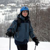
M. Scott Smith is the founder and Editor of DCSki. Scott loves outdoor activities such as camping, hiking, kayaking, skiing, and mountain biking. He is an avid photographer and writer.

Great story Scott. I got lost in it. Just like when I was there. It’s a place that casts a spell.
Just took another look at this report. Amazing landscape photos Scott! I may try to do a hike in this fascinating area in the spring of 2019. If I do, I'll refer back to this article.

Join the conversation by logging in.
Don't have an account? Create one here.