
Corridor H Question
33 users
34k+ views

My question is how to get from Forman to Davis without driving way south first? Mapquest wants you to drive practically to Petersburg after leaving Forman. There's got to be a more direct route from Forman to Davis, doesn't there?
It is a large track of 'Forgotten Land'..the locals look at you in the same way those south American native tribesfolk looked at the people that discovered them after centuries of isolation!
Untill someone trys it from where the H ends now & posts times, I would do what Myrto says..safer bet.
Not sure about Mr. Fish's wild ride, but I agree with him that we need intel. I usually come in from the north off of 50 and either drop down to Scherr or go up to Mount Storm. This would be a faster way assuming the 5.6 miles is passable (in winter). Are there not some locals on this site that are willing to take a Sunday drive??

The Greenland Gap road is as described...paved, but 1.5 lanes in places and with very old and degraded surface in places. We have not driven this route in winter because we assumed that GG would be a complete time sink, and the switchbacks b/w Patterson Creek Rd. and 220 would be mighty slow going also. Still, hard to see how with the new section, this isn't a viable option. Even if the 5.6 mi to Scherr takes 20 mins, its still reasonable in the overall picture.

The Colonel


Greenland Gap road is freshly paved but is only 1.5 lanes wide at best in many sections and has no lines painted on it at all. I see it as a great option for daylight drives in dry weather. The gap itself is extraordinarily beautiful and reminds me of some of the steep notches that cut through the mountain ranges in New England. It will probably become my regular summer route to Canaan.
As for winter, I am sure Greenland Gap Road will not be plowed like 50, 55, or 32 - the WVDOT plows will take up the whole road going one way. There are some tight and treacherous curves as well as some short steep climbs as the road winds through the tight canyon. The road runs under towering cliffs and doesn't get too much sun, so I expect it could stay snow covered and icy long after the main roads have melted off. I didn't check my cell phone service, but I can't see it working too well in there. Getting stuck in the Gap would not be fun.
I also noticed lots of work along the Corridor H right of way up to Davis. Someone has already clearcut the timber alongside 93 outside Davis for what I suspect is the future roadbed for Corridor H. The pilings and flyovers for future Corridor H bridge are completed just outside Scherr before the base of the climb up Mt Storm. Checking out Google Earth it looks as if the road will traverse the ridge opposite the Allegeny front then cross 93 and proceed up the front through the current area off 93 recently opened as a quarry. I guess the extractors are getting their extracting done before the road comes through.
Tom
Well..That was the post we were waiting for...Thanks for the front line report TGD!!
I have replayed the scenario many times and attribute the accident to the following factors in likely order of importance.
1. Too much speed for the conditions. This one is insidious and hard to judge. Be conservative.
2. I remember driving off the edge of the asphalt onto the dirt. In driving back onto the pavement that 1-2" ledge started me skidding. I probably should have opted for a slow stop on the shoulder.
3. The short wheelbase of the Jeep Cherokee made the fishtail oscillations very quick and it threatened to flip. My alarm level went up just as quickly and all fine motor control for steering out of the skid was lost. I slid off the right side of the shoulder and rolled down a small embankment.
4. The locked hubs design of the Jeep's 4WD with a limited slip differential. It felt like all 4 wheels had lost grip with the pavement. Now I have a Subaru Outback with a longer wheelbase and AWD.
Now I never take 93 in bad weather or at night. I expect that the new Corridor H will have guard rails, hopefully with reflective tape. These features would make it safer than 93 but still subject to the weather up there. Nobody can do anything about that. The long curving downhills on Cor H between Wardensville and Moorefield worry me too. Carry too much speed on a slippery road and one could easily roll over a guard rail and in places down hundreds of feet before stopping.
not sure what i could have done to prevent the slide, as i was driving well below the speed limit. we slid straight off, perpendicular to the lane direction and were lucky not to roll over. there is no guardrail there.
am hoping that an eventual corridor H connection to davis will at least have less curves, and more guardrail, if nothing else.
40 mile an hour gusts, blinding snow, WV's notoriously efficient snow removal, and lastly the fog from the lake.
I have had this happen to me plenty of times on Mt. Storm, and plenty of times on I-68.
I sure hope they mark the road well from Scherr to Davis.
not sure what i could have done to prevent the slide, as i was driving well below the speed limit. we slid straight off, perpendicular to the lane direction and were lucky not to roll over. there is no guardrail there.
am hoping that an eventual corridor H connection to davis will at least have less curves, and more guardrail, if nothing else.
Yikes! Glad your story had a happy ending too.

40 mile an hour gusts, blinding snow, WV's notoriously efficient snow removal, and lastly the fog from the lake.
I have had this happen to me plenty of times on Mt. Storm, and plenty of times on I-68.
I sure hope they mark the road well from Scherr to Davis.
Scott (SCWVA) told me a good story once about some people from his group following their GPS to CV and ended up traveling on some dirt roads and eventually discovered Bear Rocks. I guess Magellan thinks that straight over the Sods is a good shortcut to the Valley.
Glad to hear you were OK!
Exact same conditions you described on 219 between Wisp and CV, route i would take from State College to the valley. 2/3 times that I have made the trip the weather has been generally fine even through Wisp but once you hit the WV state line all of a sudden you are on elevated terrain with farmland on both sides. Once we drove through there and it was barely even snowing but it was cold and there was fresh snow on the ground and the result was blinding snow and almost no sense of where the road/lanes were....
I am hoping that the end result of Corridor H is that the route to CV is MUCH safer and as others have said, lack of switchbacks and guardrails should help a ton. But as Keith said, worst is going to be the DC GPS driver who drives 60 through snow and feel safe simply because their SUV has 4 wheel drive and they are on a highway. Also, not as big of a problem in WV, but in PA the WORST is truckers going 65 through driving snow with zero regard for the rest of human kind.

Hehe. I /like/ driving behind most truckers in snow, especially someplace like I-81 or the turnpike.
I would far rather have them on the highway driving 65 than the normal run of lane-weaving, brake-jabbing, hazard-flashing urbanites doing 35.
Pretty cool
http://www.youtube.com/watch?v=k6dbmN2YjOk
I've been in quasi-whiteouts on 93 myself so I understand what can happen there. Then again, I've been in an equally wicked whiteout on I-68 east of Morgantown and into Garrett County (and I was damn glad to have a couple tractor-trailers to follow). It really is just inherent in the topography. And I have seen some nasty accidents on the steep grade on 32 between CV and Harman. Not to mention the section between Harman and Seneca Rocks referred to above.
Bottom line for me is that Appalachian roads can get very treacherous in snowstorms anywhere there is windswept terrain or steep grades. The best way to avoid problems is to get there before the storm, and leave afterwards. When that's not possible, all else being equal, I would much rather be on a four lane highway with guardrails, reasonable grades, wide shoulders, etc., plus the hope that, being a primary travel route, a four laner might actually get plowed/treated more frequently.
Bear in mind speed on CH with such amazingly steep and high embankments has proved fatal already. So mixed with winter weather, everyone BE CAREFUL!
As to snow removal, in my experience WV does a far better job than VA and a better job than MD. This is despite the fact that it snows more and harder and the wind blows harder in WV. The one place that is consistently bad, again my experience, is Preston County. Both Garrett and Tucker are better, often significantly. Still, of all the ways I know to connect N VA with the valley, I-68 followed by 219 seems safest. The road is straighter and the grades less steep. It is slower, but it's my bailout route in tough conditions.
I can't wait until its finished, the drive from Davis to C-Ville is currently only 2.5 hrs, with the completion of Corridor H, my guess the drive will only be 2hrs!
When I was last up there, the only earth moving going on was from Scherr to Bismark going up the mountain. Where did you see the overpass possibly going in at?
Just a worthwhile note, one local did tell me that there will be an intersection at Bismark right at the top of the mountain right before you get to the Liberty gas station, not an overpass there.
I am told the work is awarded and started, but haven't really seen that.
Of course, everyone has seen the flyover crossing of 93 in Greenland Gap that is well along.
The leaves started changing a couple of weeks ago, won't be long now.
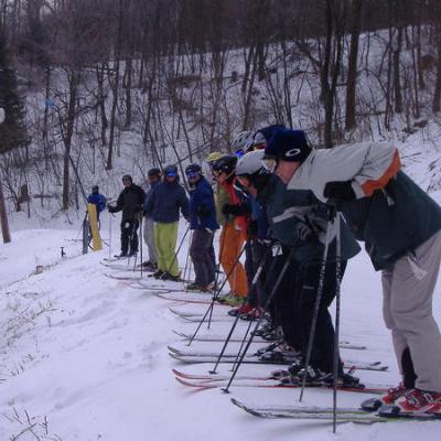
There can be some serious weather on that high plateau that 93 takes heading to Davis. Plenty of blowing and drifting and fog/poor visibility. It can be real treacherous even during heavy rain (hopefully but not always during the ski off-season.)
http://list.uvm.edu/cgi-bin/wa?A2=ind0103C&L=SKIVT-L&T=0&O=A&P=99140
If Corridor H follows the same route, it is going to be subject to the same weather so I will continue going through Seneca Rocks in snow, or, if it's really intense, I-68 to 219 S to Thomas then 32 to the valley.
I am debating whether I need to pick up some cables or chains for my Pathfinder 4x4 this winter or find some winter tires to have mounted, maybe even getting a spare set of wheels for them. I know the snow storm we drove through the next weekend(in my wife's Kia Rio, some people just don't learn) near Wintergreen sure made us nervous and the first snow storm I drive through this winter will definitely have me a little nervous and driving about 5 - 10 mph slower than in previous years.
I just took the new exit at Rt. 48/93 home from the Valley and I believe the new exit actually adds time to the drive to & from the Valley.
I just took the new exit at Rt. 48/93 home from the Valley and I believe the new exit actually adds time to the drive to & from the Valley.
Agreed. I timed it the last time up. Going to the end and doubling back added 10 minutes to my drive time compared to getting off at Knobley and taking Greenland Gap Rd over to Scherr (not going SW to 42)
Well, count me in that group. (Never heard that expression.)
I'm surprised the new exit is not a wash compared to Greenland Gap, if not just a bit faster. (Very surprised that it would be longer time-wise.) Doing a quick eyeball on Google Maps, looks like the new exit is 4 extra miles. 4 miles at 55-70 mph is less than 4 minutes. (Are you getting caught behind trucks on 93?) I could easily save that time on GG road. How fast do you guys normally drive down GG road and the roads over that temp bridge?
But still you need to drive on 93 from Mt Storm to Davis and I don't think it's a safe route in winter?
But still you need to drive on 93 from Mt Storm to Davis and I don't think it's a safe route in winter?
No road in WV is completely safe in winter. In all but the worst of conditions, I'll take the 93 route since it's a lot faster.
But still you need to drive on 93 from Mt Storm to Davis and I don't think it's a safe route in winter?
I don't like 93 in a blowing snow storm - otherwise it is fine. On a clear day, the windmills on Mt Storm are visible from Corridor H just before you pass Moorefield. If you can't see them, then it's likely blowing snow pretty hard up there. On those trips, I like to exit in Moorefield and drive into the Valley via the southern route through Seneca Rocks and Harman.
This was suggested in another DCSki thread:
I-66 West, I-81 South, 55 West into Corridor H and get off at Patterson creek rd (south), merge into 42 South, then 28 south and then 66 west and turn right to Snowshoe!
Asking for a friend who lives in DC. Coming up from Raleigh, I take WV93 off I-64 and then go through Marlington. Have been on 66 east of Snowshoe with snow on the road and do not care to repeat the experience.
HE LIVES!!!
I don't like 93 in a blowing snow storm - otherwise it is fine. On a clear day, the windmills on Mt Storm are visible from Corridor H just before you pass Moorefield. If you can't see them, then it's likely blowing snow pretty hard up there. On those trips, I like to exit in Moorefield and drive into the Valley via the southern route through Seneca Rocks and Harman.
Great idea, thanks!
ummm - you CAN'T get there from here (especially in bad weather)! LOL LOL
Been doing it for 7 years - only way: 66/a little 81/55W Moorefield, Petersburg/Seneca Rocks, Green Bank and up. Corridor-H beyond Moorefield just takes you north out of your way. Seen the road up from Marlinton (if coming from the South) closed on occasion...but then, also found abandoned cars on the back entrance to Snowshoe from Green Bank too!!! Did the trip once (once) at night 6 years ago and once (once) during a snowfall...neither twice. Between falling rocks, black ice and deer, still wrecked the Jeep 3 times!!!
Some people like that option heading to SS because you bypass Moorefield, most of Petersburg, and some of the heavier traffic (often truck) between Moorefield and Petersburg. YMMV.
Associated Press - Wed, Nov 28, 2012
Gasoline prices rise in West Virginia
CHARLESTON, W.Va. (AP) - Gasoline prices have risen in West Virginia over the past week. AAA East Central says the average price for a gallon of regular, unleaded gasoline in the state is about $3.60. That's more than six cents higher than a week ago and about 24 cents higher than a year ago. Prices range from about $3.70 in Martinsburg to $3.50 in Huntington. Nationally, gas prices average $3.42 this week.
Guess Obama gave WV coal mining the shaft, now the citizens! LOL Best gas prices were the 1st two stations on 55 off 81 (actually still in VA). Now with the Canyonero, may have to be more cognoscente of gas!
Think gas prices will have any affect on the ski industry? Probably not - if you can afford skiing or golf...gas ain't nuthin'.
Associated Press - Wed, Nov 28, 2012
Gasoline prices rise in West Virginia
I personally prefer to bypass Moorefield and Petersburg and use Patterson Creek Rd. I think it is faster and is no more dangerous than the route through Moorefield/Petersurg in winter (the road are in low elevation). You can easier save 10 minutes. You can still stop at other gas stations en route to Snowshoe. There is no big grocery store like Food Lion on that route but I prefer to shop and prepare for food before leaving DC anyway.

Unfortunately, the only refinery WVa has got ships its stuff out by barge.
Any updates?
From the website:
Construction is underway for the entire length of the Bismarck to Foreman section. In October 2010 the WVDOH opened Corridor H from Knobley Road (Grant CR 3) to Moorefield. Paving is underway from Grant CR 1 to Knobley Road to Bismarck (at the top of the hill), with the first 5.3 miles from Knobley Road to WV 93 opened to traffic in late 2012 and the remaining 4.05 miles anticipated to be completed in the fall of 2013.
The WVDOH anticipates that the Bismarck to Forman section of Corridor H may be completed in fall 2013.
Was not open last weekend but hopefully any day now.
The last I heard was that the section from Scherr to Davis wouldn't be 100% open until late 2014 or early 2015. They might be able to shift the current traffic from Rt 93 to the half of the road that is about to be completed between the Bismark bridge and Davis. Which means Rt 93 will still be one lane in each direction. Currently, RT 93 is a mess and the police are heavily enforcing the 45mph speed limit.
SCWVA
but on the webiste they treat the 42 section (bottom to top), as a different project/phase than the route 93 section (power plant). My fear was that they had lumped these together and delayed completion of both. Like many I would be happy just to have it dump me at the Bizmark gas station, but avoid the windy trip up the front. So is ScottyB right that this section will open prior to 2014/2015. Thanks for the intel on 93 being a mess up top.
I was up there just about 4-5 weeks ago and I can say the bottom to top of Scherr Mountain sections are nearly complete. Not only is this from the visuals I got, but from a friend who I play basketball with who is a former crane operator on that very section of Corridor H. Currently that 4-5 mile section from Rt 93 at the bottom to the Scherr BP gas station is 95% complete. I believe final paving is done and only thing left is guardrails, signage, etc.
The top of Scherr Mountain is a mess right now at the BP station. There is a detour as crews are placing 2 corridor h bridges across a modified Rt 93/42 section. As I traveled the brief detour around these bridges, I looked to the right to the section heading towards the bottom of the mountain, and it indeed does look done. However from this intersection towards Davis is barely 50% done with basic roadbed formations being worked on.
However, here's the kicker. It appears there is NO intersection entrance/exit ramps at the bridges crossing 93/42 near the BP station. This leads me to believe that the state may not open the bottom to top of Scherr Mountain section until the final section to Davis is open. I could be grossly wrong on this and entrance/exit ramps could be in the next phase, but it just didn't appear that way. Since I haven't been down by the power plant in 2 years, I don't know if they are adding any on off exits down there either.
According to WV Dept of Highways Corridor H web site the Bismark to Rt 93 connector at Mt Storm portion is supposed to open in fall of 2014, with full completion to Davis by summer 2015.
No mention of allowing traffic to BP at Scherr this year. BOO!!
The Colonel
Isn't the bottom, Scherr? And the top/gas station, Bismark?
http://www.wvcorridorh.com/route/lrgmap.html
Quote "The WVDOH anticipates that the Bismarck to Forman section of Corridor H may be completed in fall 2013."
Where did you find this quote? Good news if true!
oK, I found the quote but I cannot tell if this page of website has been updated since full site update indicating a construction delay caused by a reduction in federal funding?!
Could one of the DCSkiers that live out near Canaan contact the WVDOH or officials in Tucker/Grant counties for the latest info, or check with TL or Canaan Valley resort for what they are hearing? The latter have a real financial interest!
The Colonel
Had to go up to the valley 2 weeks ago, Looked like H was marked with had signs in place at Scherr and up the mtn.
Talked with one of the Flaggers at construction and she said the next section from Scherr to Bismark will open by Nov 15 or 27th if the weather is an issue.
Thanks for info, bit by bit we inch closer to Canaan Valley. I do caution all to read Denis's posts about driving portion from Bismark to Davis in a snowstorm! Driver BEWARE.
The Colonel
I drove it yesterday, 11/13/13. Much work underway but it is not open any further than last spring. You must get off on 93 in the valley, about 3 miles from the intersection of 93/42 at the bottom of the mountain.
I heard will open 11/22. Heading up 11/25 for the holiday week. Planning on hiking and skiing a few runs. Also hears about a potential storm next week.
3skiwv wrote:
I heard will open 11/22. Heading up 11/25 for the holiday week. Planning on hiking and skiing a few runs. Also hears about a potential storm next week.
....also, this is Todd E from old DCSki (Skitline was my screen name but i couldnt log in with it) so created a new one :)
Got it from a reliable source that the section up the mountain WILL be opened on Friday. Good news for most of us. I may give it a try on Friday morning.
SOOO awesome...will be on it Monday night.
Scherr to Bismark is opening at 12:30pm on 11/22/13. here is a news article
http://wvmetronews.com/2013/11/21/new-miles-of-corridor-h-to-open/
No...does not compute in this case. Brad W is an IT professional.
The Colonel
fishnski wrote:
Baywalker..brent Walker spokesman for WV dept of trans......hmmmmmmm....
*cough*secretlife*cough
So, given that's it's been a little while since I drove this, how far do we need corridor H to go for optimal routing to both Snowshoe and Timberline?
Unfortunately, IIRC, the VA portion will be done dead last, right? Does this new opening basically connect to 93 where it joins with 42?
In regards to the Wardensville to VA link of Corridor H, that I suspect would be done dead last, if never done at all. Primarily because of the amount of private homes that it would end up destroying in the process. Also Virginia still is dead set against the highway being built from the top of North Mountain to 81 as they don't have the funds. I assume as long as VA refuses to build it, WV is prohibited via a court agreement to build any closer than the west side of Wardensville. Being that states rights trump the federal government Constitutionally speaking, as long as VA refuses to build it, no amount of federal dollars can get it built.
Anyway... the biggest hurdle for that section of highway is the amount of homes it would take and families it would relocate. Just on the WV side the highways proposed route would curve south east of Wardensville crossing Trout Run Cut-off and Trout Run Roads. These two roads have tons of homes which are well kept properties.
The highway would then curve eastward as it's due south of Wardensville cutting into Anderson's Ridge, small hill/mini mountain behind Trout Run road (it's the ridge with the cell tower on it in Wardensville). That ridge has a housing development on it of which many customers (and friends) live on. I'd estimate a few dozen houses are there in the direct path on that ridge alone. After that the highway would continue due east taking out a trailer park on the other side of Anderson's ridge and demolishing several houses and a part of the Wardensville Town park. The last proposed right of way had it condeming part of the town park.
After that point it's been up in the air as to where it would intersect current Rt 55. But the various plans I've seen show Corridor H curving east north east possibly interseting Rt 55 before the VA border at the top of the mountain. If this is the case, then I can count on Google maps another dozen homes that would be taken. The direction it would take to I-81 is completely up in the air.
I worked with a lady several years ago who lives outside Strasburg and had heard about plans for Corridor H to head south east after crossing north mountain and heading towards Tom's Brook or somewhere south of Tom's Brook. That would mean it would have to cross two mountain ranges, avoid or tear through Devils Backbone State Forest and then the countless homes and properties it would take as it gets near any intersection on 81. I just don't see VA running a brand new 4 lane interstate grade highway through that area when it's not serving the state any purpose except causing decades worth of lawsuits against the state eminent domain.
I would have to say in my honest opinion, connecting Wardensville to VA with Corridor H is essentially dead. Of course the longer it waits, the more houses are built in the affected stretch and meaning more lawsuits against both states.
Virginia will never build its section (along existing SR 55) during my lifetime. Nor should it. I'm a tax payer in the state of VA and there are way too many highway/transit projects that are a much more important use of our limited transportation dollars. Plus, the constituency for getting the project done is nil compared to political interests in Northern Virginia, Hampton Roads, Richmond, and Charlottesville, among others. And state leadership has not indicated it is a priority. (DC Skiers are maybe 0.00001 percent of the Virginia population.)
15-20 minutes along SR-55 in VA plus 15 or so down North mountain through Wardensville is no biggie for the trip to Davis given that the rest of the trip is limited access Corridor H.
The heck with Va, finish the last section to Davis/Thomas and haggle over where to get it the rest of the way to 79 later.
A bypass for Wardensville would be nice but prolly not gonna happen either.
BTW the new section TITS!!!
JohnL wrote:
Virginia will never build its section (along existing SR 55) during my lifetime. Nor should it. I'm a tax payer in the state of VA and there are way too many highway/transit projects that are a much more important use of our limited transportation dollars. Plus, the constituency for getting the project done is nil compared to political interests in Northern Virginia, Hampton Roads, Richmond, and Charlottesville, among others. And state leadership has not indicated it is a priority. (DC Skiers are maybe 0.00001 percent of the Virginia population.)
15-20 minutes along SR-55 in VA plus 15 or so down North mountain through Wardensville is no biggie for the trip to Davis given that the rest of the trip is limited access Corridor H.
Teh Rich gets Richer ;)
scottyb wrote:
The heck with Va, finish the last section to Davis/Thomas and haggle over where to get it the rest of the way to 79 later.
A bypass for Wardensville would be nice but prolly not gonna happen either.
BTW the new section TITS!!!
New section 1 or 2 lanes in each direction?
jimmy wrote:
JohnL wrote:
Virginia will never build its section (along existing SR 55) during my lifetime. Nor should it. I'm a tax payer in the state of VA and there are way too many highway/transit projects that are a much more important use of our limited transportation dollars. Plus, the constituency for getting the project done is nil compared to political interests in Northern Virginia, Hampton Roads, Richmond, and Charlottesville, among others. And state leadership has not indicated it is a priority. (DC Skiers are maybe 0.00001 percent of the Virginia population.)
15-20 minutes along SR-55 in VA plus 15 or so down North mountain through Wardensville is no biggie for the trip to Davis given that the rest of the trip is limited access Corridor H.
Teh Rich gets Richer ;)
Teh Rich in Northern Virginia ain't so rich cuz our tax dollars support the rest of the state. We get a fraction back compared to what we put in. Plenty of freeloaders around, especially in the Reva area. ;)
JohnL wrote:
New section 1 or 2 lanes in each direction?
4 lane, 2 in each direction. The road crews had already been out with salt, not enough to plow at the time. Pretty nice, so much better than the old road behind a log truck. About 15 minutes or more travel time saved not to mention its way safer.