
The outlook covers December 2026 through February 2027 and reflects the influence of an unusually strong El Niño, a climate pattern associated with warmer-than-normal ocean temperatures in the tropical Pacific. El Niño can alter atmospheric circulation across North America, influencing the paths of winter storms and the distribution of precipitation.
DCSki has been following the developing El Niño for several months. In July, we revisited the disastrous 1997-1998 ski season, when a powerful El Niño coincided with persistent warmth and rain across the region. An August analysis examined forecasts suggesting that the current event could become one of the strongest on record, while a September report explored how El Niño was already influencing atmospheric patterns, including Atlantic hurricane activity.
NOAA’s new winter outlook offers the clearest seasonal picture yet of what forecasters expect as the ski season approaches.
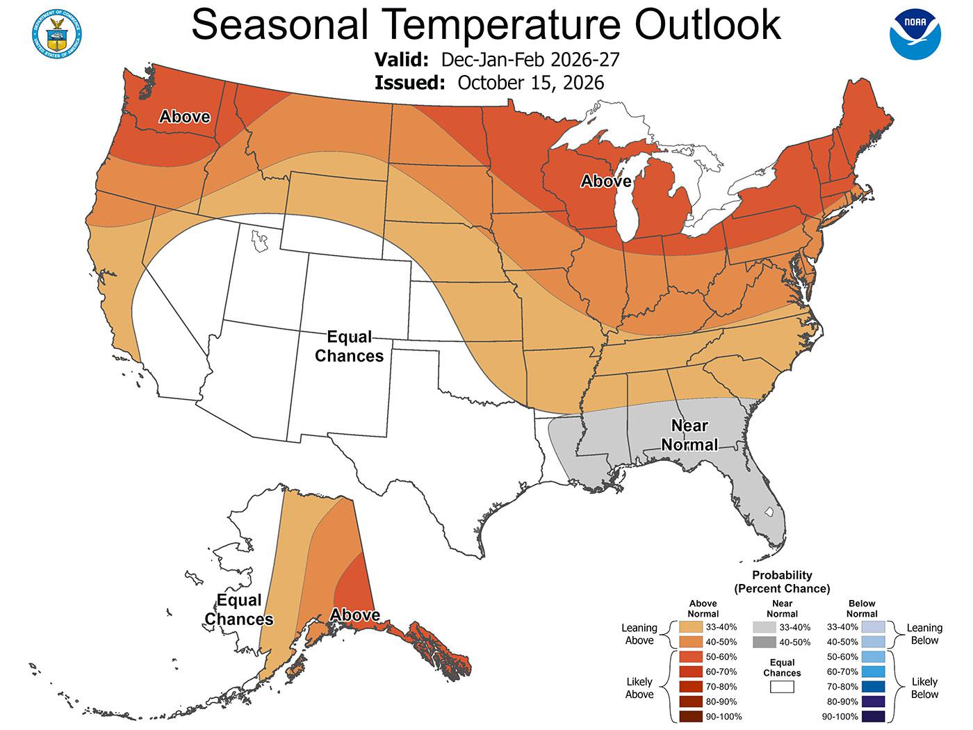
Warmer-than-average temperatures are favored across much of the northern United States, including large portions of the East. Wetter-than-average conditions are favored across the southern tier of the country and along the Eastern Seaboard, while parts of the Great Lakes and northern Rockies are expected to experience drier conditions.
For Mid-Atlantic ski resorts, the combination of warmer temperatures and increased precipitation presents a mixed picture. Additional moisture could provide opportunities for significant snowfall when cold air is in place, but warmer conditions could also increase the likelihood of rain and limit favorable snowmaking periods.
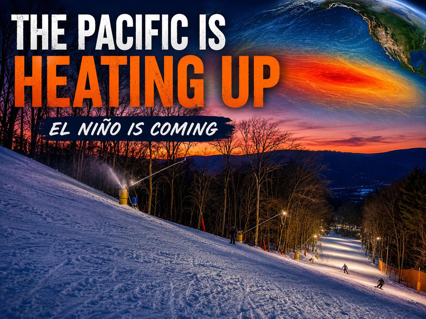
The strength of this year’s El Niño is particularly noteworthy. NOAA forecasters expect the event to remain strong to very strong into early 2027, potentially making it one of the most powerful El Niño episodes in the historical record.
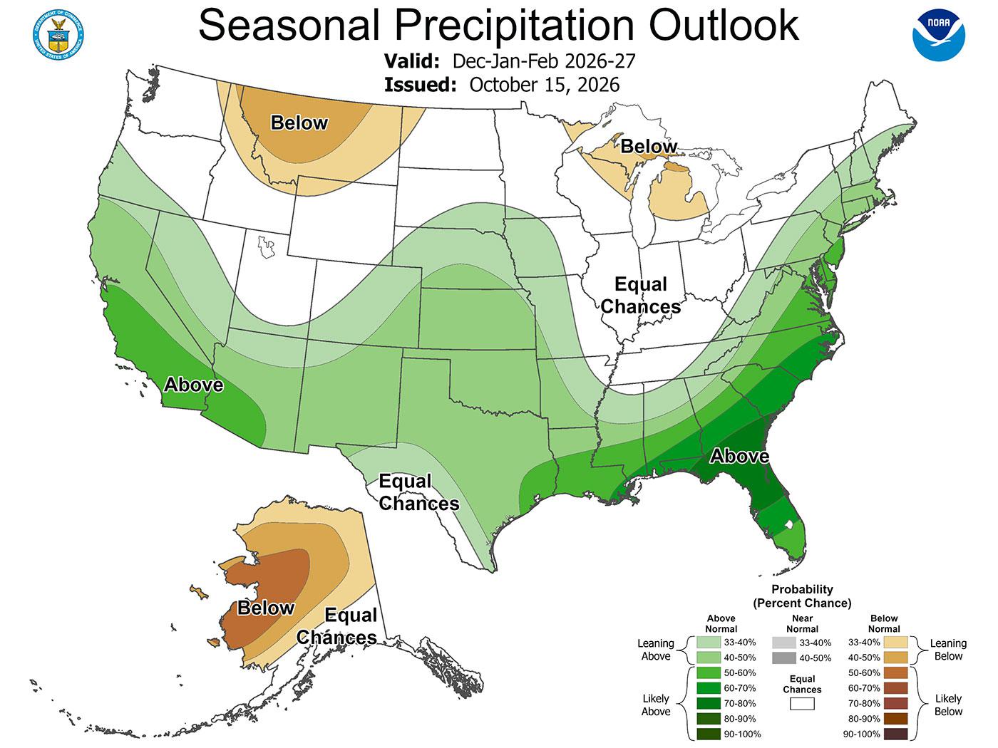
During El Niño winters, the jet stream often shifts southward, encouraging more storm activity across the southern United States. Along the East Coast, the interaction between these storms and cold air can sometimes produce substantial winter precipitation. Whether that precipitation falls as snow, sleet, freezing rain, or rain depends on temperature patterns that cannot be reliably determined months in advance.
Past El Niño winters illustrate the uncertainty. The 1997-1998 season brought repeated warmth and rain to Mid-Atlantic ski areas, while the 2009-2010 El Niño winter produced extraordinary snowfall across parts of the region. The very strong 2015-2016 event began with record December warmth but later delivered a major January snowstorm.
NOAA emphasizes that its seasonal outlooks describe probabilities rather than specific weather events. A forecast favoring above-normal temperatures does not mean every week will be warm, just as a wetter-than-average outlook does not guarantee a snowy winter.
NOAA also does not issue seasonal snowfall predictions as part of its winter outlook. Snowfall depends heavily on the timing and tracks of individual storms, and reliable forecasts generally become possible only much closer to an event.
For ski areas in Pennsylvania, Maryland, West Virginia, Virginia, and North Carolina, the coming winter will depend on how frequently cold air coincides with precipitation and how many suitable snowmaking windows develop between storms.
NOAA will update its seasonal outlook on November 19, providing another look at the evolving winter forecast as the ski season approaches.


Reader Comments