
Before leaving home, we check the hourly forecast, live webcams, trail counts, road conditions, and traffic. We might buy a lift ticket, pull up directions, text our friends, and perhaps reserve rentals or lunch. At the mountain, the same device becomes a lift pass, trail map, camera, altimeter, and emergency communicator.
It is easy to forget how recently none of that was possible.
For much of the history of Mid-Atlantic skiing, a trip to the slopes required advance planning, paper, loose change for the lockers, and a willingness to live with incomplete information. Once members of a group became separated, they might stay separated. A wrong turn to the mountain could add an hour to the drive. Conditions reported in the morning might bear little resemblance to those encountered in the afternoon. There were no webcams to check.
And yet, somehow we still managed to ski. Sometimes, the uncertainty was part of the adventure.

Calling the snow phone
Before resort web sites and apps, the most direct source of current information was the snow phone.
If you’re a younger skier or snowboarder, you probably have no idea what I’m talking about.
But if you’re a more, ahem, seasoned snowsports enthusiast, you might remember the voice of Dick Barron when you called the Seven Springs snow phone; he worked at Seven Springs for nearly 50 years and his voice became the identity of the mountain. And like me, you might even have Whitetail’s phone number stuck in your head — 717-328-9400 — a number your fingers dialed often more than once per day to see if the trek to the mountain was worthwhile.
Each ski area maintained a telephone number with a recorded report. The message usually included the number of open trails and lifts, surface conditions, base depth, hours, and perhaps a weather forecast. Many resorts updated the report at least a couple times per day.
Calling several resorts could become a pre-ski ritual. Whitetail had one report. Liberty and Roundtop had others. If West Virginia was under consideration, Snowshoe, Canaan Valley, Timberline, and Winterplace each required another call. From outside the local calling area, those calls might incur long-distance charges. (And once again, for the younger skiers, please have your elders explain what a long-distance charge was.)
The reports also required interpretation. Resorts naturally presented their conditions in the best possible light, and “rain” was simply not part of their vocabulary. If you heard “mixed precipitation,” you knew that meant rain. “Frozen granular” could encompass a remarkable variety of surfaces. A reported base depth revealed little about the thin spot forming around a bend or the windswept section near the summit.
In fact, DCSki traces its roots to the limitations of those reports. Beginning around 1994, I distributed an e-mail newsletter called the Unofficial Whitetail Ski Report. I had a season pass at Whitetail and tried to provide candid firsthand observations after my visits. Readers soon began contributing their own reports, and coverage expanded to other Mid-Atlantic mountains. The newsletter eventually evolved into DCSki.
As I recalled in a retrospective on DCSki’s first decade, the snow phone was often the only timely source of resort information. DCSki — and later its Message Forum — helped create an independent network of people comparing official reports with what they actually found on the slopes. This was all years before social media became a thing.
Today, a skier can inspect multiple live webcams before getting out of bed. Back then, some uncertainty remained until the mountain came into view.
The paper trail map
Upon arriving at a resort, skiers picked up a folded paper trail map and placed it in a jacket pocket. By the end of the day, it was usually damp, soft at the creases, and nearly impossible to return to its original shape. That’s assuming that it hadn’t been dropped from a chairlift and buried in the snow, only to resurface after the inevitable spring thaw.
Trail maps were navigation tools, but they also served as souvenirs. Skiers circled meeting places, traced routes with gloved fingers, and saved maps from memorable trips. A collection documented where someone had skied more effectively than any digital activity log.
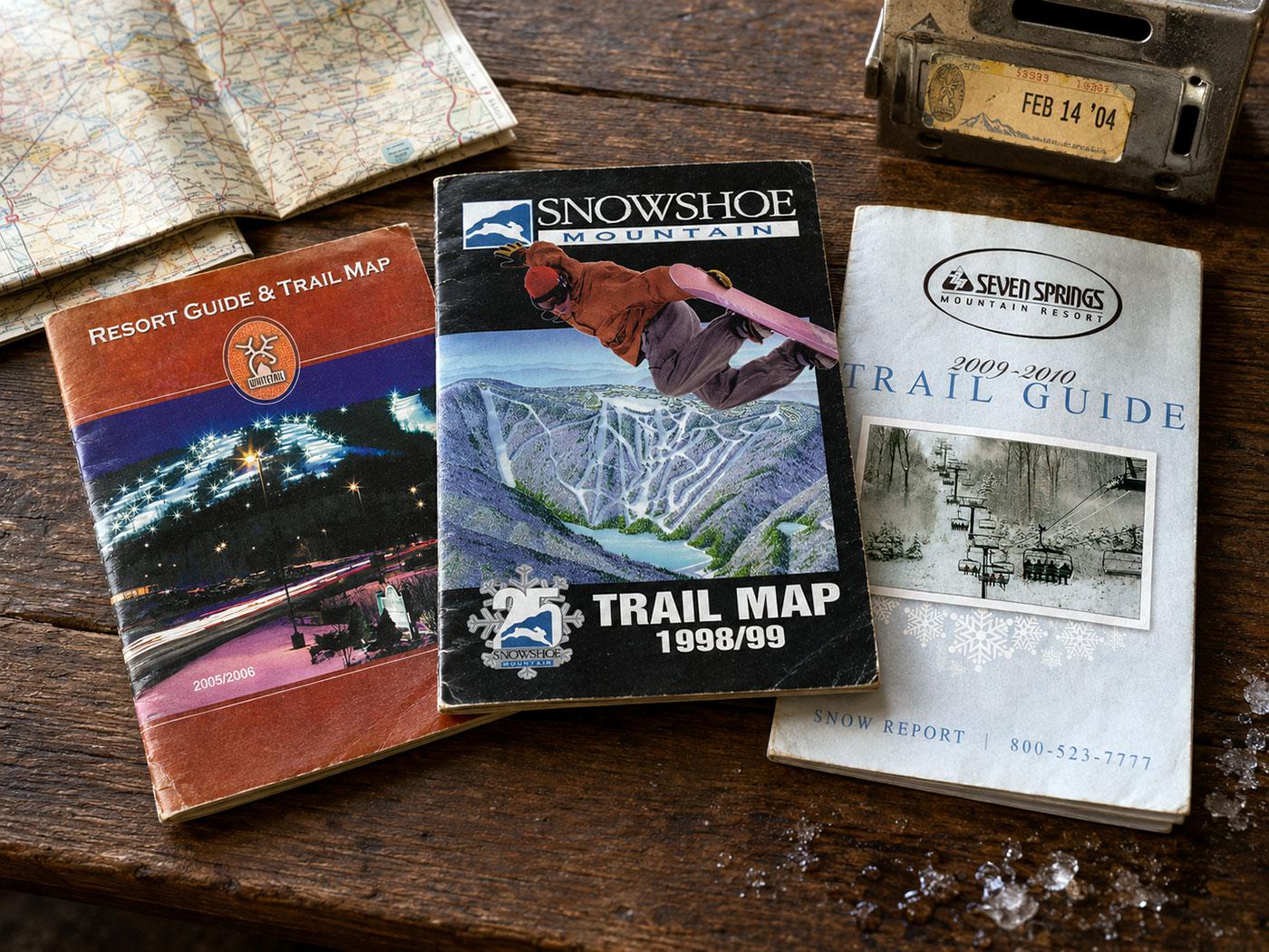
At smaller Mid-Atlantic resorts, becoming lost was difficult, although finding the correct lift or avoiding terrain above one’s ability could still require a careful inspection of a trail map. At Snowshoe, the inverted layout — with most lodging and village facilities at the summit — confused some first-time visitors. Skiing too far toward one area could lead to an unexpected shuttle ride or a lengthy return. So those who didn’t study the trail map did so at their own peril.
Paper maps required the skier to build a mental model of the mountain. You studied the layout at the base, looked for signs at intersections, and gradually learned which trails connected. There was no blue dot confirming your location and no application warning that a lift was closed.
Meet at the lodge clock
Coordinating a group may be the part of skiing that smartphones changed the most.
Before texting, friends and families made plans in advance: meet at the base lodge at noon, or at the bottom of a named lift. The instruction needed to be specific enough that everyone interpreted it the same way. (For example, there is a subtle difference between the bottom of a lift and the top of a lift.)
If someone failed to appear, the group waited, at least for a little while. Perhaps the missing skier had joined a long lift line, misunderstood the location, suffered an equipment problem, or simply decided to take one more run. There was no text saying, “Running ten minutes late.”
Parents developed systems with their children. The fail-safe was often returning to a particular part of the lodge if the group became hopelessly separated. At night, brightly colored jackets helped family members identify one another from a chairlift. Friends sometimes left notes beneath windshield wipers or on a bulletin board in the lodge.
Some groups used small two-way radios once those became affordable. The radios worked reasonably well across open slopes, although mountains, cold/dying batteries, and overlapping conversations created their own problems. Channel selection became another planning decision, and anyone who forgot to turn on the radio remained unreachable.
Being separated could be frustrating, but it also created independence. Skiers did not expect continuous coordination. A teenager might disappear with friends for several hours and reappear at the appointed time. Adults split into groups by ability and compared adventures over lunch.
Finding the mountain
Getting to a Mid-Atlantic ski area could require almost as much preparation as navigating it.
Travelers relied on highway atlases, state maps, printed resort brochures, and handwritten directions. Later, services such as MapQuest allowed drivers to print turn-by-turn instructions, usually on several sheets of paper that slid around the passenger seat.
That worked well until a turn was missed.
The challenge was greatest in West Virginia, where the fastest-looking route on a map was not always the easiest route in winter. Roads to Snowshoe, Timberline, and Canaan Valley crossed mountain ridges, threaded through small towns, and included long stretches without services. Snow or freezing rain could transform a familiar drive or even close a road.
Drivers learned routes through repetition and passed their preferences to others. One road might be shorter but far more winding. Another added mileage while avoiding a difficult mountain crossing. Gas stops were planned because the next station might be closed after dark. Printed directions sometimes included landmarks rather than street names: turn after the church, continue past the convenience store, and watch for the resort sign.
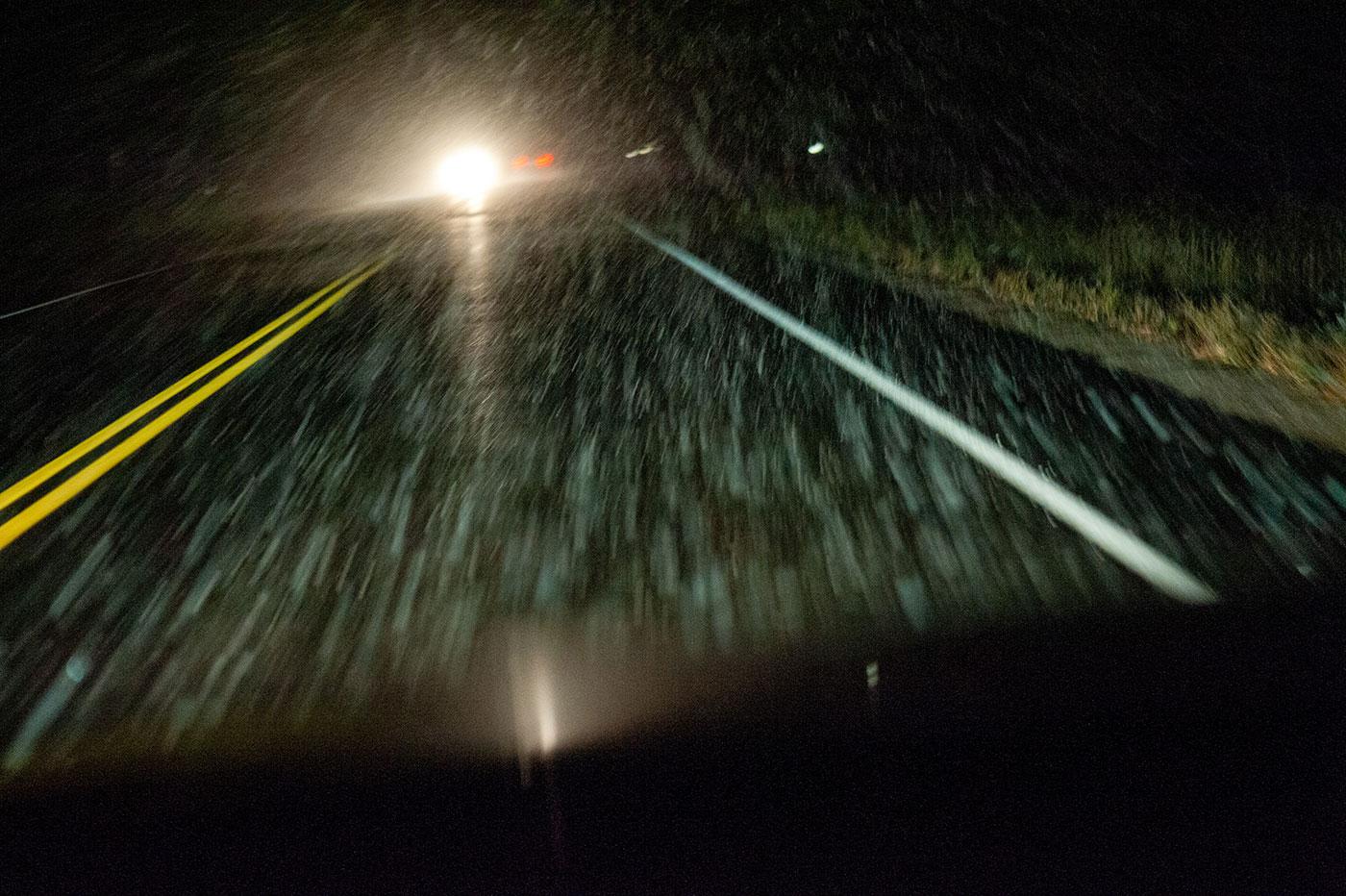
If weather deteriorated, there was no moving radar map in the dashboard and no live crowd-sourced warning about a crash ahead. Travelers listened to radio forecasts and watched the road. A pay phone at a gas station or restaurant might provide the only way to notify someone of a delay — assuming you had some quarters to feed it.
Modern navigation has removed much of that uncertainty, although blindly following a phone can still send an unsuspecting driver onto an unwise mountain road. The accumulated route knowledge shared on the DCSki Forum remains valuable precisely because firsthand winter experience can matter more than a route produced by an algorithm.
Buying access at the window
A ski day once began with a physical transaction at the ticket window.
Skiers stood in line, selected a day, twilight, evening, four-hour, or eight-hour product, and received an adhesive-backed lift ticket. The ticket was attached to a metal wicket threaded through a jacket zipper. Removing the backing with cold fingers could become the first dexterity test of the day. It was a skill that had to be earned.
Discounts might require presenting a coupon clipped from a newspaper, a card purchased at a ski shop, a student identification card, or proof of membership in a club. Tickets could also be purchased in advance from local ski shops or at seasonal ski shows, requiring another stop before the trip.
Once attached, the ticket was visible evidence of the season. Some skiers let old tickets accumulate on a jacket, creating a colorful record of where they had skied — and, not incidentally, letting everyone else know where they had skied. Others carefully removed and saved them, preserving the evidence for a more appreciative audience: themselves.

RFID gates and mobile passes have made mountain access faster in many cases. A skier can buy online, place a phone or card in a pocket, and head toward the lift. But the old ticket window also provided a human checkpoint. Guests could ask what was open, whether an afternoon ticket made sense, and where a beginner should start. Resort employees could correct confusion before someone reached the snow.
Photography with limits
Today, nearly every person on a chairlift carries a capable camera. That has transformed how ski days are documented.
Before smartphones — and before digital cameras became common — taking photographs required intent. A skier carried a separate film camera, protected it from snow, and accepted that each roll provided perhaps 24 or 36 exposures. There was no immediate preview. A finger over the lens, incorrect exposure, or poor focus might not be discovered until the film was developed days later.
That delay shaped DCSki’s early coverage. Photographs from resort visits had to be developed and printed at the local Ritz Camera, and then scanned before appearing online. Timely images were comparatively rare, although I sometimes paid extra to get 24-hour turnaround at the photo lab.
Early digital cameras improved turnaround time but introduced their own constraints: low resolution, limited storage, weak batteries in cold weather, and sluggish performance. Still, the ability to review a photograph immediately and publish it without processing film was revolutionary.
Smartphones have made documentation nearly effortless. Skiers now record entire runs, post conditions from a lift, share a powder-day photograph before lunch, and automatically preserve the location and time. Resorts receive an endless stream of guest-created publicity — and occasional visual evidence when operations do not match expectations.
Something has been gained in the breadth of that record. Yet scarcity once encouraged selectivity. With only a few exposures available, the photographer paused, composed the scene, and decided whether it was worth a frame.
Information moved more slowly
News about a resort once traveled through newspapers, newsletters, brochures, ski shops, club meetings, and conversations in lift lines.
A new chairlift could be under construction for weeks before many customers heard about it. Season-pass prices arrived through a mailed brochure. Rumors of an expansion circulated among employees and homeowners. A particularly good ski day became known through friends after it had already ended.

When DCSki appeared on the web in 1997, it accelerated that cycle. News stories and reader reports could reach the region quickly, although most people still accessed them from a desktop computer. A skier checked DCSki at home or work, printed anything useful, and then left the internet behind for the day.
The DCSki Message Forum added real-time conversation by 2000, but “real time” still meant when someone returned to a computer. Trip reports were often written that evening or the next day. Readers had time to organize their thoughts, choose photographs, and tell a story.
Now, conditions are narrated as they occur. A lift stoppage, sudden squall, or long line can appear online within seconds. That immediacy helps skiers make decisions, but it can also magnify a brief problem before the full context is known.
The weather remained a surprise
Forecasting has improved enormously, and smartphones place sophisticated weather data in every pocket. Mid-Atlantic skiers can compare models, inspect radar, monitor temperatures at different elevations, and estimate snowmaking conditions.
Before all that, we flipped on the television set and tuned it to the Weather Channel.
Yet today’s greater access to information has not made the atmosphere obedient.
The region still lives near the dividing line between rain and snow. A projected storm can shift. Cold air can arrive late. Snowfall at Snowshoe or Canaan Valley may have little relationship to conditions around Washington. A skier can study every available model and still be surprised.
Before constant forecasts, people sometimes committed earlier and accepted the result. A family with a motel reservation drove west and discovered what the mountain offered. Conditions might exceed expectations — or produce a long weekend of card games in the lodge. That’s just how it was.
Modern information allows us to chase the best conditions more effectively. It may also tempt us to wait for perfection, skipping perfectly enjoyable days because a forecast suggests something marginally better next week.
Skiing without a digital record
Many smartphone applications now track vertical feet, distance, speed, lift rides, and exact routes. At the end of the day, skiers can compare statistics and preserve a detailed map of their movements.
Earlier skiers counted runs informally, if at all. They might remember that they rode the Whitetail Express ten times or spent the afternoon lapping Shay’s Revenge, but no automatic log verified it. A day was measured through tired legs, memorable turns, and stories told in the lodge or on the drive home.
There were no leaderboards to encourage one more lap and no speed display inviting questionable decisions. The absence of data did not prevent competition, but it kept much of it ephemeral.
Smartphone tracking can be fun and useful. It can reveal improvement, help locate a separated friend, and provide safety information. It can also pull attention toward the screen during one of the few recreational activities that offers a convincing reason to ignore screens.
What we’ve gained
It is easy to romanticize the pre-smartphone ski day. But some aspects deserve no nostalgia.
Current road information improves safety. Reliable communication helps families reunite and allows injured skiers to summon assistance. Digital ticketing can reduce lines and maybe offer better deals with dynamic, demand-based pricing. Live conditions prevent wasted trips. Weather alerts provide warning when a mountain drive becomes dangerous. High-quality cameras have allowed countless experiences to be shared and preserved.
For beginners, access to information has lowered barriers. A first-time visitor can study the resort layout, reserve a lesson, learn what clothing to bring, watch instructional videos, and ask experienced skiers questions before arriving.
DCSki itself benefits from these tools. Photos can arrive from resorts and readers within minutes. News can be published from anywhere. Forum participants can report snowfall as it accumulates. A regional community no longer has to wait until everyone returns home.
Skiing before the smartphone required more planning and tolerated more uncertainty. Modern technology has made the sport safer, more accessible, and easier to navigate. But the essential experience has not changed: cold air, sliding snow, a mountain rising ahead, and the hope that the next run will be the best one of the day.




Reader Comments