End of season in sight?
February 18, 2005
31 posts
17 users
7k+ views
I've boarded in April during some terrible seasons at Timberline, Snowshoe, and 7 springs so if you need a fix it'll be there. Maybe not as close to home as you want but it'll be there, and sometimes they're days dreams are made of so just check the tires and fill the tank and watch the weather channel for some good late march/early April snow

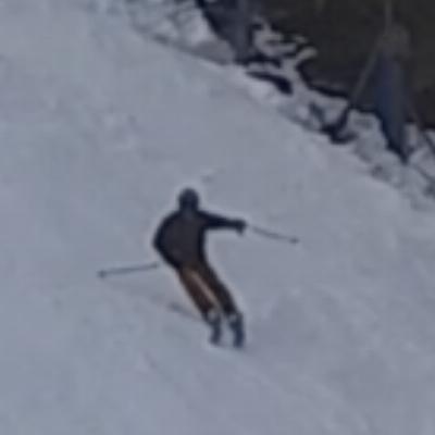
I skied 7 Springs on Saturday, and conditions were great. We stayed on the North Face side, so I can't vouch for conditions over on the main Lodge side. Natural cover areas were a little thin, but aside from that it was a great day.
That's why I have a trip to Tahoe planned for the 1st wknd in April! I WILL ski into to April this year, no matter what it takes!
As long as people keep sking the season will go on. It seems that every season the resorts west of the aleghenny front close with nearly fully open trails / great conditions.
The long-range weather outlook for the rest of February looks OK with seasonal temps expected. By Thursday of this week, it's going to get cold and will likely stay seasonably cold until the 1st of March. Unfortunately, it doesn't look like any major snow-storms are in the cards, but you never know. The base at most mid-Atlantic ski areas should hold-up reasonably well during this period. However, since the base at many ski areas is thinner than normal (for this point in the season), and we're bound to get hit with some warm weather after March 1, I look for many ski areas to close a week or two sooner than their average closure dates.
End of Season in sight!

Bite your tongue. We've still got a bunch of skiing to be done this season. I've done a lot of April/end of season skiing in the MidAtlantic.
Last April 2/3, 2004 the CV got almost 30" of snow. Lots of PowPow in April? Unbelievable!
In 2000/2001 (I think) Snowshoe got something like 70" of snow in March. I skied powder several times in March and I also closed out the season at Snowshoe on April 12. They closed while they were basically 100% open.
Without dating myself, I can remember I can skiing the Shoe on March 26 after they had received 36" of snow in two days.
Keep your fingers crossed. Don't let the fat lady sing on this season yet!
Shame on you to think of such a thing. The following is a weather summary from Herb Stevens -
Winter to return to the east...
Weather discussion 2/15/05
Thus far this winter, the weather pattern has had a certain symmetry to it...the first two weeks of December, January, and February were warmer than normal in the east, and the second two weeks of December and January were colder than normal. We are now into the second half of February, and the same thing is unfolding again...it's mild today (Tuesday), and Wednesday will be mild with a turn to colder late in the day, and then we'll be right back into winter, as temperatures will head below normal through the upcoming weekend. That's where things get really interesting, because it's starting to become apparent to me that this latest installment of colder than normal weather is going to have some staying power...more on that a little later.
This past storm caused a mixed bag of precip over much of the east yesterday, but there were some big winners...Attitash and Wildcat in New Hampshire each checked in with about a foot of new snow. Central and northern Vermont got 4-8 inches or so, as did the rest of northern New Hampshire and much of Maine, and although the precip ended as some light rain and drizzle in the mountains, there was a definite "net" of snow.
In southern New England, where a good shot of rain fell late last week (in one of my worst forecasts in the past 15 years!), rain fell again last night, but the bases are hanging tough. By Thursday, snowmaking will be possible again, for those areas that choose to do so...with President's Week looming, I think that more snow guns will be firing than one might normally see in mid-February. In the mid Atlantic, the opportunity to make snow is a timely one, as many areas need to pound it for a few more nights to provide insurance for the month of March.
In the west, light snows have fallen in the past couple of days in California, but the big winner has been Utah. A general 12-18 inch snowfall is winding down today, as the southern stream of the jet remains active. The Utah snow is not exactly champagne powder this time, as snow levels have been high (as they have been most of the winter) due to the tropical origin of the air mass that arrived over the weekend. The southern Stream is going to bring another slug of moisture ashore later this week, and the flakes will be flying again in the central and southern Rockies, while the northwest continues to find itself on the outside looking in. The season is reaching the point of no return for many resorts in this region, and with the way the upper level pattern is setting up for the next few weeks, I am afraid that the prospects are not good for a quick cure to the snow shortage.
The southern branch of the jet is going to stay in place for the foreseeable future, and it will continue to provide us with the upper level energy and the moisture to continue snows in areas that have had a good supply this winter...most notably, the southwest. Now, at the same time, the northern branch of the jet is digging out a trough in the eastern third of the country, which is about to cause the return to normal to below normal cold. We've seen this setup quite a bit this winter, but this time, it is going to happen while a blocking ridge is building over the north Atlantic...known as a Greenland Block. Such a feature produces a negative NAO (North Atlantic Oscillation), which basically bottles things up over the northern latitudes of the U.S. So, once the trough establishes itself in the east, it is less likely to move on or dissipate within ten days or so, as many of its predecessors have. If the trough is roughly in one position, and the southern stream continues to feed impulses into it, the result will be persistent snows where the warmth and moisture from the south are overrunning the dome of cold air to the north. Now, if the northern branch sends along its own impulse and it phases with something in the southern branch, VOILA, you got yourself a major east coast snowstorm.
Before any such a storm can appear, I look for a weaker system to ride along the newly established arctic boundary early in the weekend, producing light snows from the eastern Great Lakes to central and northern New England. As the cold air gets established, in several pulses over the next few days, lake effect snow will break out to the lee of Erie and Ontario. We don't ordinarily see lake effect this late into a season, but that is the result of warmer than normal water temps in both lakes. Many years, Erie is frozen by now, because it is much shallower than Ontario, and when the lake is frozen, its ability to provide water vapor to the overlying cold air mass is greatly reduced. During the next two to three weeks, areas that enjoy the benefits of lake effect snow will be very happy, as I think that there will be numerous outbreaks of air cold enough to set the lakes off.
Now, about the prospects for a major storm...it may not be major, but I am confident that the system that soaks L.A. late this week will produce snow from the Ohio Valley to southern New England early next week. What I am not as confident about is the likelihood of the coastal low (which will form after the primary dies in the eastern lakes) will be able to turn the corner sharply enough to bring the snows to northern New England. I'll take another look at that Friday. If it can't turn the corner, rest assured, there would be other opportunities within the next few weeks, as it looks to me that the longest spell of winter weather this season is just now getting underway in the east.
Dont think of these things yet. Its only februare and theres bound to be a blizzard soon as the mid-A has only gotten 15%-30% of their snowfall thus far. I think we are way overdue for another "Blizzard of '96"!
Wxrisk.com has a forecast that says pretty much the same thing as Herb Stevens - the next cold spell will have more staying power, with the possibility of a major storm.

Great post Snowmakers! I agree that it's going to return to Winter by Tursday of this week (and stay that way for 15 days or so). However, the temps are predicted to be just "seasonable" (or slightly above seasonable) for this time of year, which isn't all that cold. From Feb. 17 thru Mar. 1, we're likely to see some daytime high temps go well into the mid 40's (or even the low 50's, ie: Massanutten) at many ski areas of the mid-Atlantic, and there's probably going to be a few days with some rain showers. On the postive side, there's also a chance for a wet snow-storm or two. But, anyway you look at it, the snow base at most ski areas (within the mid-Atlantic) is likely to melt a fair amout during the latter half of this month leaving a rather thin base heading into the month of March. So, unless March is colder than normal, this ski season is going to end a bit early for a number of ski areas.
MM- what would classify as an "early" ending and for which ski areas?
I am amazed at how well most of the local areas are doing given the poor winter. In warmer winters we typically get the largest snows after presidents day. As long as temps are cool they sould stay open, new snow or not...
Closure dates of around the 12th thru the 16th of March would qualify as early closures for Blue Knob, Wisp, 7-Springs, Laurel Mt., and Hidden Valley. Closure dates by about March 4-7 would qualify as early closure dates for Whitetail, Wintergreen, Massanutten, Liberty, Bryce and Round-top. Closure dates of March 20-24 would qualify as early closure dates for Snowshoe and the Canaan Valley area. I might add that some ski areas might stay open past these dates, but with EXTREMELY LIMITED conditions, in which case a reasonable person would conclude that legitimate skiing had ended a week or two earlier.
Quote:
Great post Snowmakers! I agree that it's going to return to Winter by Tursday of this week (and stay that way for 15 days or so). However, the temps are predicted to be just "seasonable" (or slightly above seasonable) for this time of year, which isn't all that cold. From Feb. 17 thru Mar. 1, we're likely to see some daytime high temps go well into the mid 40's (or even the low 50's, ie: Massanutten) at many ski areas of the mid-Atlantic, and there's probably going to be a few days with some rain showers. On the postive side, there's also a chance for a wet snow-storm or two. But, anyway you look at it, the snow base at most ski areas (within the mid-Atlantic) is likely to melt a fair amout during the latter half of this month leaving a rather thin base heading into the month of March. So, unless March is colder than normal, this ski season is going to end a bit early for a number of ski areas.
On this one, I think Mountain Masher is spot on. Herb Stevens, wxrisk.com and others have had a lot of optimistic predictions which have fallen through this season. There have have been some major Mid-Atlantic snow storms in March, but we've also had some March's which seemed like April or May. We may get a big dump, but at this point I'm not counting on it.
Two points hit home for me. 1) This is the middle of February. Has anyone skied the glades at T-Line this year? 2) I just cleared some flower beds in my yard of last year's dead debris, and found that the mums and gladiolas have already started new growth. These ain't exactly Spring flowers. Plus my lawn could almost use a mowing.
I'm not sweating things too much because March is my main month for ski trips out West. Three more good weekends locally is all I ask.
I'll give most of the local areas major props for their aggressive snowmaking this year.
Quote:
1) This is the middle of February. Has anyone skied the glades at T-Line this year
This is an excellent metric for evaluating the quality of a mid-atlantic ski year. I've been waiting for some indication that the glades are skiable before heading out to tline. But at this point I would be happy if they just managed to get the Drop open.
Having said that, I've had fun this year the times that I have gone skiing at our local resorts. This is the Mid-Atlantic, as far as skiing goes you have to hope for the best but not be suprised when winter does not shape up like we would want it to. My only real complaint is being surrounded by people who think that warm winters are GOOD things!
Winters like this usually do have the highest possibility of larger snow dumps for our area. The midatlantic resorts are at about 1/3 of their average snow fall. The patteren has been hinting at a big nor' easter all seaosn but so far nothing has materialized. We will see. Usually if we get a big dump its arround this time of the year...
This season there is a true seperation between the agressive snow making resorts and those who are either slower to make snow (in the face of a coming warm spell) or whose operations aren't as dynamic.
Compare Whitetail to T-Line. Most of the close to DC resorts haven't had less than a foot of snow all season. But they are still in good shape right now. T-Line hasn't been fully open all season. Is the problem not enough guns to rebuild their bases and expand new terrain or not enough money to keep making snow?
I think you can write off the drop this year. In the past it has usually been opened for over a month by this time of year. There is no effort by t-line to even move guns there so...
Being the divine optimist, I am waiting for that 30+ inch heavy wet snow to fall and do what no snow making can do, open all the glades and (ahem...) favorite private runs we all have at that favorite resort. Ullr, are you listening or must we make sacrifices again?

tromano, good question. I think you answered the question with the latter of your two possibilities. Last weekend, t-line had guns set up on open trails all over the mountain making snow at the notorious "brown out" spots. It takes a good 7+ days to cover the drop with enough cover to keep it white through closing. They just haven't had the snow making window this year that they have had in the past.
I'd agree that those dates are early. About a week early in many cases, but early. BK and Laurel are probably two targets to go down early this year- BK because they're so natural-snow dependent and Laurel because if 7 Springs needs to save money they'll shut down the sister resort and concentrate operations at home.
I'm not sure, though, if Canaan skis much past the first weekend of spring anymore. A lot of resorts around here aim for their snow to run out about the same time crowds do- case in point last year, when Whitetail stopped making snow in early or mid Feb and just let their base trickle away so they could close on limited conditions the second weekend of March (the downside to this was that the next week was exceptionally cold, so when they "surprise" reopened the following weekend the conditions were far worse than they could have been. It wasn't worth the trip).
As for whether ski resorts will try to stay open with marginal conditions, I doubt it. The cash is gone after President's Day weekend. Anyone remember a couple years ago, during that ridiculously warm winter we had (99-00 I think, the one that made this winter seem like an ice age) when Roundtop and Liberty closed for the season in mid-Feb? If I remember right, they opened Christmas Eve and skied to Feb 14 or so- they weren't even open two months. Yuck. Well, the point is, if most ski resorts are looking at almost no skiers and a thin base MOST of them will just shut the doors, it's too expensive to keep an operation going at that point. Snowshoe and a couple others will persist for bragging rights in such conditions, but that's about it.
Regardless: there's a month of skiing left at worst! Get out there and enjoy it!
One of the things we've been trying to get roundtop to do is offer a second sesaon of just parks for the more hardcore.
Geez that shouldn't be too big a deal. Stretch a cheap ropetow or a J-bar up the long pipe and let the parkers come play for five bucks or so. Maybe it costs a lot of money to maintain a half-pipe in warm weather though. Dunno.
It does for a pipe but a park isnt as labor intensive. they could move the park to fife and drum and only run the one chair in the evenings and weekends. doing that you could harvest snow from other slopes for weeks.
Quote:
Winters like this usually do have the highest possibility of larger snow dumps for our area.
What makes you say this? Over a long period of time (i.e. several years) weather does tend to average out. But just because we've had a very low amount of snow this season, doesn't mean we're due for a lot of snow before the season ends.
Its not exactly scientific. This is an elnino year. Basicly this means warmer humid winter. More humidity and a higer chance for a more severe storm. So if it gets cold enough to snow then we will probably have a big one. I am not an expert but it seems to make sense to me.

Looking for statistics on average monthly snowfall at Snowshoe and the same for 2003/2004. Any suggestions?
A recent e-mail I got from Snowshoe said they normally get 48" in March. I am sure it's like mashed potatoes most of the time, but I won't complain about any snow in March.
Last year, I skied there on March 22 and had 8-10" of wonderful light powder. It was freakin awesome. The day before, it was an ice rink, day before that it was slush. All it took was cold weather and lake effects snows and bingo, powder day in March. it was probably my best ski day in a few years.
Overall, it was an epic trip -- I covered 550 miles on the road and skied a day all within a 30 hour period, but it was worth it. Now I know I can point and shoot for powder days out there.
Craig
The end of the season may be in sight at liberty, etc... but not in Garrett County or the other "real snow" locations. Wisp is blowing full blast right now, and will easily go into mid to late march. They may not make it into April this year, but I bet when they close (do to lack of skiers) they'll still have 80% of the hill covered 3 feet deep. Snowshoe will be in the same boat - there's no lack of coverage there - and likely 7springs as well. Granted it hasn't snowed as much this year as many years, but it hasn't been too bad at the resorts that aggressively make snow.
Quote:
The end of the season may be in sight at liberty, etc... but not in Garrett County or the other "real snow" locations. Wisp is blowing full blast right now, and will easily go into mid to late march. They may not make it into April this year, but I bet when they close (do to lack of skiers) they'll still have 80% of the hill covered 3 feet deep. Snowshoe will be in the same boat - there's no lack of coverage there - and likely 7springs as well. Granted it hasn't snowed as much this year as many years, but it hasn't been too bad at the resorts that aggressively make snow.
A quick glance at the web cams at a few local resorts, T-Line, 7S, Wisp, Whitetail, are all blowing snow right now. So I am not sure which resorts are down and out at this point.
I skied 7-Springs today and was surprised at how much snow they had lost. I asked a friend (who works there) what had happened; he told me that they had been hit really hard by a lot of rain a couple of days ago. But the good news at 7 Springs was this: snow was being made on 2/3 of the mountain! I have never before seen 7-Springs run that many snow guns this late in the season. Also, some heavy snow flurries were laying down a fair amount of snow. So, I would say that the ski conditions at 7-Springs will be good to excellent for the next 3 weeks and perhaps beyond!
Quote:
So, I would say that the ski conditions at 7-Springs will be good to excellent for the next 3 weeks and perhaps beyond!
What's this?
Positive vibes from MM? 
cool to hear.
Quote:
Quote:
Winters like this usually do have the highest possibility of larger snow dumps for our area.
What makes you say this? Over a long period of time (i.e. several years) weather does tend to average out. But just because we've had a very low amount of snow this season, doesn't mean we're due for a lot of snow before the season ends.
JohnL, The Great Lakes, except Erie, aren't frozen over as usually is the case in February. I'm hanging my hopes on a Great Lake Effect snowstorm, hopefully just in time for Snowy Luau.
jimmy