I believe the area may have been called Hickory Ridge in the 60s/70s?
this was not Hickory Ridge. Hickory Ridge was located on a horse farm further north from Hawley.
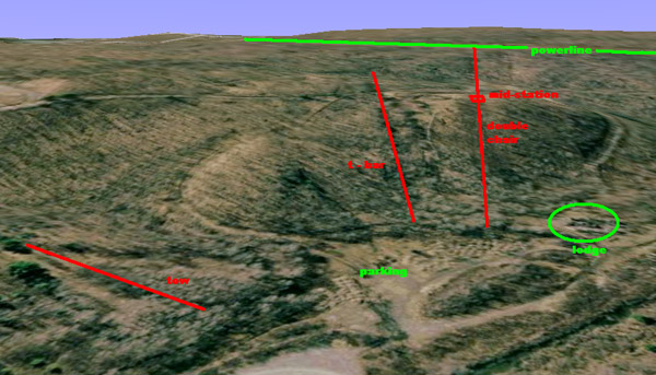
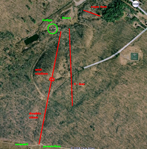
The proper name was Poco North, I learned to ski there! It had a very nice lodge in its day, the rope tow was far from the lodge in terms of walking or carrying your skis from the rental shop, and it had double chair lft and T bar. It was oneof the smaller hills but very convenient if you lived near by or visited the Poconos. Today Hawley is more of a destination but you can find the old mountain, there is I believe a private residence on the property now though.
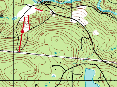
I live about 5 miles from here and my dad skied there when he was a kid. I think there were more trails than you say above, maybe 7 to 10 at the most, some trails were more like paths and not groomed. I do know they got their water for snowmaking from the stram at the base (the middle creek). The main reason they closed was becuase of Tanglwood, there was not enough business for two small areas so close
I have often wondered whatever happened to Poco North. Just tonight I realized I should search it on the net, and found this site! When I was a junior in Valley Stream High School, I went there with our ski club. It was pretty small, but fun, of course. There was an icy snow mix falling the entire day, and when the bus tried to leave, we skidded, and a tire went into a rut. We had to walk back down to the lodge,(I should say slide, as it was all ice) and wait for help. We all ended up staying overnight in Hawley, and missed school the next day. It was a great adventure!
I learned to ski at Poco North in 1967 and skied there regularly for about 5 years. I remember the "All Lift" tickets were $5.50 on weekends, beginner area only tickets were $3.50. The rope tow chewed up gloves and mittens at a remarkable rate.
Gunther was in charge of the ski school and the lodge was very modern and seemed huge to a 10 year old with a large fireplace in the center with a large copper hood hanging down from the ceiling.
The T-bar was a double pipe type (not the anchor and cable type found at other areas at the time) and was a comedy of errors watching people learning how to get pulled on it and not sit down.
There was a long flat section between the upper hill (top of the double chair) and the top of the lower hill that made going to the very top less appealing when the snow was soft and slow.
The rumor in the mid 70's was the chair lift was sold to Paper Birch (now Tanglewood) which only had a T-bar when Poco North was alive and well.
After 40 years of skiing, it is nice to remember where it all started, thanks for the website and memories.
I lived in Honesdale, five miles from the hill. The season ticket in 1970 was $80.00. With night skiing and a decent winter, it was a great deal. The lodge fire was after the area closed.
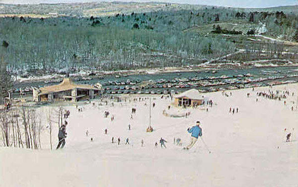
My brothers and I skied PocoNorth after Hickory Ridge closed around 1970. After PocoNorth closed, around 1973, we skied at Tanglwood and other local areas. The ski clubs from local high schools enjoyed night skiing on Thursdays. Mom learned to ski at PocoNorth. That is a great postcard of the area in its heyday.
Skied Poco North alot in 1965 - 1969. Also Skied at Paper Birch, was 12 at the time so not sure where it was, but it was close. As my son is looking at colleges in PA was wondering if either area still existed. Sad to see they don't many fond memories. Had quite a few lessons with my siblings and Gunther and how strict he was. Not at all like today, went from snow plow, to stem turn, to stem Christie then finally to paralell and you didn't get to move on till you had really mastered each! The walk to the beginers hill seemed exhausting, but best memory was also the lodge and the huge central fire place. This was a great place for a family to connect and spend the day!
I also skied PocoNorth in the late 1960's. Mostly we skied at Elk but due to the cheap season passes at PocoNorth, a bunch of us high school kids bought 'em.
Gunther was an icon to a young ski freak like me. I learned a lot about skiing from him. Plus, he totally played the part, he had the latest Lange Comp ski boots,the ones with that had Alpine national flags riveted on the back of the ski boot. I kind of remember him on Hart Javelins with Look bindings. He also wore the stretch ski pants with the single stripe running the length like Killy.
I wonder whatever happened to Gunther? Anybody know?
As a kid, I worked at a grocery store in Hawley whose owner was one of the original investors in PocoNorth. I don't know if he ever made much from his investment, but he was certainly enthusiastic during its development. On more than one occasion, I had to cut--er, mangle--chops for customers because he was in conference over the project.
I learned to ski there, but never considered myself "good" in any way. If I remember correctly, the rope tow was out of service as much as it was operational. And someone was forever falling and holding up progress. LOL
Wasn't Gunther the same Gunther who worked at the Katz store in Honesdale? Now there's a piece of regional history.
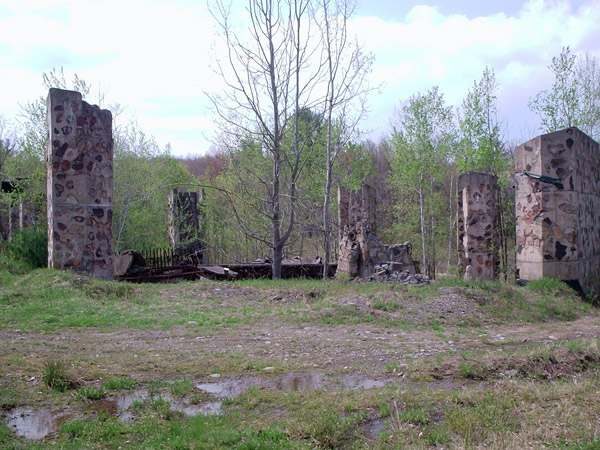
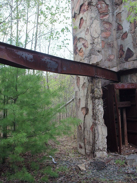
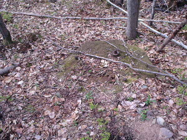
I saw the stone Lodge columns foto after glimpsing at a friend's monitor, and I immediately recognized them -very unique. What a gem of a memory this was for me! I never ski'd there, but my Father (Carpenter) built that Lodge - I believe he was the job forman. I remember he took me to the construction site when I was just a boy - vague memories of a lot of mud and stone. I may have slide fotos of the construction from my parents estate. My older cousin who had a place on the Paupack told me he remembers visiting the job site, and that stones used in constructing the Lodge fireplace were obtained right from the local area there. The Lodge as seen in the postcard shot still looks modern today. I'm proud to hear the great memories folks wrote of the Lodge, and that the columns were still standing in 2005. But I'm dissappointed to hear a residence may now be on the site, since I want to go visit the area. Long after it closed, we would stop by the site while hunting, and he would tell me stories about the place. Thanks for the article - it really brought back special memories for me.
Ad from 1969 Ski Atlas on teachski.com
http://teachski.com/books/nationalsurvey/papoconorth.jpg
Great place. Guenther Kopp was there and at Paper Birch teaching. Last I heard he's retired but doing well. He ran the ski shop at Katz' in Honesdale (bought many, many skis from him), went on his own and sold it to the Hopkins family, still called Guenther's Ski Haus. There are pics of him at Poco North and Paper Birch (now Tanglwood Ski Area) at the ski shop. This lodge was beautiful with a fantastic circular fireplace. The skiing was a great testament to the family ski life of the 60's and 70's. I remember my father meeting Robert Goulet there when he flew in on a helicopter and landed in the parking lot. After it closed fire destroyed the lodge and now one of the bank officer's sons built an underground house on the property. I've mountain biked there. Great spot with great memories.
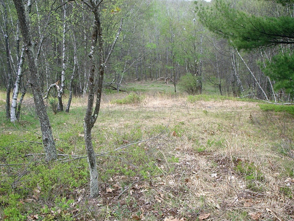
I have my true story of Poco North.When I started skiiing there the winter of 1967. It was wonderful as there were many happy families there. Poco North was managed by Ray Carrack and he used to ride his snow mobile up and down the hill. His daughter and son also skied and were wonderful. Art Schmidt was the ski director and his you gal Gloria taught there. She also played guitar around the center round fireplace were we would all gather. Paula Roos who co-owned Katz Department Store in Honesdale and Gunther Kopp who ran the sport shop was our ski school hero. He also had a ski shop down stairs in the lodge who was managed by high blonde 60's knock out Diane in a tight sweater .There was a woman named Jane who sold the tickets, and Scotty Waller ran the ski rental shop. ( i work there in 1969). We had a Jr. racing team camp that was run by Art Schmidt Jr.My friend Bob and Bill Greenwood,Johnny Murphy,Joel and Ziggy Ross,Paul Lewis, Ricky and Randy Black were all ski buddies and on the team in 1968.Dick Murphy was the head of the Ski Patrol. There was a great cafeteria upstairs. Downstairs there were two pin ball machine. There was the Baldersari family that rain the pin balls and cig machines and they skied there. One family member was Butch (RIP) became one of the worlds great mandolin players.I play mandolin and we were would ski togeather, neither had the interest at the time In 68 we had a all night ski marathon and Gregg Guston won, Katz gave the prive. I was a judge and was the first time i stayed up all night. Also the chair lift had no mid station. It just got lower and we jump off. We also would leave the T Bar mid way. There was also nights the schools came in to ski,we hot shots used to teach the girls how to ski. I reember Jill Henderson.There were two trails and there big rocks in the middle and we would jump from there. The ski of choice was Kastle CPM and Lange boots because that what Gunther used and indorsed. There was one short hill I do not see represented here, that was very short and steep .These were some of the best days of my life. I was sick the winter of 69 and received a poster signed by every season tickets holder and the employees. A few years ago I went back and saw the ski lodge burnt and everything over grown, I cried like a baby.
Rick Schmidlin
Adjunct Professor
School of Library, Archival and Information Studies (SLAIS)
The University of British Columbia
Audio/Visual Consultant
City of Vancouver Archives
http://www.answers.com/topic/rick-schmidlin
Just decided to search for this old time favorite and this site came up. I still have my ski jacket from High school with the Poco North patch on it. Went there alot in the mid '60's with Douglas Macarthur HS Ski Club. Now I live in NJ and was wondering if it was still around and close by Sad to see it gone. I remember they had the prettiest lodge with a fireplace in the middle have never seen one as nice.
Part two.
I remember: Gunther daughters Bridget and Gretchen snow blowing down the main hill at 5 and 6.
Riding the t bar half way and always getting of, it would swing and make the lift operators mad as hell, ah we were kids then.
Rick
I also learned to ski at PocoNorth. It was a cold winter day and my mom, Dorothy, really wanted to teach me. I was outfitted in leather boots two sizes too big. After the struggle of the rope tow I started down in the snow plow. When I fell one boot came off my foot and it took off down the hill with the ski.
I spent the rest of the day in the lodge coloring with Moni.
I still have the boots and an old racing bib on display in my basement.
Guenther had three daughters named Jackie, Britta and Moni.
True above, it hard to jog the ol 40 year memory
My brother and I learned to ski at Poco North in the winters of 1969 and 1970. The lodge was quite impressive. I recall the beginners rope two and two chairlifts. Equipment cost $20 for GT90 skis and (molded rubber - I.E. COLD) Grenoble boots from Sears. Memories of skiing in a blizzard - older brother very angry that he got his VW van stuck in the parking lot picking us up.
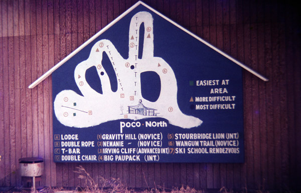
awesome trail map! that's the first I've ever seen for Poconorth... thanks Peter B.
I enjoyed reading the professor's comments about Poco North. It really brought back memories. A friend and I ventured to Poco North from Trenton, NJ back in 1968 or 69 to visit my older friend's old buddy, Ray Carrack. I'll never forget getting a tour of the property from Mr.Carrack on his snowmobile. First and only time I ever rode on one of those machines. That was quite a memorable experience for this kid of 19. I remember Mr. Carrack as a very friendly and gracious host. I also remember having supper that evening at a beautiful lodge nearby called "Split Rock". I understand that is gone also. Hard to believe over 40 years have passed. Thanks for the memories.
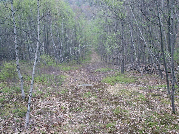
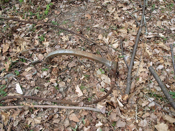
I went to Camp Watonka in Hawley in the late 70s. We used to hike over to this place and can remember the lodge still intact with broken glass and old ski equipment, presumably rentals everywhere. At the point, I think the lifts were still intact and the mountain still looked like a ski resort.
That was the first place I put skies on! I think I was like 4 or 5 years old.
These memories are all so great to read. Really takes me back! - learned to ski here. I remember night skiing to the tunes of Herb Albert and the Tijuana Brass. To this day, when I hear that music, I think of POCO NOrth. Loved the lodge and LOVED the blueberry pie!!
I remember a J-bar, too.
Rick - the short steep hill that you're remembering was Irving cliff. It's pictured in Peter B's photo (way above) - there are 2 black cirle slopes. the one on the left is Irving cliff. I remember once when my older sister and I waxed my younger sister's skis (unbeknownst to her). She went down Irving cliff and just kept going! Ended up in the parking lot! Great fun!
Here's a link to some 8mm footage of Poco North. Taken by my Dad in the late 1960's. It's very short, but I thought maybe you might like a glimpse from the past.
https://youtu.be/T4we2v2pOYU




Reader Comments