XC - everywhere
January 24, 2010
For those interested in Backcountry skiing in the Canaan Valley area:
There is a "simple" way to make an entire loop of the valley. This is not a one way in, one way out... this loop would take you from Canaan Heights to Canaan State Park and from the state park to Timberline and then back up the other side of the valley back to Canaan Heights.
Total mileage: 25+
Total time (completed 3 days ago): 8h20min on the snow
There are so many variations, and so many ways to "bail out" after 7 miles, after 11 miles, after 15 miles and even after 18 miles.
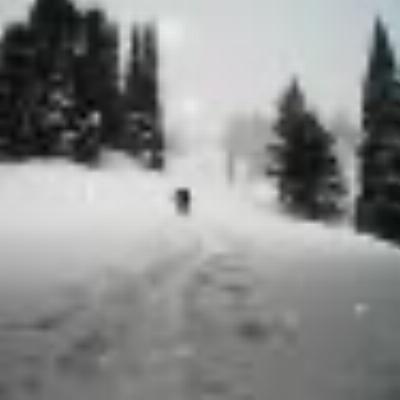
Look beyond!
Email me if you want more details.
I made my first trek out to Timberline and the Canaan Valley this past thursday, and am curious about the numerous tracks off the side of T-line's slopes, specifically, salamander. It's obvious these tracks are cross/back country, but how does everyone get up the mountain? Do they purchase the T-line lift tickets and cross country the mountain, or is there a cheaper/easier way?
While I'm very interested to traverse this area, I can't see myself paying lift ticket prices to XC ski.
Badger, some ski right up Salamander and others buy 1 ride lift tickets to avoid the 1,000' trek. 1 ride tickets are somewhere around 5-10 bucks. Lots (probably even more) do the same at CV Resort too.
Vic, did you do this loop on your Guides?
I was going to make the loop on the Guides, but went through two changes since. Unwillingly, I purchased a pair of Evos (rossignol) - I really didn't want to have skis that everyone has, but it turns out they are the best skis I have ever owned.
I broke 20+ miles of trails on that day with them - they break fast and climb super well. They take some gettnig used to in order to make them glide well, but that's okay.
SKIING UP Salamander, BTW, is the easiest. Take your time, it's only 750 feet of ascent to the Governor's turn. Pace yourself, and relax after you get there. You will have at least 3/4 of a mile of completely flat terrain to "rest".
SKIING UP Salamander, BTW, is the easiest. Take your time, it's only 750 feet of ascent to the Governor's turn. Pace yourself, and relax after you get there. You will have at least 3/4 of a mile of completely flat terrain to "rest".
Do you ski up Salamander or in the trees parallel to the actual slope?
How old are you? And what kind of ski background do you have? I like to ski, all kinds, and enjoy XC, but this is intimidating from an aerobic fitness and stamina point of view.
Not meaning to be nosy. A PM will do if you don't want to answer publicly, or at all.
I am not quite 42 - but my fiancée swears I am like "4" sometimes.
Background?
Well, started skiing in '72 (alpine), stopped for many years, started again, took up snowboarding and telemark skiing. During the same time, I retired all my Alpine Touring Gear because it's too slow to travel with... And then bought the Ultimate Global Ski pass (Kite Skiing), and finally broke a bone (pretty severe last year), and now with the rehab: long distance, light gear, fun gear, quite, peaceful, building muscles around the broken shoulder.
When there is snow, you can do either.
I like to get it over with, and so getting away from the noise is faster if you just use Salamander. There are otherwise 4 variations to get up, all starting from the cafeteria level of Tline:
1. Salamander to S turns, to Governor's turn.
2. Lower thunder, cut East follow the bike trail.
3. Whiteout to mid station, go East towards The Drop, cut across the drop, continue for 100 meters, go East (uphill)using marked bike trails. You'll end up atop The Drop, zig zagging your way up.
4. Go to the lift (bottom lift), to the tunel of Winterset, continue uphill and make a sharp left going East. That is one of the original trails (needs a lot of snow, for it isn't well maintained.
There are couple of others... but all are harder than Salamander, yet far less boring, yet slower.
I don't know the terms here. The only named corners I know on Salamander are the "S" turn, and "Windy corner", the big turn to the left after the flat run in from the top. Forest Rd. 80 meets the trail here, and if followed it leads to Whitegrass via Blackbird Wing and 3 mile. Is that the same as the "Governor's turn"? It seems to me that is the wrong way for going to Canaan Heights. A google map with route superimposed would be helpful if you are willing. I don't think a lot of people are going to poach your route given the distance of ~ 25 miles.
I recently skied the Rossi Evo. Rented them for this day trip.
http://www.dcski.com/ubbthreads33/ubbthreads.php?ubb=showflat&Number=56584#Post56584They were a very nice ski and I note modestly priced too. They turned fine on groomed downhills but I'm not sure I would want to be on them in wild snow in someplace steep & tight.
Windy Corner can only be the Governor's turn.
The first image below is a 15+ miles loop.
Tline to F80 to Whitegrass for lunch to Tline on flat land.
This route is perfect for Intermediate (easier than you think). There are numerous highlights, including the fact that it gets easier as the miles go...
photo - 15 miles
The next loop is harder. In fact, it's 25+ miles, and it only gets harder as the miles go.
The first 8 miles were some of the harder miles.
The reward was immense.
Note: the start and finish take place at the bottom of the image (from Canaan Heights)
25 mile loop on XC
Great. Thanks! I may try the small one.
Denis
You can start with this:
Tline up to Governor's turn on Salamander ski trail.
Flat to meet up with Forest 80.
Make a right on Forest 80 and downhill (easy down).
Across from Idleman's Trail (bottom of FR80) make a left to flat ground towards Whitegrass.
Arrive at WG for lunch.
Make your way back to FR80, and this time take the Idleman's Trail.
Cross the small bridge (brand new) and continue towards Tline.
Make your way to Winterset (very short downhill) and past the tunnel.
Arrive at the lodge.
This loop is about 8 miles long and great way to get accustomed to longer distances.
Here's roughly 8 miles of trails. A favorite to get you started on long distance with a goal. I'd take a beginner on this trail - one who is almost Intermediate xc skier. Ideally, go after a little bit of snow has fallen - otherwise just be a little careful of a few streams (small crossings).
Timberline to Whitegrass to Timberline LOOP
Great map Vic!...I always thought it was the "government" turn because it goes onto government land...are these maps on your visitcanaan site?...
Thanks!
I am working on a trail guide book to be released in April 2010 - yeah, time flies. However, not too much time to get this map online yet. Once the book is released, I will be working on getting additional maps and updates on Visit Canaan.
Those loops would make great x-country or rando races. This would be the year to do it.
FR 80 is pretty tame in both directions. The old 24hr race MTB race used FR 80, but in the opposite direction. I've climbed both Salamander & FR 80 and FR 80 is by far the easier of the climbs.
Vic you forgot to name the flat going from tline to idlemans. it's called "the boneyard"

Since the Boneyard trail is not "so well" maintained, it requires more snow than mother nature is willing. For this reason, I recommend taking the "upper Boneyard" (name is made up) - so as to avoid obstacles (rocks, wood, etc...)
I wish someone could drop the name of that trail - just South of the Boneyard.