Wintergreen report 1/27/06
February 6, 2006
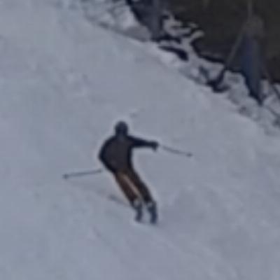
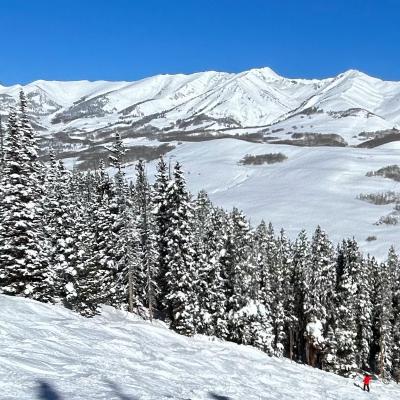
It was a bluebird day on the slopes. The trails were in good shape -- not as good as mid-December, but pretty awesome considering the recent January thaw. They obviously have been making a TON of snow in the last 2 days. The machine-made packed powder was quite good, and held up well to the day's 45F temps. It was a bit crowded for a weekday, due to about 10 busloads of kids showing up, but the Highlands and Big Acorn areas were not bad at all.
There are still a few dirt spots on some trails, and I hit quite a number of rocks rattling around on the Highlands (time for p-tex repair!). But these are fairly minor comapred to all the great new snow.
Thanks for the report 219. May be heading there soon.
Quote:
It was a bluebird day on the slopes. The trails were in good shape -- not as good as mid-December, but pretty awesome considering the recent January thaw. They obviously have been making a TON of snow in the last 2 days. The machine-made packed powder was quite good, and held up well to the day's 45F temps. It was a bit crowded for a weekday, due to about 10 busloads of kids showing up, but the Highlands and Big Acorn areas were not bad at all.
There are still a few dirt spots on some trails, and I hit quite a number of rocks rattling around on the Highlands (time for p-tex repair!). But these are fairly minor comapred to all the great new snow.
Very similar conditions at Liberty today, Saturday 1/28. Would be happy to declare it a satisfying day of spring skiing, if it weren't still January  May try to file a more detailed report with photos in a day or two.
Quote:
PS: does anyone know how to P-tex ski bases, or should I leave it up to the professionals?
It's easy to do and you can make a very good repair, especially for small damaged areas. I did quite a bit of p-tex repair on Saturday at home.
What's your budget? For about $5, you can pick up some p-tex candles. Light one end with a match, rotate and let it burn/drip over a piece of foil for a while until the tip is molten (will turn shiny/clear) and then lightly press/drip into the damaged area on the ski base until you fill the divot. Once it cools, shave it down (preferably with a metal base planer, about $8). Repeat as needed.
For more $$, you can buy irons or guns to melt the p-tex in. I have always been satisfied with the candles myself, but guns are best for large repairs (like core shots).
Most people shy away from the candles because they can leave ash/carbon chunks in the repair if done improperly, which is cosmetically undesirable on skis with colorful bases. If you're careful to rotate the candle while it's heating up, you can minimize ash/carbon chunks. And it's not even a big deal on skis with black bases, like I have now.
Craig
Yup! Something sorta satisfying about doing your own base work in anticipation of a day at the slopes.
Appreciate the updates from you guys. Gonna be skiing Wintergreen this Sat and Sun 2/4&5. Will be busy with a large family group, but might like to share a few runs if anyone wants to rendezvous. Not sure if my timing is the best, a month ago it seemed clever to go for Superbowl weekend??
The point forecast link
http://www.erh.noaa.gov/ifps/MapClick.ph...&TextType=2 provided recently by skier219 seems to suggest warmer temperatures than the reports from Wintergreen website
http://www.wintergreenresort.com/ski_and_ride/ski_report.cfm , which indicated a little natural fell on Monday night and suitable overnight snowmaking temps for part of this week. Pretty wacky forecast seems to indicate cooler, but fluctuating temps with variable possibilities of precip coming during warmer periods :-(
In any event, I've already started to pack the minivan.
you might be a week too early, or you might be ok. maybe they'll even have the nut lift fixed

I wonder how that point forecast is generated? WG is just about 1 mile east of the blue ridge that is the boundry between the central virgina and western virginia NWS districts. So a point forecast based on the central district might be more of an extrapolation than an interpolation. Otoh, the WG resort forecast always seems suspiciously optimistic.
just speculating while watching my tline thread...
I always try not to commit to WG more than one week in advance.
Afton Pass is where 64 crosses the Blue Ridge, just north of Wintergreen. I remember a March storm a few years back that just HAMMERED the Shenandoah Valley side, while the grass was green and the flowers were blooming on the Charlottesville side. At the top of Afton pass, there was literally a 10 inch ledge of natural snow, similar to what the groomers leave at the edge of trails, at the line between those two NWS districts.
I understand Wintergreen plans snowmaking based on a particular individual's forecasts for the mountain. Over the years, this guy has a great track record.
Quote:
I wonder how that point forecast is generated? WG is just about 1 mile east of the blue ridge that is the boundry between the central virgina and western virginia NWS districts. So a point forecast based on the central district might be more of an extrapolation than an interpolation. Otoh, the WG resort forecast always seems suspiciously optimistic.
The NWS point forecast I linked to is specific to the latitude/longitude at the top of the Highlands lift, at about 3500ft elevation. It gets pulled directly from the NWS forecast prediction database (a large 3D weather model that is updated hourly). They use a fairly detailed topographical model that takes terrain/elevation into account. I was pretty pleased to punch in the lat/lon to the NWS database and get back the same elevation my topo maps show. I place a high amount of confidence in the NWS model, especially as the forecast window gets within 2-3 days. By the way, you can modify that URL with other lat/lon coordinates and get forecasts for other locations in the area as well. It works great for Snowshoe too....
The Wintergreen website forecast, on the other hand, has definitely been inaccurate. I have seen it both hotter and cooler than reality, and of course, they seem to be quite optimistic when the precipitation is in liquid form...
Quote:
I understand Wintergreen plans snowmaking based on a particular individual's forecasts for the mountain. Over the years, this guy has a great track record.
Since the installation of their fancy new snowmaking system, they make decisions based on actual measured slopeside conditions (I am sure they still keep an eye on the forecast however). They have weather stations all over the mountain, approximately one station for every 5 snow guns, and control snowmaking from a fancy mountain operations "command center". You can read more about it on the York snowmaking website. WG has the most advanced snowmaking systm in the US right now, perhaps the world. I would love to get a tour of their operations someday.
Interestingly, when I was up there last Friday, the UPS guy made a delivery while I was eating lunch at my car. They received 15-20 boxes of "Snomax", which is a snowmaking enhancer (bacteria/protein).
That's interesting about the number of snowmaking weather stations as friday night they were making snow in only a few select areas - top of eagle mostly which already had good snow, but not on any highlands or the forlorn diamond. I hypothesized that the temp might be so marginal that would be the only place possible, or that they were too cheap to run them all at once knowing that a blazing Saturday afternoon was only a few hours away.
My question about the forecast is do they start with a point forecast for center of the NWS district and then have a function uses (lon,lat,atl) to adjust temp and precip, or do they actually plug the coordinates you select into an intermediary function - which seems a little too computationally intense. I guess it is a little moot as I am only there 5 days so far this year to verify it one way or another!
You ever work with NETDATA.CDF files ?
Quote:
My question about the forecast is do they start with a point forecast for center of the NWS district and then have a function uses (lon,lat,atl) to adjust temp and precip, or do they actually plug the coordinates you select into an intermediary function - which seems a little too computationally intense. I guess it is a little moot as I am only there 5 days so far this year to verify it one way or another!
I'd love to hear an answer to this as well. I do know that most profession forecasts start with a number of different computational models that you hear so much about. In my line of work, I often use Computational Fluid Dynamics (CFD) to model the flow around some object, an airplane for example. I get the impression that their weather models are somewhat similar to my CFD models, they just model the whole world. In CFD you have to discritize the volume of air around the object of interest into smaller volumes. When you run the model you can get the state of the fluid at any one of the volumes. And, of course, you can interpolate in between. It would be my guess that you have discritize the globe into regions much smaller than the typical NWS district but I don't know. I'm not really sure how accurately they model features such as bodies of water and mountains but I'm sure they must to some degree because of the way they effect weather both locally and downstream. The other question is, even if they're model is of high resolution, from how many locations do they evaluate it? With the newest maps on the NWS website you can get a point forecast for almost every square mile. I'm sure they're the result of some sort of interpolation like you described. How many locations are they interpolating from? Each district has a dozen or two realtime reporting station. I'd guess they all get their own forecast and everything else is an interpolation.
But what do I know? 

Hey Murphy, I'm a CFD'er at NASA Langley!
I wrote a small weather program for Mac OS X called "Wx", which hits the same forecast database (National Digital Forecast Database, NDFD) as I linked to in the URL. The one difference is that the URL points to a simplified, canned forecast for a specific amount of time (5-7 days I think) for quicker response. When I query the NDFD in my software, I supply latitude, longitude, start date, number of days, and date format (12-hour). This query then goes into the NDFD, which is essentially a big CFD solution dataset, and delivers back a forecast as an XML document. More info on the NDFD xml service is given here:
http://www.weather.gov/xml/
I don't know the resolution of the "grid" for NDFD, but I know it's enough to pick up elevation changes at most ski areas around here. I was experimenting with digits of my lat/lon inputs (currently have two decimal places of degrees for approx 0.7 mile fidelity) and it was reporting back elevation differences that looked right. For my next version, I am going to 3 decimal places for 0.07 mile fidelity to satisfy customer requests. I know the NDFD server shows 4-5 decimal places accuracy for the lat/lon inputs, but that is not necessarily the true grid resolution for their simulations. Like we do in CFD, I am guessing they have a preset grid that captures some/most topographical features, and then they interpolate in the NDFD to respond to queries. I am sure a computational meteorologist could tell us more about typical grid scales used for the actual simulations.
From what I can tell, the discrete observation sites around the country also pull their local forecasts from the NDFD (not necessarily via the xml feed though). The sites themselves do not serve as data points for other forecasts, but I would not be surprised if hourly observations are fed into the NDFD as some sort of updated boundary condition.
If you have time, you can alter the lat/lon inputs in that URL I gave and "crawl" around an area of interest to see how the forecast changes. I used a similar approach (in software) to crawl around Snowshoe and educate myself on how mountain weather varies in that area. One of these days, I would like to used the NDFD data to make a 2D or 3D forecast, rather than just the point forecasts I generate now.
Craig
Quote:
You ever work with NETDATA.CDF files ?
No, but that sounds real familiar -- what are they?
Their system really is pretty slick. Those weather stations are also continually monitoring humidity, which has a huge impact on the quality of snow produced.
As for forecasting in general, I wonder what impact the snow-covered slopes themselves have on slopeside weather. Very little I'm sure when the wind blows, but it has to contribute to the fog on those cool, humid days, and when there's no breeze, the snow itself must chill the air.
All that said, we just need some cold, dry weather, plain and simple.
Well, I looked around for a few minutes and that's just too much fun. It looks like the actual grid is irregular and there are maybe three actual forecast verification sites in north central virginia. I did not see how the individual (lon,lat) point forecasts are generated, but it looks like it is pretty much a black box to the SOAP user. I'll agree they are generating something for 3490' at the top of highlands, I just don't know what that something is. There is a presentations page that looks really promising for some late night cruising:
http://www.weather.gov/ndfd/presentation.htm I did also find this...
Quote:
This does not mean that all forecasts in the NDFD will be updated hourly, but usually only a small portion affecting limited areas and/or periods.
NETDATA.CDF is (or was?) the 3D data file format used by atmospheric and meterological sciences for at least some of their applications. Oddly enough, the mass-spectroscopy vendors picked it up also (they do have 3D data) which is where I ran into since one of the vendors had screwed it up and I had to write code to unscrew it. [they didn't realize it was screwed up since they wrote their own libs to both read and write, but if anyone else wanted to read it....] I used to go to conferences hosted by DU which coincidentally has a signficant atmostpheric sciences department and I would talk to guys doing that work. Anyway, I was wondering if in developing WX program that you ever had to read CDF data.
more than you need to know
ps: there is this amazing 3D grid of sensors around the world recording astounding amounts of climatologic data every and a huge branch of computational science trying to figure out what to do with data that you can't store. this is only rivaled by what the NSA is doing.
ohhh, a topo map with transparant forecast overlays for temp, humidity, precip, would be just too cool. i bet the DOD already has those....
Then a 3D map a'la Google Earth with the same overlays with atmospheric altitude gradiations...!!!!!!!!!!
Quote:
only rivaled by what the NSA is doing
Shhhhhhh.......their listening now. 
Quote:
As for forecasting in general, I wonder what impact the snow-covered slopes themselves have on slopeside weather. Very little I'm sure when the wind blows, but it has to contribute to the fog on those cool, humid days, and when there's no breeze, the snow itself must chill the air.
I think snow cover makes a big difference and I'm not sure how well most models account for it. I often read the technical weather discussion from my local NWS meterologist and he'll often mention adjusting temps. down from what the models predict because the snow reduces radiation heating.
Hey Skier,
What group do you work for? We've done a bit of work with you guys in the past. Did we do dinner at a brew pub in Columbus a few months back?
I just started to scratch the surface of the link you said. I found that their "grid resolution" was 5km. I believe they're referring to their forecast grid resolution, not some sort of computational model. In the NWS technical forecast discussions I always hear about the regional meterologist updating their grids. From what I understand this as much art as it is science. They draw from several of these weather models and then apply their own intuition, experience or what ever else and come up with a forecast for the grids. I think that's the data you see.
I'm in the Configuration Aerodynamics Branch (Larry Leavitt, Rich Wahls, Zac Applin are the heads). I wasn't out at the Columbus meeting, but a bunch of my colleagues were including Jeff Flamm and Steve Bauer.
Yeah, I think I made a poor choice by using the word "grid" before. We think of it in terms of the computational grid, but the NWS uses "grid" to describe their weather/forecast network of zones. When they talk about grid forecasts, I think those are compiled/written by humans for regions.
I do have a contact at the NWS, and can bug him with questions if we can't find the info on their site.
Here's another forecast to check:
http://www.erh.noaa.gov/ifps/MapClick.php?CityName=Nellysford&state=VA&site=LWXI got this by putting in the zip code for Nellysford down in the valley. Anyway, they have a clickable image map on that site that you can use to get point forecasts in the area, and it also shows the elevation under the map. Click on the mountains to the upper left of Nellysford (red dot), along the Blue Ridge Parkway, and you can home in on WG. The point does seem to snap to certain locations (one of which coincidentally matches WG) but we're also dealing with an image map here, which may complicate things even more.
Craig
Quote:
I'm in the Configuration Aerodynamics Branch (Larry Leavitt, Rich Wahls, Zac Applin are the heads). I wasn't out at the Columbus meeting, but a bunch of my colleagues were including Jeff Flamm and Steve Bauer.
Yeah, I think I made a poor choice by using the word "grid" before. We think of it in terms of the computational grid, but the NWS uses "grid" to describe their weather/forecast network of zones. When they talk about grid forecasts, I think those are compiled/written by humans for regions.
I do have a contact at the NWS, and can bug him with questions if we can't find the info on their site.
Here's another forecast to check:
http://www.erh.noaa.gov/ifps/MapClick.php?CityName=Nellysford&state=VA&site=LWX
I got this by putting in the zip code for Nellysford down in the valley. Anyway, they have a clickable image map on that site that you can use to get point forecasts in the area, and it also shows the elevation under the map. Click on the mountains to the upper left of Nellysford (red dot), along the Blue Ridge Parkway, and you can home in on WG. The point does seem to snap to certain locations (one of which coincidentally matches WG) but we're also dealing with an image map here, which may complicate things even more.
Craig
We had a program with Susan Gorton of the flow control group but it fell victim to NASA budget cuts. A co-worker will actually be up there for some testing in the near future on another program.
I love those new maps that the NWS has out. I probably spent 10 minutes clicking on that map you linked. I never found what I thought should be Wintergreen but I did find 3,500' location a few miles south west. It's intersting to note how on some days the elevation difference produces a big temperature on some days and hardly any on others. That tells me that it's not just some sort of interpolation between grids (zones) with an elevation correction but rather each grid has a 3D forecast with temperature and p-type as a function of elevation.
Oh yeah, I know Susan and her branch. The NASA Aeronautics program is getting revitalized, so research opportunities ought to get better come FY07.
The last two times I drove up to Wintergreen, it got warmer as I drove up the hill, compared to the valley below. Both were warm days (45F). I would be curious to know if the forecast reflected that inversion on those days. When it's seasonably cold, it's almost always 4-8 deg F cooler up on the hill.
You can go to Microsoft Terraserver, or use Google Earth, to zoom in on Wintergreen and get the right lat/lon coordinates for various parts of the mtn.
Craig
Quote:
Oh yeah, I know Susan and her branch. The NASA Aeronautics program is getting revitalized, so research opportunities ought to get better come FY07.
The last two times I drove up to Wintergreen, it got warmer as I drove up the hill, compared to the valley below. Both were warm days (45F). I would be curious to know if the forecast reflected that inversion on those days. When it's seasonably cold, it's almost always 4-8 deg F cooler up on the hill.
You can go to Microsoft Terraserver, or use Google Earth, to zoom in on Wintergreen and get the right lat/lon coordinates for various parts of the mtn.
Craig
That's the first postive thing I've heard from NASA personnel in over a year. You made my day.
Great minds must think alike. Apparently, so do ours. Using Terraserver is exactly what I did. The highest elevation I got with those coords was around 2,300'. The 3,500' spot was a few miles south west. Close enough I reckon.
By the way, I saw you were planning on heading to Snowshoe next weekend. I'll be doing the same although I won't be arriving until late Sunday (can't stand the crowds). If you're gonna still be around we should have a drink or something.
How did this conversation get turned into NASA aeronautic research bid solicitation? I leave this board for one day and suddenly everyone is talking careers. Criminy. Where's Jimmy to revive the Untopic when you need it?
(skier219 this is more directed at Murphy than you. Since we live in the same town and his intelligence is far superior to mine, I have to resort to the old trick of mocking him in order to have any sense of self-worth at all. Sorry you had to get caught in the ugly crossfire

)
Quote:
That's the first postive thing I've heard from NASA personnel in over a year. You made my day.
Great minds must think alike. Apparently, so do ours. Using Terraserver is exactly what I did. The highest elevation I got with those coords was around 2,300'. The 3,500' spot was a few miles south west. Close enough I reckon.
By the way, I saw you were planning on heading to Snowshoe next weekend. I'll be doing the same although I won't be arriving until late Sunday (can't stand the crowds). If you're gonna still be around we should have a drink or something.
[Roger Z, you'll have to indulge a bit more shop talk, but maybe it will give you more material to bug Murphy!]
Tell you what, it's been a lousy year for NASA aero. We're feeling pretty OK now, but there have been some low points due to the aero budget getting pinched. We lost a lot of good people, civil servants and contractors, in face of possible job cuts. There is still a risk of some job losses, but overall, aero is looking a lot better now that they have returned the emphasis to fundamental research. The prior plan under O'Keefe would have put a lot of money into flight demos, which leaves a lot less to fund people and research. Just hope Mike Griffin and Lisa Porter don't get hit by a bus any time soon! They are putting together one of the best aero programs I have seen in my 15 years at Langley, despite the lowest aero budget in multiple decades.
With Terraserver, I can zoom in on the Highlands on the satellite image. It returns about ~3490 ft elevation at the top. That gave me the lat/lon I have been plugging into the NWS database.
We're heading to Snowshoe on Thursday morning, and will be there until Sunday afternoon (probably leave around 3pm Sunday , since we have to get home early and prepare for my wife's ACL surgery on Monday AM -- that is to fix her injury from our last trip to Snowshoe). If you happen to get there earlier on Sunday, maybe we can make a few runs. I'll be there with my wife's family, seven people total. We're staying at Powder Monkey. Should have some great snow by the looks of it.
Craig
Quote:
Tell you what, it's been a lousy year for NASA aero. We're feeling pretty OK now, but there have been some low points due to the aero budget getting pinched. We lost a lot of good people, civil servants and contractors, in face of possible job cuts. There is still a risk of some job losses, but overall, aero is looking a lot better now that they have returned the emphasis to fundamental research. The prior plan under O'Keefe would have put a lot of money into flight demos, which leaves a lot less to fund people and research. Just hope Mike Griffin and Lisa Porter don't get hit by a bus any time soon! They are putting together one of the best aero programs I have seen in my 15 years at Langley, despite the lowest aero budget in multiple decades.
With Terraserver, I can zoom in on the Highlands on the satellite image. It returns about ~3490 ft elevation at the top. That gave me the lat/lon I have been plugging into the NWS database.
We're heading to Snowshoe on Thursday morning, and will be there until Sunday afternoon (probably leave around 3pm Sunday , since we have to get home early and prepare for my wife's ACL surgery on Monday AM -- that is to fix her injury from our last trip to Snowshoe). If you happen to get there earlier on Sunday, maybe we can make a few runs. I'll be there with my wife's family, seven people total. We're staying at Powder Monkey. Should have some great snow by the looks of it.
That's great news. In 2004, about 60% of my company's work came from NASA Glenn or Langley. We were fortunate enough that none of it was cut but we missed out on a lot of follow-on work that we were hoping for.
Got it this time (Wintergreen). Must have written down the wrong coords from Terraserver.
We probably won't make it to Snowshoe until about 7pm. Doin' lunch with the in-laws in Roanoke. Have to catch up with you some other time. We don't have a place yet but we usually stay at the Powder Monkey as well. Pretty nice for the money, particularly compared to the central village. And I prefer to be a little removed from the hustle and bustle. I'm actually considering staying across from the Powder Monkey at Mountain Crest or Ridgewood. It's a lot cheaper. Have you ever stayed there? Is it a dump?
Quote:
We don't have a place yet but we usually stay at the Powder Monkey as well. Pretty nice for the money, particularly compared to the central village. And I prefer to be a little removed from the hustle and bustle. I'm actually considering staying across from the Powder Monkey at Mountain Crest or Ridgewood. It's a lot cheaper. Have you ever stayed there? Is it a dump?
You must be thinking of Powder Ridge (I mix them up all the time too). We stayed there last April (actually had a nice powder dump that Sat night) and it was a great condo. We have not stayed at Mountain Crest or Ridgewood, but I know that the walk to the slopes can be long-ish from those units. Based on past experience, we always try for slopeside (or short walk) now.
Powder Monkey condos are at the top of the Powder Monkey lift, and diagonally across the street from the Cupp/Shays access point. It will be our first time there. This was the only 3bdr slopeside condo we could find (Powder Ridge maxes out at 2bdr) that was reasonably priced. We drove through on our last trip, and they look like really nice condos. The complex is much smaller than some of the others -- 12-15 units or so. It seems to be far enough from the village to be quiet, but close enough for a quick walk in. And I like the idea of being a quick walk from Cupp/Shays while the rest of the family is slopeside to a green trail. Should work out well.
I learn more and more every time we visit. Haven't ever stayed at the same place twice.
Craig