OTW & Lower Shays Stats
December 5, 2013
72 posts
19 users
35k+ views
Does anyone have the stats for OTW & Lower Shays? There's been some comments made that "OTW is like a longer Lower Shays". To me Lower Shays feels steeper and longer than OTW, but my feeling is probably wrong. The only stat I could find is that Lower Shays has a pitch of 52 degrees (per SS webpage). 52 degrees seems a bit exaggerated. Does anybody have the real stats?
52% not 52 degrees. 27.5 degrees. Sorry no stats for off the wall.
Quote:
52% not 52 degrees. 27.5 degrees. Sorry no stats for off the wall.
I have trouble believing Lower Shay's is 27.5 degrees. People disappear from view (when you watch from the top) too quickly to be just 27.5 degrees.
It may be 52% of 90 degrees, or roughly 47 degrees.
If someone has the stats on Extrovert, I am curious on how the 3 compare.
Since I'm sitting here at work with nothing I would rather be doing I decided to take up Bushwacker's challenge and measure the pitch of all three runs. Here are the results:
Lower Shay's looks to have around 800' of vert but only 400' are near a 50% grade. I'm guessing a little here because the run wasn't cut at the time of the topo map or satellite image.
Off the Wall has a very similar grade but for a slightly shorter vert of about 300'.
Extorvert actually is steeper and for a longer distance. It averages close to 60% for over 500' of vert and probably exceeds 60-65% for the first 100' although the resolution of the terraserver maps isn't really high enough to determine pitch over such a short distance.
Back to work

"Shay's Revenge, with steeps of 52 degrees and "mountain size" moguls, even the most hardcore skiers" This is the actual quote from SS's virtual map.
"Shay's Revenge, with steeps of 52% and "mountain size" moguls, even the most hardcore skiers" from the general write up of the Western Territory under the Trail Map section of SS's webpage.
They seem to interchange degrees & percentages.
Anybody have any USGS quad maps of this area?
It's not 52 degrees. Think of the percent/degree think like percent/proof in alcohol. Drinking a 100% alcohol content sets you up for a good night; 100 proof alcohol is embalming fluid. A 52 degree slope would have a pitch well over 100 percent.
For comparison purposes: Tuckerman's Ravine- reputed steepest run on the east coast- has a pitch around 45 degrees (I've been told). The steepest runs at Jackson Hole and Breckenridge are just over 50 degrees; at 60 degrees it becomes very difficult to hold snow on a trail and at 70-72 degrees snow can no longer be held at all. Shays is simply not in that ballpark, anyway you look at it.
That's not to say that a 52 percent pitch isn't respectable. That's a good run by most any standard, especially when it's icy and mogul-strewn. Cut your teeth on an icy, mogully east coast run and you'll find the 35 degree pitches (70 percent grade) out west modest by comparison!
Now if y'all REALLY want steeps, you should join me in my crusade to develop Buckhorn Mountain into the steepest, nastiest moutain in North America...

Quote:
Now if y'all REALLY want steeps, you should join me in my crusade to develop Buckhorn Mountain into the steepest, nastiest moutain in North America...
Googled that, Washington State?
fwiw, please roger, be carefuls tonite at happy hour. I think you've got your alco% mixed up w/your alco proof. 100 proof = 50%...from one Apres Expert to another 
Quote:
Googled that, Washington State?
Keep looking. It's a little closer than that.
Okay folks ... I guess I don't know how to think of this. Are you saying that percent grade represents drop over run i.e. 800 feet of vertical drop over 800 feet horizontal run represents a 100% grade (and a 45 degree slope)? In that case, a 90 degree slope represents an infinite percent drop (or undefined as horizontal run approaches zero).
I guess that makes sense, but I've got to tell you that Lower Shays sure feels like a lot more than a 24 degree drop. That said, I think the 52% nomenclature on the SS website is an error. It may not be 52 degrees, but it's more than 52 percent.
See? I always get those two mixed up. So you're saying if I drank 100% alcohol I could ski a 50 degree slope painlessly. I'll never keep these straight.
I guess Murphy makes crusader number two. Buckhorn sits on the WV/VA line. If you google the mountain peaks of WV it should give you the coordinates.
here? That does look steep!
Roger, i'd suspect enuf 100% alcohol would enable you to ski down the stack at a power plant "painlessly".
lol
No, that wasn't it Jimmy, but the Tazewell area has lots of rich opportunities too. Here it is:
http://www.terraserver-usa.com/image.asp...uefield%7cWV%7cI haven't found a grade on Shay's steeper than 57%, and that was being creative with the calcs. 52 or 53% is the average pitch for that 400 vert, though it might be a shade steeper in places. If you shave a mogul just right, you can get to 60%, but we're talking the average pitch of the slope itself, not creative grooming.
Oh, and, for comparison purposes- on that Buckhorn map, the terrain that slopes NW into the Dry Fork is about 53%. The terrain on the northeast pitches- particular at Jesse's Knob- approach 70% in the steeper places and average over 60% for several hundred feet. This mountain would see about 10 skier visits per year.
Quote:
This Q&A and the debate that follows deals with the issue of the toughest trail in the Mid-Atlantic:
http://www.dcski.com/faq/view_faq.php?faq_id=8&mode=headlines
Thanks johnfmh, That brings up lower wildcat for consideration. Maybe one of our terraserver gurus can give us vertical & pitch for that. So far we have
OTW @ 300' x50%
lower shays @ 400' x50%
extrovert @ 600' x 60%
Well it was my first attempt at trying to do anything like this on the topos but here is what I came up with for lower wildcat. Lower wildcat had about a 600ft vertical drop over a 1200ft horizontal run. Taking the inverse tangent of 600/1200 I found lower wildcat to average about 26.6 degrees. These numbers seam right to me but I did this real fast so someone might want to check up on my math.
On the whole % vs. ° thing... % (gradient) simply means that every 100 feet out you go, you go down x feet. Shay's has a gradient of 52%, meaning every 52 feet of straight vertical down is 100 feet further out from where you were.... the slope is -52/100 or -13/25.
If you graph that fuction you would be able to measure the angle of elevation where the function intercepts the x-axis. Since we're given the initial condition of f(0)=400, we can infer that the average slope of Lower Shay's Revenge can be graphed with the function f(x)= -13x/25 + 400
Since we know that every 52 feet down is 100 feet out (or every 13 feet down is 25 feet out) we can use the basic trigomentric function tanget to calculate the angle at which Shay's is pitched. The arctangent of 13/25 will yield 27.5° as the angle of elevation.
Assuming that there is a 52 foot drop over 100 horizontal, this is a 52% grade (think of the signs you see on the highway when approachiong a downgrade such as between Harmon WV and Seneca Rocks. It is esentially a 1 to 2 slope. So the grade of Lower Shays is 52% as published. I went to the askjeeves.com and typed in "determine steepness of a slope". Up popped a page called "Measuring Slope Steepness". The following were copied from this page:
Measuring Slope Steepness
The easiest way to determine the percent slope of an area is to measure the change in height (elevation over a measured distance), then calculate the percentage of slope.
Use the following formula to determine slope:
Rise Run = Slope %
OR
(Change in elevation measured distance = slope %)
e.g. 30 metres 100 metres = .3 or 30%
Standard slope descriptors
Slope (%) Approximate degrees Terminology
0 - 0.5 0 Level
0.5 - 2 0.3 - 1.1 Nearly level
2 - 5 1.1 - 3 Very gentle slope
5 - 9 3 - 5 Gentle slope
9 - 15 5 - 8.5 Moderate slope
15 - 30 8.5 - 16.5 Strong slope
30 - 45 16.5 - 24 Very strong slope
45 - 70 24 - 35 Extreme slope
70 - 100 35 - 45 Steep slope
> 100 > 45 Very steep slope
The page from Ask Jeeves is at:
http://web.ask.com/redir?u=http%3A%2F%2F...&Complete=1I also searched elsewhere and garnared the following:
O"n a 45-degree slope, you will be able to reach out and touch the ground above you, merely by stretching out your arm. Even to a confident expert skier, this will feel like a virtual precipice. We're now into the realm of "extreme skiers", now often referred to as "big mountain freeriders".
At 55 degrees, you can touch the slope above you with your elbow. And around 60 degrees, there is a limit reached: sometimes the snow will not stick to slopes this steep.
http://travel.guardian.co.uk/activities/wintersports/story/0,7447,457939,00.html
Also suggest looking at the Tuckerman's Ravene picture at this site:
http://www.tucman.com/tuckerman/enlargement/?comp=TU001Hope this helps.
The Colonel
And this is neat...
When you're skiing down a trail and you've begun to ski the trail comfortably and confidently (you're no longer "falling over the edge" and skidding around trying to keep in control) you've reached the mid-point of the trail's slope, its local point of inflection, meaning you're no longer dropping rapidly nor flattening out... you're just skiing.
"For comparison purposes: Tuckerman's Ravine- reputed steepest run on the east coast- has a pitch around 45 degrees (I've been told). The steepest runs at Jackson Hole and Breckenridge are just over 50 degrees; at 60 degrees it becomes very difficult to hold snow on a trail and at 70-72 degrees snow can no longer be held at all. Shays is simply not in that ballpark, anyway you look at it"
Don't think you are quite accurate on any of those stats.
The steepest run at Snowbird, which is regarded as one of the steepest resorts in the USA, is Great Scott, at 42 degrees, or a 90% grade.
dude! Man forget Great Scott (actually it does not really exist ... it is but a single line between was locals call "rat's nest" and "north face" but they are never on the maps) it is not that hard. Now I can show you a s-t-e-e-p chute line thru a gate at Snowbird facing the Gadzoom lift.. like your edge will not even hold the snow just falls out from under you ... you just have to accept the slide and hope for the best (and damn well make that next turn)!
The Corbet's thing at Jackson is tricky because you have do do a pretty big cornice drop into a steep but if you can control the rebound (and avoid the ledge/chatters all the others have left) on the landing your golden.
I'll qualify those stats- those are what I've seen for numbers. If they're not accurate, well, so be it.
here's a fun one -- ye old Grizzly Downhill at Snowbasin. Best groomed run I think i've been on... (well semi-groomed, plenty of moguls when i was there...)
Dang steep in places, article claims it starts at 70% and has pitches up to 74% grade. average is much lower. STILL top of mountain to bottom, can't complain! If you want more at the bottom, you can ski.
http://www.skimag.com/skimag/news/article/0,12795,325731,00.html
I can't handle all the degrees and percents stats, I just know steep when I see it. Short and steep, like we have in mid-Atlantic (e.g., Gunbarrel at Roundtop or Dixie Dare at Massanutten) is cool and great practice, but sort of a different animal than a slope perhaps not quite as steep, but goes on for 1000+ feet of vertical like some of the stuff I saw at Kirkwood this past season. Throw in slots, cliff bands, trees - and steepness alone is no longer your biggest concern. Also, if you're fortunate enough to be skiing in a foot or more of fresh snow, it makes steeps less intimidating because you don't have as much speed to check as on a packed slope. Here's a thread with stats on some famous steeps:
http://forums.epicski.com/showthread.php?t=6582&highlight=steep+measuringHere's a Ski magazine article on the math of steeps:
http://www.skimag.com/skimag/ski_life/article/0,12795,325926,00.html
Here's a shot of Ramrod at Roundtop. Not quite as steep as Gunbarrel, but almost. Not too impressive in this pic, but top 100yrds offer some quick turns.
http://community.webshots.com/photo/59715224/59717450CRQHTFThis is one of my favorite shots on the web of some of the big vert steeps at Kirkwood:
http://community.webshots.com/photo/88708768/88708768pcOrqF
Would that chute near Gadzoom be your infamous mountain goating episode?

Crush and Jim K. make some good points about true "difficulty of steep runs." It's really not how steep a run is, but what happens to you if you should fall. If a fall means a slide of 1000 feet, or a tumble into rocks, trees or over a cliff, the pucker factor is upped tremendously. Plus, lots of steep chutes are made a lot tougher by mandatory air to get into the chute (a la Corbett's.) Lose an edge when landing the entry, and the results may not be pleasant. Though Corbett's is so wide, I don't know if I'd call it a chute.
Lots of fresh powder makes skiing steeps much easier - the drag from the snow really helps with speed control. If it's deep enough, just keep your skis in the fall line.
The top of the Grizzly Downhill is really not that steep (though I wouldn't want to have to tuck it

). It's not a slope where you stand at the top looking down and your knees start buckling. Though lines in some of those rock bands under the Grizzly Tram are a lot steeper - people have died in there in recent years.
Probable skiing Urban Legend: rumor has it that the patrol at Blackcomb don't bother patrolling Couloir Extreme (formerly Sudan Ridge.) They just hang out at the bottom and wait for the accidents to slide down to them.
How do the following trails/slopes compare to the stuff thats been mentioned at Jackson Hole or Blackcomb? I've never skied either of those places YET!
High Rustler, Alta
Paradise, MRG
Goat, Stowe
I've skied all three. High Rustler & Goat were steep but they didn't have the pucker factor that Paradise has.
How does the stuff at JH & Blackcomb compare?
..har har yeah J.L. that wuz it! But not THAT chute the good one to the skier's right!!!! Yeah not the one that had all the BIG scary rocks in it!!! ;-)
The biggest pucker factor run I've ever skied was at Lake Louise. Some of the double diamonds that come off the back bowls are really good. I've heard Fernie has even more gut-wrenching runs. But far and away the steepest, gnarliest, nastiest, most frightening thing I have ever seen (but not skied) are the Palisades at Sugar Bowl in California. I wouldn't go near it without about a season of training and a safety rope- falling does mean serious injury or death, they are not kidding. Anyone ever seen them? It's difficult to describe how nasty they are, they're just bad (and every chute ends in a mandatory cliff jump).
Some great points have been made about steepness. My preferred line isn't the one that's so steep that the whole way down you're turning in mortal fear. The ones I prefer most are where you get to the top, think "whoo that's steep," take a couple breaths to steel your nerves, draw a line, and go. The feeling of nailing something that's moderately intimidating is exhilirating. To that extent, I'd label a hidden bowl off of East St. Pats at Steamboat, Don's Descent at Big Mountain, Parachute at Solitude, and Couloir Extreme at Whistler (as well as this chute the comes down in between two granite walls there) as some of my favorite runs. As far as Couloir Extreme goes- there's a goat trail that goes around the headwall (a vertical drop-in). If you avoid the headwall the rest is steep but doable- it's steep enough that if you aren't on the sweet spot of your ski, you'll fall. That's gettin' steep. But it's not as intimidating as people make it out to be.
Couple of runs I've walked away from that I'd like to have another crack at: Haskill Slide at Big Mtn and the Expert Chutes at Jackson. Assuming I ever go back to Jackson- what's the point of going back to that anthill, right JohnL?

Grzzly was fun but no pucker factor involved... at the top it is STEEP, you get to the edge and glance down and think "hmm that does look a bit steep". And some people do turn back and take the tram... somewhere near the bottom after the BIG TURN is a VASTLY steeper section still, toss in some moguls and ... For a groomed run this is as steep as i've skied on I think and throw in the top to bottom length - yowza! ... -- the pt I was trying to make is that this run is something that one can compare against runs here in the MidAtl that are almost 100% groomed most of the time (or semi-groomed/moguls).
OFF trail is a complete 'nuther beast in my mind... however TYPICALLY the steepiness is all over the place. I think I have been steeper off trail but for shorter stretches by far and typically then again MUCH MORE SNOW to fiddle about in, make comparisons difficult, I think.
HERE's the COOLEST thing I have ever seen and I wouldn't touch it myself. From the BOTTOM of the tram at Snowbasin looking up towards the whispy peaks of the Snowbasin mountain...
But what did I see, why 2 snowborders peering over the cornices at me (not really but you could just make their heads!)... AND... and we really couldn't believe it as we looked up and stared, they jumped in and worked there way down from the top of these STARTLINGLY STEEP PEAKS to the tram loading area!
From our vantage point it looked like near vertical but it must not have been. IT WAS AMAZING!
If they had fallen... certainly a LONG tumble unless they could catch themselves somehow.
Looked extremely dangerous but that's hard to say really too.
Now there do seem to be chutes down from the top of the tram area at snowbasin as well... skiers RIGHT i think facing towards the basin side (not facing out towards SLC)...
It was clear some folks do ski or board down this stuff... but I can only look. No way would I try it ... unless maybe I was dying of something horrible, then maybe!
:-)
Paradise is some of the most fun on this coast, kinda of tires you out after about 5 runs down it though. I guess i need to ski 2000 vert mountains more often. And yeah the pucker factor as snow fall down the hill with each turn is pretty high.
Paradise is also on my list of "passed it but wish I hadn't" runs. If I ever get back to MRG, I'll be sure to do it.
KevR your discussion about the cornices at Snowbasin reminded me of the chutes above Honeycomb Canyon at Solitude. More dastardly looking stuff up there, but apparently you can hike up there and NOT have to ski those runs. You can take intermediate- intermediate!- backcountry over to Alta or continue traversing to the semi-legendary Silver Fork Canyon, which looks spectacular. I didn't know either was possible until my last day of skiing at Solitude, so if I go back I will try to find someone to hike up there and at least do Silver Fork.
Anybody ever been in the backcountry above Solitude, Brighton and Alta? Crush, you been back there?
there's a tour you can take when you are out there - its advertized in the local mags.. basically you ski through "backcountry" to all the major resorts... actually google search -- got this:
Ever wonder what it would be like to ski five resorts and the back country, going through one of the most scenic areas of the Wastach Mountain Range? The tour offers the advanced skier the opportunity to ski back country routes between and through as many as five resorts in a single day with guides trained in snow safety. The tour includes guide service, lunch, lift access and transportation back to the point of origin. Skiers must be of advanced ability and in good physical condition. Departures from Park City Resort run Monday, Wednesday, Friday and Sunday and also include Solitude, Brighton, Alta and Snowbird. Tuesday, Thursday and Saturday departures from Snowbird include Alta, Brighton, and Solitude. Tour price is TBA. For reservations call Ski Utah at 801-534-1907
Quote:
I just know steep when I see it. Short and steep, like we have in mid-Atlantic (e.g., Gunbarrel at Roundtop or Dixie Dare at Massanutten
Please tell me you were kidding right?
Well then think of the comparable Goosebumps trail at Seven Springs. Point I was trying to make is if these trails went on for another half mile at the same steepness they would be pretty impressive.
If you stacked the headwall of Gunbarrel on top of itself 10x, it would be a double black just about anywhere out West. There are very short sections of it which are probably > 40 degrees. Speed control is not an issue on it currently since you can recover control or scrape speed (as most do) on the flatter sections below the headwall.
I wouldn't make that claim about any other trail in the Mid-Atlantic.
Never been to Roundtop, so I can't comment. I have been out west and a double black there is very scary. This is quite a claim. I may have to make a trip to PA next year to check it out
There aren't too many double blacks out West that I find scary and most of the ones I do require 10+ jumps to enter the trail or have cliff sections which you could slide off if you had a bad fall.
Part of the challenge of skiing the headwall at Roundtop is picking a line. Because of the very high percentage of unskilled sliders at Roundtop (I've seen numerous people sliding down it on their butts), there are often deep trenches cut through it; you can't ski over the trenches without losing your skis. I've seen one very skilled patroller at Roundtop do just the same; he left both skis on the mountain and he ended up at the bottom of the headwall. With the trenches cutting across the slope, you are left with 10-20 foot wide gulleys to ski in.
It is easy for a skilled skier to make it down the headwall of Gunbarrel; however, you do have to pay attention because some of the lines are unskiable. And just making it down in my book doesn't count; you have to be able to ski the exact line you've mapped out with fluidity and grace. I've yet to do that on upper Gunbarrel.
Some of the local bad boys don't worry about the trenches and just huck 20+ of vertical.
Also note that part of the steepness on upper Gunbarrel is due to faux cornices built up by snowmaking. And the consequences of a fall on the headwall are minimal since you'll most likely only slide 50 feet or so.
The top of Gunbarrel is as close as we have to true double black terrain in the Mid-Atl. Unfortunately, by "top" it's meant the tippy top, maybe 10-15 vertical feet. If you work it real hard, you can get three or four turns in before it loops back into a normal double diamond, then a normal diamond, then a blue square for the balance of the run. Still, those first few turns are very worth it; you should give it a try someday Urrl.
Two seasons ago, I was turning on a knife edge point, the alternatives were a six foot jump into a goat line or an icy face where you couldn't get an edge. Five times I bailed into the goat line, the sixth I nailed the edge for the balance of the drop. Those three or four turns I nailed down the knife edge ranked up there with Utah and the chutes I was skiing in Tahoe as the best turns of the whole season.
So, stacking the top 15 feet of vertical on Gunbarrel 10 times over would certainly be double black anywhere, even if that only means 150 feet of vertical. It'd be a nasty long stretch.
And yes, watching the local 18 year olds huck the top is always fun too. They are very responsible- always one person making sure the run is clear for jumps and sometimes two folks watching out. If you're willing to take your own life into your hands but not risk anyone else's, that's cool in my books.
Last year I'd say it was more like 50 feet of very tough vertical. Either way, it's still very short.
So Crush, will you share your goat story with the class?
GB is a great little run but very very short really and just the top bits are a true challenge. As for double-black... well its all relative isn't it? Generally I think a bit more like this -- if I fall here on this trail am I likely to: a) get back up with only pride injured, b) slide along until I can roll over and catch an edge and stop (pride injured too), or c) really hurt myself (unconcious and oblivious of pride)
When I was at JH, I saw the double-blacks -- and I mean actual OFFICIAL signed trails here not a hike-to-me area -- and they *seemed* to be mostly in the "c" catagory. On the other hand I can't think of any other OFFICIAL trails that I've felt like this about -- certainly not in mid-atlantic (although my foray is rather limited to WT, RT, LB, SS, and Wisp..)even in the rest of Utah, Colorado, and Montana where I have skied, I can't say in general I felt that I was on or looking at a trail that was a definitive 'c'.
Yes there are off trail "areas" everywhere that CLEARLY have "c" places in them BUT my experience is there are obvious clear avenues to avoid the really dangerous stuff. Whereas at JH, and maybe it was just my wet behind-the-ears-self, but I thought consistently that most double-blacks fell into the 'c' catagory and you didn't have to look hard to find them just get off the lift, ski left/ski right and stop at the nearest sign... (mainly off the tram & down through there)-- and then follow jagged cliffs down to waiting crocks at the bottom!
Maybe it was just me... anyway I still dream about the Hobacks... dang it, must get back there.
Ski slope steepness has been something that has held my interest for some time. I have posted on this subject numerous times at EpicSki and SkiNC. I do not consider myself an "extreme skier" especially when I have the sense, or lack of nerve, to back away from some serious steeps when the conditions are not right. I do, however, enjoy the challenge of skiing runs in the upper thirty to upper forty degree range. Terrain most rock stars don't think twice about.
Over the past couple of seasons, I have been measuring black diamond trails in North Carolina and out West. I started doing this after several people commented that there are no "real" black diamonds in NC. I knew this was a ridiculous argument so I purchased a small pocketable angle finder from Home Dept for $6 and began measuring various trails and recording their steepness in degrees. I only measure the steepest sustained areas of the run and not the average since this can be very misleading. I consider a sustained area to be at least three connected short radius turns in length down the fall line. Mandatory air off cliffs and cornices were not considered. Besides, I like to keep my feet on the ground.
What I have found is really quite interesting. First, the steepest trail in NC is actually one of the steepest on the East Coast. The top skier's right of Sugar Mountain's Boulder Dash is 38° or 78%. This is a short but technical double fall line so the top left is 35°. Midway, it is in the mid thirties before merging at the lower section of the milder Tom Terrific. Interestingly, Whoopdeedoo is labeled with a double diamond yet it is wider, less technical and less steep (35°) than BD. It is longer and looks more daunting from the lift so maybe that is Sugar's reasoning. Sugar grooms ALL of their slopes daily with a winch cat so bumps are never a factor (except for the ruts that build up along the sides from adventure seekers). This smoothness is what leads to the numerous top to bottom slide for lifes I have witnessed.
Some of the steepest sections of trails I have measured while out West include Alta's High Rustler and Stone Crusher, both at 47°. Snowbird's famed Regulator Johnson is 30°. The steepest I measured at Vail is a very short section of the single diamond Steep and Deep at 42°. Most of the Back Bowls are in the upper 20's and low 30's. Interestingly, the double diamond Blue Ox and Highline both max out at 33°. So it is not just small East Coast mountains that can be accused of trail rating inflation. Some of the FIS trails I measured include the top of the Olympic Grizzly Downhill at 37°, Deer Valley's Champion Mogul Course at 28°, and a very steep section of Beaver Creek's Eagle Downhill at 40°.
The steepest areas I've measured were very short pitches on the 50° sides of Glory Gulch at Alta and 52 Degree Trees at Wolf Creek. They did not lie when they named that run. It must be noted that short sustained pitches like this can be found at most Western resorts that get plenty of the right kind of snow. Summit County Colorado is not one of them as most slopes max out in the low forties (A-Basin being the exception). I have never skied Snowbird's Great Scott but the top of that run has got to be greater than 42°. Maybe that is the average?
As far as Ski Roundtop goes, I was fortunate to be one of those 19 year olds present in 1985 on the days they opened Upper Ramrod and Gunbarrel for the first time. Before, we used to think Lower Ramrod and Upper Lafayette's Leap were the baddest trails around. Having skied GB countless times, I can honestly say it is one of the steepest slopes on the entire East Coast. True, it may not be long but if you can negotiate the top's obstacles and ski it well, there are not too many slopes out West that you will not be able to handle. It has been three years since I skied there so I did not have my inclinometer with me then. I'd be curious to know what the steepest sustained section of GB is if someone wants to measure it next year. My guess is 38 to 40 degrees.
My best guess for the steepest section of Snowshoe's Lower Shay's is 32°. Again, someone needs to go out and measure it to settle any arguments.
Sorry for the long ramble on my first post here but you folks grabbed my attention.
Cornbread- great post, one question. Did you measure with or without snow on the slopes?
With snow. But, you bring up a good point. Snow fall, snowmaking, grooming, and wind all can effect a slope's steepness. As an example, conditions can change over the course of a season making one steep slope less steep and a gentler slope steeper. I would say that this is less dramatic at East Coast areas compared to those out West.
Using topography maps is a good way to get the average pitch of a slope with or without snow. But, the only way to get a true representation of the steepest sustained section of a ski run is to go out and measure it by hand when there is snow on it. Besides, for most of our intentions and purposes, we ski on snow and not dirt. Although my skis' bases and edges would suggest otherwise.
Aaaah, finally real data! Excellent -- now if just had the info database up and going. Further, we (that is those of us that INCLINED to such things) could all arm ourselves thusly and provide even more info...
Here are two I am curious about:
-- slopes from top of the tram at Big Sky (not the Big Couloir)
-- the Big Couloir
actually i have them quoted as:
" There are gnarlier lines at Big Sky, such as the 50-degree Castro's Shoulder, but none are more prominent or less forgiving than Big Couloir, a 42-degree, 2,000-foot beast. "
actually NO idea where castro's shoulder is...
So -- I'm up for opinions on GNARLIEST offical trail... anywhere. I have no offers really, not enough experience.
WAIT WAIT - from nearly the same place I got that:
The World's Top 10 Classic Steeps | Ruby Bowl: Whistler Blackcomb, British Columbia | Corbet's Couloir: Jackson Hole, Wyoming | Hangman's Hollow: Mammoth Mountain, California | The Palisades: Squaw Valley, California | Les Grands Montets: Chamonix, France | Trefide Couloir: La Grave, France | Highland Bowl: Aspen, Colorado | Big Couloir: Big Sky, Montana | El Marte: Las Lenas, Argentina | Valluga; St. Anton, Austria
--- link:
http://away.com/tripideas/downhill-skiing-301073.html
I have a friend that's claimed to have skied most the domestic ones... did not do Big Coulior though but the others I think.
Kev, I've got to guess that top 10 list you provided under-represents the Alps.
Talking about steep stuff we've all seen could go on and on... no statistics, but very anecdotally below is a short list of memorable steep inbounds/official runs I've seen. BTW I use the term seen because some I didn't have the lungs, legs, or cojones to ski

.
-"Steeper Than Hell" at Snowbird, UT - my old memories may be fading on this one, but I seem to remember a very steep and fairly narrow bump run, but only goes for about 500' vert. I noticed their recent trail map only gives this a single black diamond - whew, tough standards at Alta/Bird
-"Gunbarrel" at Heavenly, CA (not to be confused with GB @ Roundtop
) - not as bad as STH, but still very steep with unrelenting bumps for about 1500 vertical feet
-2 or 3 runs in the Castlerock section of Sugarbush, VT - long (1000+ vert) and steep and probably icy most of the time too
-there's a fistful of steep bump runs in the Mary Jane section of Winter Park, CO with verts around 1300-1500'
-"Outer Limits" at Killington, VT has something like 1200 vertical feet of continuous bumps, a nasty nearby run called "Devil's Fiddle" is an ungroomed version of same drop, but rarely seems open these days
Cool thing about most of the above is that you can ride chair lifts right beside them and watch folks strut their stuff.
The one thing I heard about snow is that somehow it makes slopes less steep on average. I haven't figured out the logic on that but if true, then a measurement of 40 degrees on a snowy slope (assuming you aren't measuring an unusual cut in the snow) should actually translate into a slightly steeper base.
Anyway, another place I found some bona fide steep terrain was in some in-bounds glades at Alpine Meadows. I'm betting that stuff was approaching 40 degrees or so; certainly was some of the steepest stuff I touched my three days in Tahoe.
Cornbread,
Cool post! Do you happen to have any info for some of the other local resorts? Might be a nice figure of merit to go along with stats like vert and skiable acres.
Thanks again!
RogerZ,
I was at alpine 1st weekend of april this year, and I agree, seemed pretty steep to me. In particular the area just to skiers right of the Alpine Bowl Chair ("Palisades"). is this the area you were talking about?
Great resort. I can't wait to go back.
Quote:
The one thing I heard about snow is that somehow it makes slopes less steep on average. I haven't figured out the logic on that but if true, then a measurement of 40 degrees on a snowy slope (assuming you aren't measuring an unusual cut in the snow) should actually translate into a slightly steeper base.
I would say that holds true for really steep terrain in the 50 to 90 degree range, especially shorter pitches. As someone said earlier, snow adhearance is difficult on steep pitches like this. Snow is constanly sloughing off steep pitches under its own weight, accumulates at the base, and eventually builds up and flattens out the run. Sloughing is also why it is rare to have avalanches on really steep terrain.
There certainly can be a decrease in steepness on a 40 degree slope due to snow accumulation but I would think it is to a lesser degree. What also happens, especially in the snowy West, is that very steep terrain, cliffs, and waterfalls fill in with snow and actually become skiable. You can see this early in the season in Utah when there is not a lot of a base built up. Go out, say early february, when they have a 10 foot base built up and those cliffs and boulders will be filled in nicely and become skiable. There was a lot of talk at TGR this past season stating that many lines that are rarely skiable at Alta, were this season due to the 180 inch base they had. To some degree, that rugged and steep terrain had become less so in both regards due to massive amounts of snowfall and wind deposited accumulation.
Also, consider the leeward side of a ridgeline that is aroud 40 degrees. Much of the snow that is deposited builds up at the top and eventually forms a cornice so in this case, the slope actually becomes steeper. There are many factors, natural and man made, that are going to effect the pitch at any given time during the season.
Quote:
Cornbread,
Cool post! Do you happen to have any info for some of the other local resorts? Might be a nice figure of merit to go along with stats like vert and skiable acres.
Thanks again!
I agree with you that this is a nice stat especially for those of us who care about such things. But, I do not think the ski area marketing departments would want this info well known for a variety of image reasons. So, it will be up to the likes of us to keep and record accurate information. There was talk of doing this over at EpicSki but it never materialized.
I have measured all of the black diamond terrain in NC except for Appalachian which I can assure you does not get steeper than the low 20s. I've also measured some of the more popular runs throught Utah, Colorado, and Taos, NM.
Here's what I found in NC from least steep mountain to steepest:
5. Appalachian
4. Ski Beech
Lower Southern Star: 20 degrees
Lower White Lightning, skiers right: 24 degrees
Lower White Lightning, skiers left: 27 degrees
3. Hawksnest
Narrow Gauge: 22 degrees
Merlin: 24 degrees
Sock-Em-Dog: 24 degrees
Top Gun, top: 23 degrees
Top Gun, bottom: 25 to 27 degrees
2. Wolf Laurel
Upper Streak: 27 degrees
Flame Out, top: 28 degrees
The Bowl, top: 28 degrees
The Bowl, middle: 33 degrees
1. Sugar Mountain
Tom Terrific, top right: 25 degrees
Tom Terrific, top center and top left: 33 degrees
Whopdeedoo, middle: 33 degrees
Whoopdeedoo, top left and top right: 35 degrees
Boulder Dash, middle left: 33 degrees
Boulder Dash, top left: 35 degrees
Boulder Dash, middle right: 35 degrees
Boulder Dash, top right: 38 degrees
If I remember right, the Alpine Bowl was closed when I was there due to weather. The area I'm talking about is to the left of the Scott chair. There's a "hike-to" gladed area (actually, you don't have to hike to it at all. You can ski right to it). Keep skiing the ridge as far as you can go in-bounds and there are some wonderfully steep chutes about 20-30 feet wide to ski down. I hit them at three in the afternoon with 6-8 inches of untouched powder; floated down the run. Only problem was I missed the turn off back to the beginner lift and wound up humpin' it up the entrance road. It was definitely worth it!
Would love to go back and do the upper bowls. Maybe this coming winter...
Quote:
Tom Terrific, top center and top left: 33 degrees
Whopdeedoo, middle: 33 degrees
Whoopdeedoo, top left and top right: 35 degrees
Boulder Dash, middle left: 33 degrees
Boulder Dash, top left: 35 degrees
Boulder Dash, middle right: 35 degrees
Boulder Dash, top right: 38 degrees
Interesting. Having never been to any NC resorts, I had no idea there was any terrain there with that kind of steepness. How sustained are these pitches? I've had Sugar described to me as being similar terrain-wise to Wintergreen, and I can tell you there are no slopes with comprable steepness at Wintergreen!
Again, thanks for the cool data and the valuable service.
Quote:
Quote:
Tom Terrific, top center and top left: 33 degrees
Whopdeedoo, middle: 33 degrees
Whoopdeedoo, top left and top right: 35 degrees
Boulder Dash, middle left: 33 degrees
Boulder Dash, top left: 35 degrees
Boulder Dash, middle right: 35 degrees
Boulder Dash, top right: 38 degrees
Interesting. Having never been to any NC resorts, I had no idea there was any terrain there with that kind of steepness. How sustained are these pitches? I've had Sugar described to me as being similar terrain-wise to Wintergreen, and I can tell you there are no slopes with comprable steepness at Wintergreen!
Again, thanks for the cool data and the valuable service.
You can believe it wgo. Although, I know most people have a tough time comprehending mountains so far to the south are as steep and as big. Hell, most people I talk to out West don't even know NC has mountains or snow.
Sugar is a very repsecatble 1,200 vertical feet. The terrain at the top is steep and there are areas up there that are even steeper if they chose to cut trails (highly unlikely). Tom Terrific reminds me of Upper Ramrod at Roundtop in pitch and length. The steep sections of Boulder Dash are less than 100 vertical feet. I'd have to guess that it is longer than the steep sections of RT's Gunbarrel. Whoopdeedoo is probably in the 200 vertical foot range and the pitch is sustained for most of the run. I skied those runs with two instructors from Snowshoe this past winter and I asked them what they thought of BD and WDD in comparison to Lower Shays. Both agreed that LS was not as steep as either but was a little longer than WDD.
The middle of the mountain is very nice cruising terrain in the teen and low 20 degree range. It then bottlenecks and flattens out and gets pretty boring a little past the midway point. They do a great job making snow and they certainly get their money out of their 3 new groomers since they flatten EVERYTHING, but besides that, it's a fun place because of the steep terrain and that's the only reason why I go there as much as I do. Everything else in NC is lame in comparrison except for Wolf Laurel but that place is absolutely the worst run mountain of the 50 plus I have been to (great on a big powder day though).
I've never been to Wintergreen. I'd like to, but until then, maybe you could measure the terrain for us?
Cornbread-
You're right about NC having some serious terrain in the mountains, unfortunately they don't have the weather to back it. The mountains in the south are some of the steepest mountains on the entire east coast, even more amazing is the fact that they are tree covered and steep.
The big mountains, though, descend to elevations too low to sustain serious skiing. The Black Mountain range could have some great skiing but is almost entirely protected. There are also some smaller mountains in SW VA that look like collapsed circus tents- phenomenally steep but way too low to ever have a ski resort on them. In a thunderstorm they look like something out of the movie Pumpkinhead.
Anyone who doesn't think the southeast has mountains really needs to go on the Blue Ridge Parkway in southern NC. There's some peaks down there that would impress even the average westerner.
Quote:
Cornbread-
You're right about NC having some serious terrain in the mountains, unfortunately they don't have the weather to back it. The mountains in the south are some of the steepest mountains on the entire east coast, even more amazing is the fact that they are tree covered and steep.
The big mountains, though, descend to elevations too low to sustain serious skiing. The Black Mountain range could have some great skiing but is almost entirely protected. There are also some smaller mountains in SW VA that look like collapsed circus tents- phenomenally steep but way too low to ever have a ski resort on them. In a thunderstorm they look like something out of the movie Pumpkinhead.
Anyone who doesn't think the southeast has mountains really needs to go on the Blue Ridge Parkway in southern NC. There's some peaks down there that would impress even the average westerner.
The other problem with Sugar is slow lifts and a long, boring flat runout after BD and TT. I'd rather have sustained steepness than one 100 foot spot with 33+ degrees. Lower Shays offers more sustained steep vert. I'd rather ski it or OTW than Boulder Dash or Tom Terrific. The recovery area of TT is also a trail merge and is sketchy. Unless you go midweek (as I did), you have to ski defensively to avoid hitting skiers on th blue trail that merges into TT from the skier's left.
Quote:
Cornbread-
You're right about NC having some serious terrain in the mountains, unfortunately they don't have the weather to back it. The mountains in the south are some of the steepest mountains on the entire east coast, even more amazing is the fact that they are tree covered and steep.
The big mountains, though, descend to elevations too low to sustain serious skiing. The Black Mountain range could have some great skiing but is almost entirely protected. There are also some smaller mountains in SW VA that look like collapsed circus tents- phenomenally steep but way too low to ever have a ski resort on them. In a thunderstorm they look like something out of the movie Pumpkinhead.
Anyone who doesn't think the southeast has mountains really needs to go on the Blue Ridge Parkway in southern NC. There's some peaks down there that would impress even the average westerner.
Another interesting fact is that the ski areas in Boone, NC are the highest on the East Coast. Beech tops out at 5,300 feet. That is the only reason they can have the snow, natural and man made, and the length of season that they do.
5505 (give or take) actually. Sugar is at 5300. Would be nice to a 6000 footer in NC but that will probably never happen.
Cornbread,
Interesting first post. What is the approximate minimum distance along a trail that you'll considering measuring? You said at least three turns, but that varies a lot from individual to individual.
How accurate do you think your measurements are?
I'm surprised that High Rustler came in at 47 degrees; I would have thought it was a lot less steep than that. What section did you measure?
Quote:
Quote:
Cornbread-
You're right about NC having some serious terrain in the mountains, unfortunately they don't have the weather to back it. The mountains in the south are some of the steepest mountains on the entire east coast, even more amazing is the fact that they are tree covered and steep.
The big mountains, though, descend to elevations too low to sustain serious skiing. The Black Mountain range could have some great skiing but is almost entirely protected. There are also some smaller mountains in SW VA that look like collapsed circus tents- phenomenally steep but way too low to ever have a ski resort on them. In a thunderstorm they look like something out of the movie Pumpkinhead.
Anyone who doesn't think the southeast has mountains really needs to go on the Blue Ridge Parkway in southern NC. There's some peaks down there that would impress even the average westerner.
The other problem with Sugar is slow lifts and a long, boring flat runout after BD and TT. I'd rather have sustained steepness than one 100 foot spot with 33+ degrees. Lower Shays offers more sustained steep vert. I'd rather ski it or OTW than Boulder Dash or Tom Terrific. The recovery area of TT is also a trail merge and is sketchy. Unless you go midweek (as I did), you have to ski defensively to avoid hitting skiers on th blue trail that merges into TT from the skier's left.
I do not mean to come across as an advocate for NC skiing. I am not. For the most part, I think the skiing sucks as it does at Snowshoe. My intentions were to report the steepness of various slopes and that is what this topic was about. However, Sugar Mountain, undeniably, has some of the steepest terrain on the East Coast.
I agree with you that Sugar has a lot of problems. What area in the Mid-Atlantic/South does not? Again, the only reason I go there is to ski the real steeps that they have. Why did you not ski the 200 foot vertical 35 degree Whoopdeedoo? Lower Shays' one steep section is not much longer and it is not as steep. I also agree that there is a long flat boring run off below BD and TT, but this does not occur until the midway un-loading point. From just above the 3/4 unloading station to the halfway load point, the terrain is nicely pitched blue cruisers mutch like LS and Cupp Run are at Snowshoe.
I guess the same argument can be made about defensive skiing and trail mergers at Snowshoe. The whole place is littered with trail mergers and intersections, not to mention bad skiers. If you stayed to the skiers' right at the merger you spoke of, you have plenty of time to see any skiers merging and easily avoid them without skiing overly defensive. From there, you can continue to rip down the side of the trail which is where all the good gaper pushed snow is to be found when it gets crowded.
You did the right thing going to Sugar midweek. The only time to go is then or on a non-holiday Sunday when they run that slow yellow lift at 10 minutes and 30 seconds. I measured that too. Going on a Saturday or holiday, you will stand in line for thirty minutes and a ride up the mountain will take you close to twenty minutes. Hardly worth that $57 lift ticket.
It would be nice if the Mid-Atlantic had a 1,500 foot vertical 30 plus degree run like Heavanly's Gunbarrel, Taos' Al's Run, or Alta's High Rustler. But, that is not the case. Not even at Snowshoe which really does not offer much more in sustained steep skiing than what is found at Sugar Mountain and Whoopdeedoo.
Quote:
5505 (give or take) actually. Sugar is at 5300. Would be nice to a 6000 footer in NC but that will probably never happen.
You are correct. Thanks for catching that. There is lots of dreaming about skiing those 6,000 foot peaks.
Quote:
Cornbread,
Interesting first post. What is the approximate minimum distance along a trail that you'll considering measuring? You said at least three turns, but that varies a lot from individual to individual.
How accurate do you think your measurements are?
I'm surprised that High Rustler came in at 47 degrees; I would have thought it was a lot less steep than that. What section did you measure?
I go by 3 linked and complete short radius turns which I would estimate to be approximately 40-50 feet in length (not vertical). I have measured steeper areas at some areas but did not include them because they were not long enough. A good example is at the top of Upper Streak at Wolf Laurel. Wolf always blasts snow all season long at this area and eventually a steep giant mound of snow builds up forming what almost appears to be a cornice. I have measured it during the past two seasons to be 40 degrees but it is only about two turns in length so I don't consider it "official". It still is fun to ski though. This also occurs on OTW and to a larger extent Gunbarrell which I think would easily fit into the three turn length and should be recorded.
I believe my method of measuring a slope's steepness to be fairly accurate. I use a $6 Johnson Pitch and Angle Locator that I bought at Home Depot. It has a needle and dial that measure in degrees and also pitch for roofers. The dial is bigger and more easily read than those that are found on Life Link's $20 inclinometer or more expensive compasses that back country skiers use. I measure the steepest sustained section of a trail (3 SR turns or greater) by placing the device on a ski pole that is layed flat and parallel to the snow while pointing down the slope's fall line. I must lay on my side to read the measurement so doing so on icey terrain can be a bit of a fun challenge. I must say that all the truly steep runs I have recorded were done when there was plenty of soft snow on the ground to keep me from doing a slide for life. I then record the measurements on that section's correponding place on the trail map. Quite geeky I must admit but it is all in the name of science, and who really has the steepest terrain.
The 47 degrees I measured at High Rustler and Stone Crusher were at the very top of those runs. These sections were not much longer than 50 feet but they are steep and I would not want to make a wrong move up there when conditions are less than ideal. The runs then mellow out into the low 40's and probably begin to hit the mid to low 30's about half way down. I've seen a few photos on the net of these sections that I'll try and post.
Overall, I think this is a pretty accurate measurement for recording the steepest sustained sections of skiable terrain. More so than measuring the overall average of the run using topo maps or the rise over run method. If you or anyone else has some comments or suggetstions regarding my method, I'd appreciate the feedback. I guess the biggest argument can and will be made regarding the length measured. But I feel that this is a good measuring point since three connected turns is continual skiing and it allows for some challenge. Besides, anyone who can link turns together over that length has the ability to do so on a longer run of the same steepness.
The main disadvantage with your measuring method is that you are assuming that the section you are laying your ski pole on is representative of the entire 40-50 foot section. Most steep slopes probably vary +/- 5 degrees (or more) over short sections.
It is still a fun experiment to get some numbers and compare them across resorts. It is also interesting to compare the numbers with one's intuition about how challenging (and risky) a trail really is.
BTW, 40-50 feet over 3 turns = some pretty long radius turns for many tight steep sections. I agree with not considering anything shorter than that distance.
Per some of the trails mentioned:
I was surprised that Highline was not steep at all given it was one of the few double black diamonds at Vail. However, it does get pretty bumped up which adds to the challenge. Prima/Pronto, Prima/Prima Cornice and some of the tree/ridge shots under the Northwoods Lift are definitely the most challenging (and best) expert terrain on Vail's front side.
Alta doesn't really have any sustained steeps (unless you are hiking above Devil's Castle and Ballroom, etc.), but boy does it have some classic short steep lines through trees, down gulleys, around cliffs, etc. Where do you normally enter High Rustler? Do you do the billy goat line to the left at the very top of the ridge or do you ski down (~towards Eagle's Nest) and cut left?
ok #1 too many number for my brain! Like I just say "eyah I can ski that!"
JohnL - dude next time you are up here I can show you a nice one at Alta a little chute off Glory Hole that is a hoot (6 hop turns then point 'em down thru a 10 foot neck and then ...) and then you spill out into this huge open area you can go really fast and have a big grin on your face!
See Ya!
JohnL,
Here is a picture of the top portion of
High Rustler , and another, that are in the 47 degree range. If you are refering to those short sections of variations in the snow as pictured, I find it very easy to get an accurate representation of the trail's steepness for any given 40-50 foot section, even if it is not a smooth surface or covered with bumps. I am not measuring the steep back sides of troughs or bumps as this clearly would not be an accurate reading. I think when you are standing on any given trail and look across its horizon you get a very good picture of what and where steepest sustained pitch is located. In that regard, it is not an assumption but the actual sustained pitch and I am very careful where I lay the pole to take that measurement. Also, I am considering connected short radius turns and not hop or swing turns. I agree that this could be very difficult to accomplish in a tight section. I guess then we would have to go by an estimated length of 40-50 feet.
Thanks for your comments.
As for HR, I have entered it from the top, just below the top skiers' right, from Stone Crusher and Lone Pine to the left, and even through that little chute coming from Eagle's Nest. It all depends on the conditions and where I am at. Funny thing, this past December is the first time I have not skied "High Boy" during an Alta trip. It was my first day of the season, and I was getting over the flu and really out of shape. Besides, skiing the High T over to Greely Bowl just about killed me as it was in worse shape than I was.
Just wanted to take a moment to say again what a cool thread this is. Not bad for an off season discussion. And for next season I'll certainly think about taking some measurements at Wintergreen and Massanutten.
Bumped, on account of the fact that this is still one of my favorite DCski threads and we need to have something to talk about besides ziplines and snowmobiles.
If a ski area, especially in the east, claims numbers such as Ski Denton (claims 66 deg.), they are full of it. It is either confusion of % gradient with slope angle, or it is duplicitous advertising. Most of the runs in Tuckerman Ravine at Mt. Washington, NH are under 45 degrees. A handful are steeper, Chute and Sluice - 50, dodges Drop, center Headwall, and Duchess - 55. Airplane Gully in the Great Gulf is 45 for the first 200 vertical. That is frightfully steep. I did it once when I was young and stupid. A friend of mine at Timberline used to insist that lower Off the Wall was 45. I took him and my slope inclinometer to the spot and measured 30, and only for about 100 ft. 30 deg is a very respectable expert pitch. extrovert, lower wildcat, outer limits at Killington are all about 30.
% gradient is used by railroad and road engineers. It is 100 x tangent(slope angle). An easy way to relate the two, for adventure skiers, is % ~ 2 x (slope angle). This is accurate within a couple degrees for slopes of 30 to 45 degrees. These are the prime angles for avalanches. If in doubt, it is generally safe to ski slopes under 30 degrees with nothing steeper above you. It is possible to have a great time skiing deep powder on slopes near to but less than 30 deg. I'd happily settle for that for every ski day for the rest of my life. :)
if you ski backcountry carry an inclinometer. It is also very useful to calibrate your head by taking frequent measurements. Skiers invariably overestimate slope angles. The less experienced, the greater the overestimate.
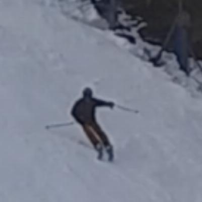
Test to see if I can post pics in this old thread.

Test to see if I can post in this old thread.