
|
|
|
DCSki’s Editor is in the midst of a road trip. He checks in with occasional “Notes from the Road” in this series.
Since graduating from college, I have made a point to go on regular “road trips” -; packing up the car for an extended trip across the country, often with no particular destination in mind but always with an eagerness to explore and seek out adventure.
In the past six years, I’ve been on three such road trips; the most recent, in September of 2000, was chronicled here on DCSki.
All three road trips shared one thing in common: they occurred during the summer. Sometimes early summer, sometimes late summer -; but always summer. Around a year ago, my mind began to drift towards the thought of planning a road trip in the dead of winter.
“You want to do what??” exclaimed several of my friends when I explained that I wanted -; with my own free will -; to trek across the country in the middle of January.
The midwest can be a cold, dreary place in the winter with shortened days and roads frequently closed due to snow storms. Naturally, one of the final destinations at the top of my list -; Colorado -; is also known to have snow-covered roads in the winter (sometimes, even in the summer).
No matter. This was going to be an adventure, and Mother Nature was welcome to contribute to that theme.
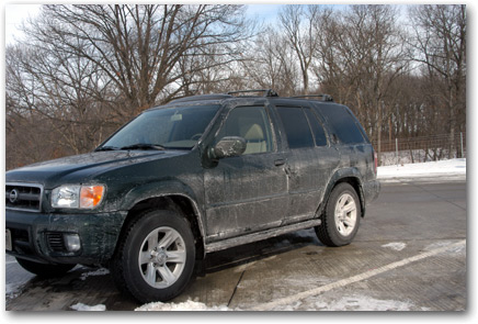
So I packed up my Pathfinder, pointed the GPS to I-70, and passed Whitetail. And Seven Springs. And kept on driving.
Shortly after Pittsburgh, snow began to fall, and it stayed with me through most of Indiana and Missouri. It was dark and the roads were quite slippery -; but there wasn’t much traffic, and salt trucks were attempting to keep up with the storm. By the next day, my car was coated in salt and gunk.
|
|
|
Driving through the midwest is pretty boring, and the scenery in Missouri and Illinois is pretty similar to the scenery around Maryland -; pretty flat, lots of trees.
The scenery really starts to shift once you pass through Kansas City (located, ironically, in Missouri) and into the heartland of Kansas. There, the trees yield to undulating fields of corn. Or, in the winter, undulating fields of, um, missing corn. The temperature climbed into the low 60’s by the time I reached the western edge of Kansas -; a big change from the 8 degrees I woke up to the previous morning in Cloverdale, Indiana. The country had been covered by snow until Kansas, but the snow slowly disappeared as I drove through Kansas. I hoped it would reappear somewhere in Colorado.
Here, the land feels big. The horizon stretches far in the distance, and is touched by a deep, blue sky that stretches to touch the distant horizon in each direction. It feels like you’re in the middle of an IMAX movie. (Life imitating a simulation of life?) I grew up in Colorado where one can see forever into the distance, and have felt claustrophobic ever since moving to the tree-covered Maryland.
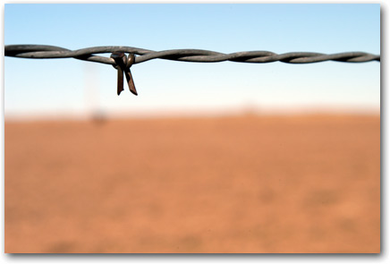
It is easy to imagine that you are crossing through time when you cross I-70 through Kansas. The landscape becomes barren, dotted only by occasional farms. No, make that homesteads. Where else can you find homesteads? But that’s what you see in Kansas, and it continues into the plains of Colorado.
Occasionally, you’ll see the isolated remains of a homestead that had been vacated dozens of years ago, or the ghost of a small gas station that had been paved over by time. The type of gas station with two small pumps and one small building -; now, just a few stands of wood and a rusted old-fashioned pump, watching in vain as traffic whizzes by on I-70 with no exit ramp. Here, an exit ramp is a lifeline, and small clumps of commerce pop up along exit points, grasping for business from weary travelers. There are countless McDonalds and Cracker Barrels along I-70, stretching from east to west.
|
|
|
In western Kansas, you will also find oil pumps -; strange looking machinery placed in seemingly random locations across the land -; moving up and down, pulling up drops of oil. Sometimes you will spot one in the distance, and will focus to see if it’s moving or not. Some are silent; others continue to pump away. Some are rustic shades of grey; others have been painted in colorful colors. I remembered staring in awe at these contraptions as a kid (mind you, this was before Nintendo, so we were easily amused), and they continue to pump to this day, pulling oil up from somewhere deep below the ground.
I always enjoy driving through Kansas, because it’s the heartland of America and has a rustic feel to it. But it is a very wide state, and takes a very long time to drive across it. And the scenery is basically the same the whole way. Open your eyes and take a mental snapshot; now close your eyes, drive 100 miles, and open your eyes again. The picture will be hauntingly similar.
(Note: Please do not attempt to drive 100 miles with your eyes closed. I was speaking metaphorically.)
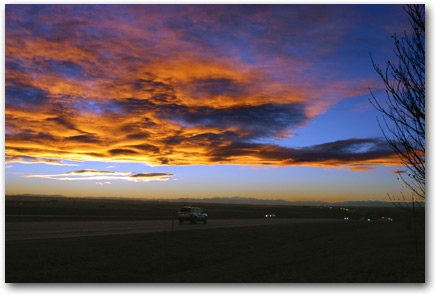
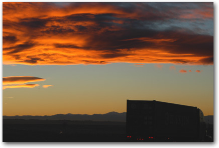
It’s always a thrill for me to cross over the border of Kansas and into my home state of Colorado. The scenery doesn’t change much -; the eastern third of Colorado is plains and prairies, far removed from the mountains that sprout up just past Denver.
But, eventually, you will see the landscape rise up ever so slightly in the distance. Is it clouds hugging the horizon? Or the peaks of the Rocky Mountains? In my case, the peaks began to poke up just as the sun set, leading to these two sunset shots:
|
|
|
|
|
|
I often wonder what the first settlers must have thought as they saw exactly the same view. After traveling for weeks across flat plains, suddenly -; what is this? A mountain range? How in the heck are we going to get past that? And it was no easy undertaking. The Rocky Mountains rise majestically out of the plains and, in the days before dynamite-blasted asphalt-covered interstates, there was no easy way to cross.
It was dark as I drove into Denver. I knew there was a Panera Bread store in Denver, one of my favorite restaurants, because my GPS receiver told me so. And I wanted a Sierra Turkey sandwich and a Baker’s Dozen of bagels to take with me to my first destination, Vail Resort. (By this point, I had given far too much business to Wendy’s on my trip.) My GPS led me on a harrowing drive through downtown Denver until I caught a fleeting glimpse of Panera passing by me -; on a one-way road, during rush-hour traffic, with no parking anywhere in site.
I then spent the next 40 minutes navigating the streets of downtown Denver, passing Panera several times but never quite finding a place to park -; so close, yet so far! This was a bit stressful, and I was sure Panera would be closed by the time I finally found a way to get to it. But I was ultimately successful, and munched on a Sierra Turkey sandwich from an overlook on I-70 looking down on the city lights of Denver.
I-70 becomes really interesting after passing Denver, as it clumbs up, up, up into the mountains and criss-crosses the Continental Divide, at times giving up and brute-forcing its way through the tall mountains in places such as the Eisenhower Tunnel.
It was dark, but I could still see the towering mountains to my side on this clear night as I drove past resorts such as Breckenridge and Copper Mountain. My car’s thermometer, which registered 50 degrees in the mile-high Denver, eventually dipped down to the upper teens by the time I climbed up above 10,000 feet in elevation. Finally, I pulled into the town of Vail and found my condo, my home for the next several days.
|
|
|
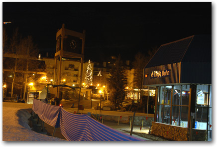
I was tired, but not too tired to walk several minutes from my condo in Lionshead to the Eagle Bahn gondola terminal. I would return the next day with my skis. After nearly 2,000 miles, I was sick of driving and ready for some skiing. But it was time to sleep.
All photos by M. Scott Smith.
M. Scott Smith is the founder and Editor of DCSki. Scott loves outdoor activities such as camping, hiking, kayaking, skiing, and mountain biking. He is an avid photographer and writer.