Kevin Whipple writes in with information about the Big Pocono Ski Area, which used to be located near today’s Camelback Ski Area. Kevin writes:
“Another lost ski area from Pennsylvania is the Big Pocono Ski Area in Tannersville, located in Monroe county. Some of the photos and information below come from the book: Camelback - The Downs and Ups of a Banana Belt Ski Area, by Jill Wechsler.
Many people in the Poconos do not remember or know that there used to be another ski area on Big Pocono Mountain (also known as Camelback Mountain), other than the Pocono’s most popular ski area - Camelback Mountain Ski Resort. This area preceded Camelback and was developed by some of the same folks who would be instrumental in the construction of Camelback later on. It was built on land adjacent to the current ski resort, and as of now has not yet been incorporated into the ski resort.
Somewhere around 1950 the first tow was constructed on this site, but the trail it served ended in a swamp that did not freeze over sufficiently enough in winter as the investors had hoped. They started a new rope tow further up the ridge. This tow opened for the 1950-51 ski season, serving a steep nursery slope and two quite difficult trails. The facilities included a his and hers outhouse and a hot dog shack. There were no rentals, no repairs, and no lodge. The area was only open on weekends on a limited basis depending on the weather. There was no snowmaking.
This tow operated for four seasons, but the investors soon realized that this venture would not be profitable. It was said that they would average about 35 days a season with snow good enough to ski, but this was cut short by only operating on weekends. In the summer of 1955, there was a major flood caused by the hurricanes Connie and Diane. This washed away whatever facilities Big Pocono had at it’s base. Although repairable, there was not enough money to put in a modern lift and snowmaking which was needed to make it a success.
These investors would go on to spearhead the efforts of developing the Camelback Ski Resort on another part of Big Pocono (Camelback) Mountain. The old tow site is heavily grown in today and is very hard to identify. The old truck that was used to drive the tow is still in place on the mountain. Currently, the land the old tow was built on sits next to the perimeter Nile Mile ski trail of Camelback Mountain Ski Resort. However, there has been talk of the ski area possibly cutting new terrain on this section of hillside. It would be a steep and beautiful section of mountain if they decide to go ahead with it.
I’m sending along some pictures taken in the summer of 2005 (about forty years since the tow closed).”
|
|
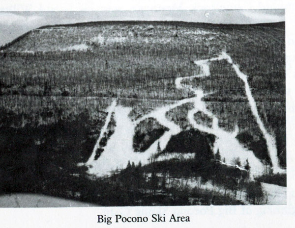
An aerial photo taken sometime during the ski area’s operation. The original tow that didn’t work out is in the left in this picture. The main tow was actually very long and served probably over 400 feet of vertical drop. Photo from Camelback - The Downs and Ups of a Banana Belt Ski Area by Jill Wechsler.
|
|
|
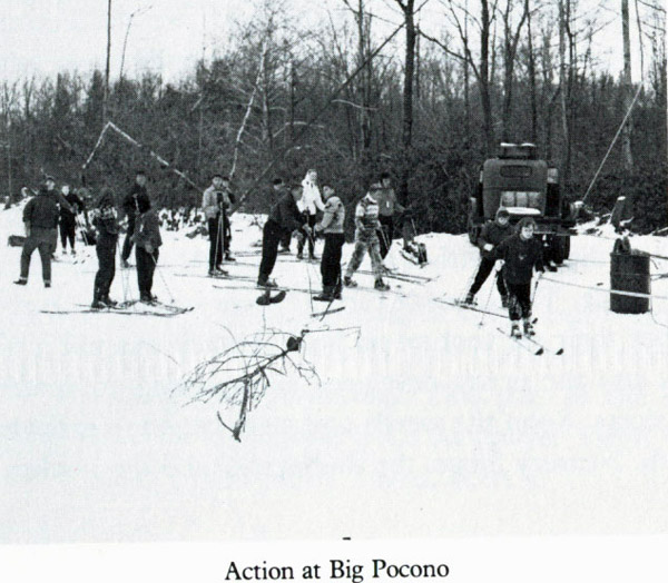
Skiers using the tow. The truck in this picture is still up on the hill today. Photo from Camelback - The Downs and Ups of a Banana Belt Ski Area by Jill Wechsler.
|
|
|
An aerial image from Google Earth. It shows the general location of the towlines, as well as some of the current facilities for Camelback Ski Resort. Image provided by Kevin Whipple.
|
|
|
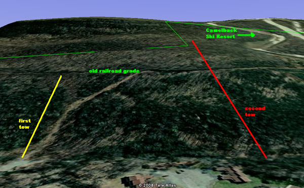
A 3-d view of the hillside. Image provided by Kevin Whipple.
|
|
|
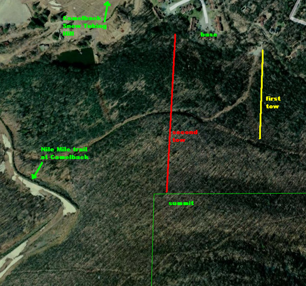
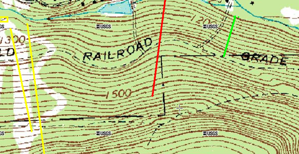
A topographic map of the area, with the old tow lines marked and the location of the current facilities of Camelback Ski Resort. Image provided by Kevin Whipple.
|
|
|
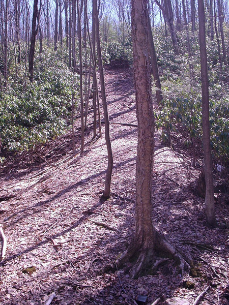
Looking up the towline from the base. This is just barely still discernible and it becomes much more grown in in just a bit further up the hill. Very steep. Photo provided by Kevin Whipple.
|
|
|
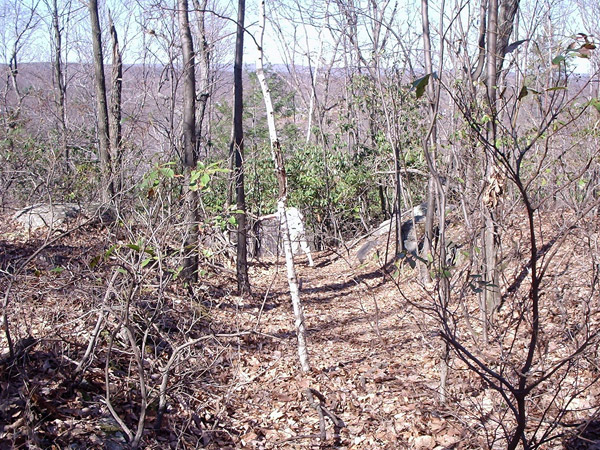
Looking down the towline from just above the railroad grade, and just below the truck that served as the drive. Photo provided by Kevin Whipple.
|
|
|
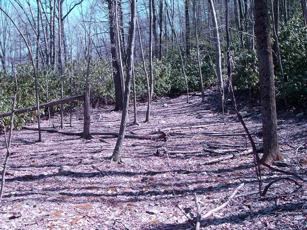
The nursery slope at the base of the hill. This is a rather steep learning hill, and might be of intermediate grade. Photo provided by Kevin Whipple.
|
|
|
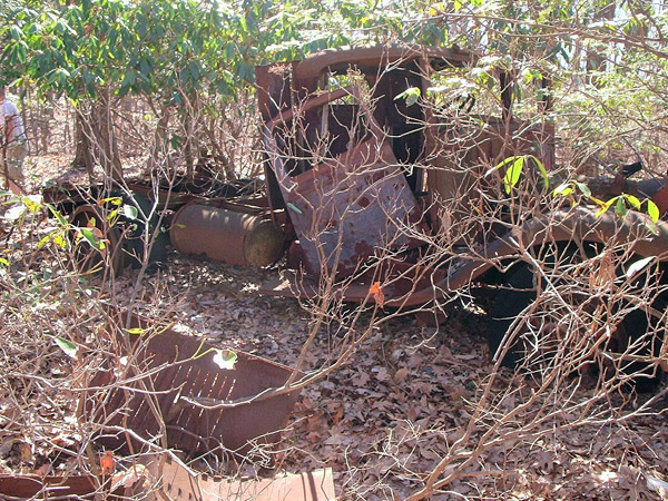
The remnants of the truck that served as the drive for the tow. The rear wheels have sheave wheels attached to them for the tow. This truck sits along the towline just above the old railroad grade. Photo provided by Kevin Whipple.
|
|
|
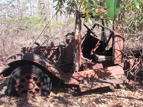
A close up of the truck that powered the tow. Photo provided by Kevin Whipple.
|
|
|
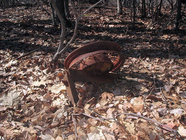
The sheave wheel that may have been attached to a tree or wooden post, but now sits along the towline. Photo provided by Kevin Whipple.
|
|
|
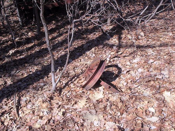
Another fallen sheave wheel. There are not many remnants of the tow along the towpath, but some do remain. Photo provided by Kevin Whipple.
|

I had a chance to snoop around on my last day of skiing this year (April 1, 2018). Time was short, but I did find traces of the "original tow lift that didn't work," as described in the caption above. There are a few auto rims in the trees. Remember, that was from decades ago, so they're much higher than you'd expect since those trees grew substantially. Also, the trees didn't grow perfectly straight, so the mounts have turned slightly from facing perfectly uphill. Next time I have a chance I'll search for spirits of skiers past along the lift line that did work. That should be a fun hike.

