Weekend Storm?
December 29, 2009
83 posts
25 users
35k+ views
Anyone have any thoughts on it...
As usual crackuweather is hyping the storm (
link)... while the NWS barely mentions it

I talked about this Storm a couple of Days ago on the Christmas weather thread & on Davids Wedding thread..you don't read my posts Abe?


...anyway the thinking is that David will still have a white wedding on Sat But most of his (Light) Snow will come from another System. West Va will only get a slight Brush from the Accu Coastal Storm before it heads out to Sea & goes Bye-Bye. South & east Of WV will see a little more..The End...
PS..OH, the next Model Info comes out in an hour but I still think its a done deal..
It keeps Snowniacs like us clicking on their web site and getting them ad revenue.
storm looks great on models for this area
resorts will only puck up a little (wintergreen = winner)
for DC:
3-5 looks possible
I see yer post at 548pm..musta seen the slightly juicier latest info

....every run sees a little better snow loving scenerio..If this was Gamblin & I could ask the Model to deal me another run or take the one I had now I'd call it..This runs good enough for me!
Next up is the X-mas Storm potential..Besides a few WV Alpp mini Snows..
Model guidance is starting to agree. NWS is climbing on board for I95 corridor snow on Saturday and into Sunday.
I'm dreamin' of a white Christmas......
heck yeah, chance snow showers every day starting friday night on the noaa for the land of milk and honey
Canaan NOAA 'cast
Ha... I guess I missed your posts on this fishnski... I almost asked what you were thinking on this in my first post

Abe,
Found site, but what is the code for the colors?
The Colonel
Alright... so you got the weather covered for the wedding.
Who is the Photographer?
<smile>
Some of my models are showing a foot for Richmond, with 8-10" for the VA mountains and 4-8" for the WV mountains. Not sure I believe that yet. The official NWS forecast is still just talking about snow showers....
How long ago did you find that Graphic Abe? Good find! Look at the Bottom Colonel & it gives you the code..I'm sure you figured it out by now though.
NWS as of 130 AM Thur has only raised the Snow chance from 30 to 40% for SAT for Snowshoe..They want to be REAL sure..like when it Starts!
Years ago I could Drive the Socks off any Courier in DC/Suburbs just using some crumpled ole paper maps (With a dispatcher from hell throwing jobs right & left at ya it was a Talent to route yourself thru the maze) & now folks have GPS units with some voice telling them where to go...Years ago before I even knew what a Weather Model was let alone find the Data from them I could do a pretty good Job Figuring out the Weather for DC & the Ski Mountains & now you don't even have to analyze a weather model anymore...A computer does it for you...Its over Johnny...we don't have to think anymore..we are now going to get Dumb & Dumber!...
(Quote by JimK.."He is a legend in his own mind"..Another.."Legendary F-casting skills"..End Quotes)
This storm Popped up on the Radar back on Dec 6th & I waited till the 8th to make sure there was some consistency to the model runs before I posted about an Early X-mass week Snow Storm on the "Too early for X-mass week F-cast" thread...We have come a long way folks!
Strom is looking GREAT to say the least as of now. People on wx boards are hyping a major hit to the mid Atlantic. Models are surprisingly consistent with the forecast. I am going to post the following two graphics but please dont take word for word... just show potential for an extremely major storm for this area. If this is the case, I would plan on NOT driving to places like shoe that are difficult drives in good weather. Conditions could be quite bad pretty much anywhere you decide to go. Likely bulls-eye will probe be just south of DC, with DC def in the mix for a major hit! I will post a full forecast, possibly with a sexy graphic attached if I have time!!!
GFS:

WRF/NAM:

The South/East thing is still in Play..So still going with a brush by the bulk of Precip for the WV Alpps but that is just the start for them because as you can see from L-Ski's GFS Map which goes out to tue,there is more "Alpp" stuff coming..the Models can get excited like us & over do it but it should still be a good one....After this weekend thread is over Switch over to the X-mass weather thread for X-mass eve/Day storm watch updates!
Keep us updated
. Hopefully Snowshoe gets hit. I might have to take a sick day tomorrow to get ahead of the storm...
Thats another good one Chaga..one of many available all over the internet now...Did ya ck out the x-mass storm??..looking bigger than this one!..Its gonna be a December to remember!..I switched my stay at Gore mountain from X-mass week to New years week..I will be spending X-mass up at Perryville,Md, hopefully in an all out NEaster & then heading up to the Dacks the next Day..yee Hawwwww!!..Maybe I should drive the 5 hours from my coastal NC Camp up to Sugar Mtn,NC & enjoy the foot of snow they will be getting this weekend...HHmmmmmm...
Remember all the Nov weather Hype/Pattern Change Threads????
haha sorry but, no. That gives you a suggestion of what the weather might be like but not much more past 5 days. Past 5 days its only a suggestion of what might happen w/the weather, indicative of an overall pattern.
Thats another good one Chaga..one of many available all over the internet now...Did ya ck out the x-mass storm??..looking bigger than this one!..Its gonna be a December to remember!..I switched my stay at Gore mountain from X-mass week to New years week..I will be spending X-mass up at Perryville,Md, hopefully in an all out NEaster & then heading up to the Dacks the next Day..yee Hawwwww!!..Maybe I should drive the 5 hours from my coastal NC Camp up to Sugar Mtn,NC & enjoy the foot of snow they will be getting this weekend...HHmmmmmm...
Remember all the Nov weather Hype/Pattern Change Threads????
Dont look past this storm! Just get really excited for this strom! It literally is coming together right now to be nothing short of historic for the entire state of Virginia. If the current solution plays out, DC will be sitting under a solid 20+ while places south are buried under 3 feet!!!
Current potential for DC!! (my current forecast):
80% >2 in
60% >5
40% >8
25% >12
10% >15
Given this, there is a good possibility DC will get more from this storm than has fallen any year over the past 3 years! Get excited! I will post more as time goes on, potential is there but models still need to stay favorable and not switch on us/go south!
Geez driving to Snowshoe friday night for Fri, sat and sun nights. Coming back monday morning and going to monday night Game in DC. May be a fun driving experience both ways!!!
How does things shape up for the eastern panhandle of WV????
biggest accums will be closer to cities it looks like but really everyone is in the game with 12+ a very good possibility.
Just fyi, the 18Z nam gives DC 3.5+ feet through sunday and complete blizzard conditions. Depending on tonight models, we could have a blizzard watch for DC. Really could be historic.
updates:
97% >2 in
80% >5
60% >8
45% >12
20% >15
10% >20
3% >30
L-ski any thoughts on the clipper coming in after on Mon. for the CV folks.
ummmm ok so NAM/WRF gives Dulles 71 inches.... yes 71 INCHES of snow through sunday.
ummmm ok so NAM/WRF gives Dulles 71 inches.... yes 71 INCHES of snow through sunday.
Nam is going Bonkers..use the GPS to get a better grip on reality...
KeithT, You won't be able to tell when the clipper gets to the Alpps..it will just be one blur of a storm from late fri till tue eve. I mean..after the main storm pulls east & north we start the backside stuff..then the clipper, then a little backside off of that..Thats what I meant when I said we will have WV Alpp type stuff thru early week..then a lull till X-mass eve..then BAM!..we start the process all over again!!
have not given the clipper much of a look. Probably will be an extra 6-12 for CV from upslope after the storm alone. Would not be surprised if a week from now CV is under 3-4+ of snow. Overall, Christmas might be EPIC for the area... literally epic (and another storm around Christmas)
ummmm ok so NAM/WRF gives Dulles 71 inches.... yes 71 INCHES of snow through sunday.
Nam is going Bonkers..use the GPS to get a better grip on reality...
KeithT, You won't be able to tell when the clipper gets to the Alpps..it will just be one blur of a storm from late fri till tue eve. I mean..after the main storm pulls east & north we start the backside stuff..then the clipper, then a little backside off of that..Thats what I meant when I said we will have WV Alpp type stuff thru early week..then a lull till X-mass eve..then BAM!..we start the process all over again!!
General thought is the GFS is a little suppressed and really is the outlier when comparing all the models. NAM is far overblown so solution will be somewhere in the middle
I guess the other important aspect of the clipper is whatever anyone gets, it aint goin to melt anytime soon and then---
BAM!!
at least according to nam.
definitely... and considering if you look at the total forcasted snowfall over the next 2 weeks its over 5 feet (after 3 major storms) for the dc area and the models really cant even pick up LES or upslope (so tons of possibilities for mountains). Like I said, christmas could be nothing short of epic skiing everywhere.
Looking at this storm... even whitetail/liberty/roundtop might be able to open 100% on natural.
L-ski, when will the next model runs be available??
should be out around 10:30-11:30
Possible, given the size of this storm, that servers will be crashed. Has happened before in large storms due to so many online. I am going to grab a few brews and watch football but will make a post later tonight ASAP when models come out.
Best site imo:
http://www.nco.ncep.noaa.gov/pmb/nwprod/analysis/check out accumulated precip on the 00z NAM and GFS around that time, what we really care about.
I am already seeing the NWS's NDFD service slowing to a crawl. When I was able to get some data, it showed a 15:1 snow:water ratio for Wintergreen. 3" overnight Friday, 4" Saturday morning, and another 4-5" Saturday afternoon. So about 12" Fri-Sat.
I honestly don't know if I believe the hyper snow amounts being shown by the models right now. I haven't witnessed that much predicted since following weather models in this area, and have no idea if it's credible. I am thinking we'll probably see less snow than the models are suggesting right now, just a skeptical hunch.
However, I am heading to Wintergreen to ski tomorrow with an extra change of underwear in case I want to stick around and get into position for Saturday (probably SS or stay at WTG). I had some evil laughs going while scraping down these fat bastards tonight:
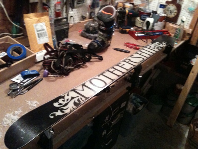
Will this be the storm of the century? Will the Motherships make their debut in Virginia in December? Maybe I better pack two changes of underwear....
GO GO GO GO GO GO GO!!!!!!!!!!!!!!
David,
First, good luck on the upcoming exam...you will ace it for sure.
Then, well, the best of everything for the rest of your life that really is just beginning. Have a great honeymoon...is there such a thing as a bad one?!
You leaving insures our having epic snows while you are enjoying the warm sands, etc.
Best wishes to you and yours,
Merry Christmas!
The Colonel
Hey guys! Been awhile since the last time I was on here. Just been extremely busy with work and all (nothing like being with a tiny start-up that is growing faster than we can keep up! Didn't help that I just got done sinking some $30,000 worth of renovations into this house as well)
Yeah, this snow event looks like it is going to be epic. Looks like good ol' Massanutten is going to be getting some serious output from this as well!
I'll be heading up there right after work tomorrow and staying through the weekend. Also, looking more into the future, looks like Seven Springs is going to be looking very nice, as I'll be up that way for Christmas (visiting my brother who lives in Uniontown).
I am going to stick with my previous forecast for now (DC area). Looking like 14 would be a good call for DC area. Places in VA WILL record over 20 from this. Really all comes down to where the banding sets up for who really get squashed.
I am guessing most resorts by monday will have over 12 with the looser maybe being whitetail (<10 inches posible, prob around 10) due to their location away from the upslope and little too west for the majority of this storm. I would post more but really dont want to jinx it... seems when i dont care is when we really get a bomb.
Ill try and get a map out tomorrow just for fun.
How much snow do you guys think Snowshoe will get? They're saying ~20 inches but you know how optimistic they are
.
-Paul
Will this be the storm of the century? Will the Motherships make their debut in Virginia in December? Maybe I better pack two changes of underwear....
yeah, because if it snows that much, you might proverbially ruin one pair ....

Just imagine, motherships in december in virginia - crazy sick.
The pagamony family will be driving to snowshoe on sunday, pick up the leftovers, and hope for more. If anyone else is going to be up there, feel free to send me a message on dc ski and we can hook up - internet is probably more reliable than cell service. I am a lousy skier but a pretty good beer drinker. I really wish this storm was a few days later, but we'll tough it out.

If there is a choice between saturday or sunday, sunday is the no-brainer! I wouldn't call it left-overs since saturday skiers will be storm riding as its still piling up. I would call it WAY better skiing than on saturday
David,
First, good luck on the upcoming exam...you will ace it for sure.
Then, well, the best of everything for the rest of your life that really is just beginning. Have a great honeymoon...is there such a thing as a bad one?!
You leaving insures our having epic snows while you are enjoying the warm sands, etc.
Best wishes to you and yours,
Merry Christmas!
The Colonel
David could be getting married during a blizzard. How great is that?

Just so's the guests arrive by tonight.
David,
Any way we can convince you to become a Mormon?
1-2 new blushing brides a year for you = 1-2 epic storms for us.

(Congrats and good luck.)
now looking like 16 for DC is a conservative estimate. Might push over 20, at least ten is almost certain!
Shoe/WVA resorts will get some from this but prob not 20 from the main storm. If you include upslope/the clipper then maybe 20 by mid next week. Same for CV, and most areas. Real winners will be wintergreen and snowtime resorts. If you are at whitetail tomorrow you are in for a treat!
You know it's a big storm when the NWS starts talking in feet!
URGENT - WINTER WEATHER MESSAGE
NATIONAL WEATHER SERVICE BALTIMORE MD/WASHINGTON DC
1207 PM EST FRI DEC 18 2009
VAZ021-025-026-036>039-050-056-WVZ054-190115-
/O.CON.KLWX.WS.W.0008.091218T2300Z-091220T1100Z/
HIGHLAND-AUGUSTA-ROCKINGHAM-NELSON-ALBEMARLE-GREENE-MADISON-
ORANGE-SPOTSYLVANIA-PENDLETON-
INCLUDING THE CITIES OF...STAUNTON...WAYNESBORO...HARRISONBURG...
CHARLOTTESVILLE...FREDERICKSBURG
1207 PM EST FRI DEC 18 2009
...WINTER STORM WARNING REMAINS IN EFFECT FROM 6 PM THIS EVENING
TO 6 AM EST SUNDAY...
A WINTER STORM WARNING REMAINS IN EFFECT FROM 6 PM THIS EVENING
TO 6 AM EST SUNDAY.
* PRECIPITATION TYPE...SNOW.
* ACCUMULATIONS...HEAVY SNOW WITH ACCUMULATIONS OF 1 TO 2 FEET
THROUGH SATURDAY NIGHT...WITH THE HIGHER AMOUNTS AT HIGHER
ELEVATIONS.
* TIMING...SNOW WILL BEGIN BETWEEN 6 AND 9 PM FRIDAY EVENING AND
WILL CONTINUE THROUGH SATURDAY NIGHT. SNOW WILL BE HEAVIEST FROM
1 AM TO 3 PM SATURDAY.
* TEMPERATURES...BELOW FREEZING THROUGH THE EVENT. MID TO UPPER
20S IN THE VALLEYS AND FOOTHILLS...LOWER TO MID 20S IN THE
MOUNTAINS.
* WINDS...10 TO 15 MPH THROUGH THE EVENT WITH GUSTS TO 25 MPH ON
SATURDAY AND SUNDAY.
I would have just been eating this up if I still lived back up in MD/DC..I just caught the 4pm Dolly sods cam & I witnessed the begining of the snow..it was a trip..the snow was over & spilling over the Timberline to CV ski area mountain range (Cabin mountain) but had not yet made it into the valley & up to the Cam location up in the heights..THE BEGINNING!!!
Knee deep up in the NC mountains allready...
Final forecast:
Im thinking for NOVA (McLean):
75% chance of >12
60% chance of >15
40% chance of >18
25% chance of >20
14% chance of >2 feet
My guess is 18-24 for may part of VA and 17 for DC. Scary thing is 30+ is not out of the realm of possibility, this area will be incapacitated until Christmas eve if we break 2.5 feet.
Mountains:
Wintegreen: ~3 feet+
Mass: ~2 feet
Liberty/Roundtop: 1-1.5 feet
Whitetail: 1 foot
Snowshoe: 17
CV: 15 (20+ including upslope through monday PM)
7 Springs/Wisp: 6-10 (15 including upslope)
My final forecast, will be fun to see what is actually reported. A 20-30 mile shift in this storm will mean huge differences. Its really crazy because 3 feet is not completely impossible for DC area and I think someone will eclipse 30 inches within 40 miles of DC.
If anyone is at wintergreen, baseless powder for sunday... EPIC will be the word of the day. Please please post pictures!!
NWS now saying 1-2 feet for DC... if you ever see forecasts for DC in feet rather than inches you know something is crazy
Thats kind of a strange way to F-cast Chances..is that the way they are teaching you up there Mr. Langley? I would add 15% to all your chances.
Its starting to blow down here at the SE NC beaches so the storm is winding up!..+ L-ski, when you get such a Biggie like this in such a large populated area there are to many diff amounts that will be taken... a general 1 to 2 feet is all anyone needs to know at this point..Epic!...& the WV Alpps will just pile up untill further notice..Why Count?..You heard it here 1st folks.......Its on!
nah its giving the breakdown that I have mentally.. generally 1-2 feet is what you can gain from that but it highlights the realities. If I was issuing a forecast to general public it would be nice and broad so I could cover my a$$. Just figure this is a why to highlight the potential yet uncertainty with a storm of this magnitude... saying 1-2 feet does not include the possibility of 3 feet or possibility of a bust low. In reality its all a very educated guess when you come down to it, guarantee every met has numbers like this in their head!
We all appreciate your work L-ski...keep on gettin on brother!..your only going to get better over the years & at some point your gonna have to charge for your services..& then you will be gone

I will add..My pick of the Storm for the DC area is Birdsville,MD..20 inches...Word??..Snowshoe will be my skiers pick for the most overall snow from storm..Front & backside..Besides Beech/Sugar North Carolina which I don't consider Mid Atl..They are SE..
ya shoe will be absolutely buried by mid next week... and Christmas storm anyone?? haha some runs have another bomb on christmas eve/day
I think the biggest "problem" with this storm may be that we cant get to some resorts
So here is the deal:
All local and national meteorologists are freaking out... 24 inches for DC area is about a 50% chance and 30+ for NOVA is around 30%
Historic Storm.. possibly the largest ever almost securely in the top 5
Ditto props to L-Ski. I've been following his predictions along with those of Capital Weather Gang on Wash Post dot com. They've been in pretty close agreement. Been very useful to me. (Besides helping me with ski plans, I was in advance of the run on the grocery and booze stores around DC. Booze being somewhat more important...)
Five-star rating from me. Pox and endless summer to those of you who rated him down to three stars. May your skis and snowboards hit glacier-harden rocks. May you ski/board in the trees and may the trees win. May you be stuck on Timberline's lift when the chipmunk finally seizes up for good.
We'll be flying a Nittany Lion banner on the way to the slopes Sunday AM.
So where to go Sunday? Sounds like Wintergreen is the best option? I've only ever skiied at Snowshoe around here. That was last year, around this same weekend, and it snowed (partly why I went) and the road there was pretty terrible even in light 1-3 inches of snow. Is it feasible to drive to Wintergreen Sunday morning from D.C.?
Anywhere else that would be better and easier to get to?
Well I made it to Snowshoe. I left Fairfax around 3:00PM and made a pit stop in Front Royal. Took me about 5 hours from Front Royal with sections of complete white out and I was doing about 10-20MPH. I saw a ton of wrecks...on the way up the mountain I even saw an abandoned Porsche 911 Turbo (seriously??). Once I got to the top of the mountain it was blowing like *crazy* - a lot of drifts and the road was partially blocked due to a Snowshoe bus being stuck. If anyone else is up here let me know - it would be fun to make some turns in the freshies with fellow dcskiers...
As of now I'd say we almost have 2 feet but I'll have a better idea tomorrow, its *really* coming down. Tomorrow is going to be amazing
.
So where to go Sunday? Is it feasible to drive to Wintergreen Sunday morning from D.C.?
Anywhere else that would be better and easier to get to?
Yeh...your Back yard

...1st post down..Now HAND over some more!...Sorry I'm getting sleepy

..nighty nite...
PS nice to see ya made it safe PaulR..enjoy the Epic-ness!
I would have liked to have driven down to wintergreen friday evening, but my gf was afraid of getting snowed-in and missing work monday. While I would have loved this scenario, unfortunately, WTG (and everywhere else) will still have limited terrain open this weekend b/c not enough trails have base. However, I'll be heading down to WTG Tuesday evening for some Wednesday-Thursday skiing with the hopes of most (if not all) trails groomed and open. If WTG had the fortune to make a base on most trails prior to this storm, this truly would be EPIC skiing.
So where to go Sunday? Sounds like Wintergreen is the best option? I've only ever skiied at Snowshoe around here. That was last year, around this same weekend, and it snowed (partly why I went) and the road there was pretty terrible even in light 1-3 inches of snow. Is it feasible to drive to Wintergreen Sunday morning from D.C.?
Anywhere else that would be better and easier to get to?
Eric, WGN tends to do a good job of keeping their roads up from Nellysford open. I've driven up under some poor conditions and made it there OK. No guarantees but chances are quite good you'll get there Sunday, esp. if the storm tapers off Saturday night.
But right now (about 7:45 a.m. Saturday), they say they've received 2 feet and roads are impassible. Call before you go.
Here's their website link. Woody
2 feet & still more to go??!!..I was trying to find an oficial obs from up there but I Can't so we will have to believe the resort..HUGE anyway you look at it!..Neaster Capitol of the Mid Atl?
Only place that I have seen to match that this Morn is Mount Mitchel,NC with 24 inches (Highest mountain on East coast)
Snowshoe with 17..so far..
Canaan Valley with 11..so far..
Laurel summit with 3
Whats in you alls backyard??
About six inches in my backyard in Falls Church, VA at 820am. Supposedly a lot more still to come. It's falling steady right now, but not furiously. The kind of snowfall that has staying power.
Chestnuts roasting by the computer terminal
Jack Frost nipping at the hard drive
Old farts with their eyes all aglow
will find it hard to stay indoors today..
I'm gonna kill David when i see him
.
There ya go guys. My Christmas gift to all DCSkiers out there. Merry Christmas!!! Enjoy this snow.
BTW, the wedding is still happening!
...Sorry Jimmy, just think how I'll be feeling getting on a plane tomorrow (hopefully).
Ugggghh... your Wedding present is in the Mail...Don't blame me if ya don't get it

front end of storm brough more than expected... thats why mountains got POUNDED last night and will continue into foreseeable future.
About a foot+ here in DC with another foot or so to come. Unfortunately it would be absolutely deadly to attempt to drive anywhere more than a mile from your house. Would have driven myself to a resort and gotten stuck but today is my sister's sweet sixteen! Good for her, bad for me!
just listening to the Weather Channel--some woman stuck on the WV turnpike for 17 hours. 15 inches and nice skier packed runs at my house at the foot of the Blue Ridge--I'll enjoy those for a while on my new 10th Mountains. Perhaps ski up to the Blackburn Trail center on the Appalachain Trail in the morning and double pole back down the road. No need to drive at this point.
20 inches here at Luray in the Shenandoah Valley. Hope to get to Mass. tomorrow sometime.
Where do you think would be the best bet as far as realistic travel/open terrain/snow?
Wintergreen actually seems like they won't have the advanced terrain open. Missed opportunity there!
Whitetail? Mass.? Somewhere else? Wish I had driven Friday afternoon to Snowshoe but can't do everything.
To me the big question is, Who will be running lifts AND leaving some runs open but ungroomed? To my knowledge Canaan are the only folks who do this, leaving Weiss Meadows untouched. I wish there were more. It is disheartening when a once a decade event like this occurs and the groomers immediately pack it all down. It still makes some very good skiing on TRUE packed powder. But it could be EPIC.
17" between Lost River, Baker, and Wardensville. Just got done making a few turns on the board in the back yard... however the snow is too deep and not enough pitch for me to have consistent speed.
ya problem will be that whitetail will groom (and lib & roundtop) and probably make snow on top of the fresh.. very lame
snow filling in good.. part 2 of storm just cranked up around 1 pm.. prob lasts until 6-9 then showers for DC. totals of 20+ common with some approaching 30+.
I'm very pleased with my forecast.. busted maybe a little low (18) but I selfishly think I did a bit better than a lot of the mets! hehe
Langleyskier, you da man!
Thanks for following this storm and keeping us posted on its progress and prospects.
Woody
Ya did good L-Ski but remember who broke the Snowstorm story..& the X-mas storm Grasshopper..How many moons was that ago?..After years of nailing Storms here on DCSKI & Bragging about it I have learned that to this day no one likes a Mohamed Ali type of weather dude..You are the fresh start for DCski posters..let me be the dude that everyone blows off as a blow hard..you need to retain your class & characture..or just say it like it is...U-DA-MAN!!!!!!
X-mas storm looking like a Alpp thang..Not so much lowlands.
After years of nailing Storms here on DCSKI & Bragging about it I have learned that to this day no one likes a Mohamed Ali type of weather dude..
How well is Ali doin' now?

Don't worry Fish, ya got the valley covered. Keep posting updates; I'm real interested in the next two weekends. May have to leave family early over Xmas and sneak in a day next weekend.
X-mas storm looking like a Alpp thang..Not so much lowlands.
Meh most likely.. but DC area is on a hot streak.. stil a 20% chance it could go coastal and give us some fun. But ya, prob snow to sleet to ice to rain for most or all for Christmas eve-christmas. But will be cold cold after and before. Overall, sweet early season
Greetings from the Caribbean! I hope all is going well in the Mid Atlantic. Hopefully everyone here got to make some powder turns. If you did, don't forget who gets the credit for all that snow!!
BTW, the wedding still went on and went great. Even got to see Mr and Mrs Jimmy!!
Don't forget your sunscreen Snow Man!
EDIT..Changed Snow Boy to Snow Man....
David,
Congrats...how did you manage to get on your scheduled flight? Nearly all airports were knee deep in delayed travelers! Enjoy the sun and beach! There will be more than enough snow for all of us this coming winter!
The Colonel
David,
Congrats...how did you manage to get on your scheduled flight? Nearly all airports were knee deep in delayed travelers! Enjoy the sun and beach! There will be more than enough snow for all of us this coming winter!
The Colonel
Pittsburgh wasn't that bad. Had no more than 5 inches up there when we arrived on Saturday evening. It's just this weather for the return trip that is making me nervous...
Just got back from Omaha, Ohare, and Dulles Airports after leaving on the 22nd and returning on the 28th. Made it in before the massive blizzard that hit Nebraska, but the airports were clear and on time. Just a bit of de-icing going on at Ohare on the 22nd.