slope steepness
January 6, 2007
20 posts
11 users
12k+ views
I apologize for posting something completely unrelated to temperatures and global warming, but has there ever been a thread here which provided a comprehensive list of the steepness of our local slopes? I searched the archives and found a pretty good thread from May 2005 that discussed slope steepness for several NC resorts as well as OTW and Shays, but I was wondering if anyone has ever run across a more complete list.
The closest thing I know of is
skistats . They have lift lengths and vertical rise, from which you can calculate steepness of the trail underneath the lift at least.
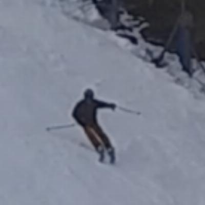
I've measured the steepness of the slopes at Whitetail. The steepest sections of Bold Decision are 30 degrees.
I have no comprehensive list but there was a nice discussion of expert trails in the east over at Epic awhile back:
Hardest trails in the East The steepest was Gunbarrel at Roundtop coming in at 31.6 degrees for it's steepest 136'.
The next is Extovert at Blue Knob at 28.5 degrees average.
Then Laurel's Lower Wildcat at 28.1 degee average.
Then there's Denton's gladed run Extreme at 27.7 degrees.
I don't think any WVA or MD trails were rated.
The method to calulate these numbers is explained in the thread so if somebody has the time and math skills, go to it.
Rusty's measurement puts Whitetail's Bold Decision at # 2.
So east coast ski hills have a hard time getting runs past 31 degrees... 30 degrees really. Wonder if this has something to do with the general wear-down of the mountains. Steepest slope I think I've skied in the Mid-Atlantic is D Trail at Blue Knob. It's the only one I've ever been on with mandatory air (yeah it was like two feet, but it still counts). And what about the upper two runs at Sugar Mtn in NC? I've heard those had some good pitches to 'em. Forget their names now.
Skiing Magazine reported that Challenger Chute at Deer Valley was 40 degrees. It didn't seem too bad last year. Looking forward to seeing it again. That thread also gave me some good ideas for PCMR and The Canyons! I think there's a pitch off of Moraine on 9990 that is over 40 degrees. Great little slope, right in sight of the lift. Similar line on 10th Mountain at PCMR.
Yeah, the thread over at epic was pretty good. I think that the thread on dcski from May 2005 links to that thread as well. Good stuff.
I would say the Bold Decision "Buldge" is steep, the rest is about the same as the others on that hill.
I think The Face is pretty steep at the top -- that's at Wisp.
Out west, The Grizzly downhill run claims +70% grades I think, that's at Snowbasin and dang steep in places I'd say for groomers (semi-groomed, long: top-to-bottom of mountain)
OK here is the thread I was referring to:
http://www.dcski.com/ubbthreads22/showfl...rt=all&vc=1RogerZ the steep slopes at Sugar you refer to are Boulder Dash and Whoopdeedoo. I've never skied Sugar but if I ever happen to find myself in that neck of the woods in the winter I would certainly go check 'em out.
Whitetail's Bold is certainly not as steep as Roundtop's Gunbarrel. And I'd hesitate to compare the 30 degree sections of Bold to an "average" pitch of a different slope. My guess is that Bold's average would be about 22 degrees. The first 1/4 of Bold has a much flatter pitch (16 -19 degrees). Whitetail does have a 50 foot cliff that measures 55-70 degrees, but it's never been blown and we never get enough natural snow to make it skiable. For some reason, every time I suggest making snow on it "one of these days when the whole mountain is already open", the safety guy just laughs hysterically.
Well, heck. Just make snow on the top and bottom of it. There's some racers up at Roundtop that would be happy to huck it!

Quote:
Whitetail's Bold is certainly not as steep as Roundtop's Gunbarrel. And I'd hesitate to compare the 30 degree sections of Bold to an "average" pitch of a different slope. My guess is that Bold's average would be about 22 degrees. The first 1/4 of Bold has a much flatter pitch (16 -19 degrees). Whitetail does have a 50 foot cliff that measures 55-70 degrees, but it's never been blown and we never get enough natural snow to make it skiable. For some reason, every time I suggest making snow on it "one of these days when the whole mountain is already open", the safety guy just laughs hysterically.
Where at whitetail is it?
Hey Rusty, shouldn't a "cliff" have a degree of pitch of 90?
Or more if it's overhung.

I imagine this spot you're talking about is not on a groomer, I have spied a few nice shots in the trees I'd like to poach sometime.....maybe when the next noreaster blows thru sometime in the next 10 years....
I am pretty sure the cliff he is talking about falls from Angel Drop to Bad Decision. Or maybe from Exhibition on the other side?? WT has some pretty nice terrain.
Wasn't that steep section of Shay's Revenge at Snowshoe around 27 degrees or so? That's the steepest trail I have skied in the region.
Stuff out west might be steeper but it's also generally much easier to hold an edge on the snow out there.
30 degrees of icy hardpack at full throttle is a lot hairier than 30 degrees in fluff thats for sure.
Quote:
I am pretty sure the cliff he is talking about falls from Angel Drop to Bad Decision. Or maybe from Exhibition on the other side?? WT has some pretty nice terrain.
yeah, there's some tastey looking lines in the woods there between Angel & Bold. Too bad it's technically 'forbidden' to ski off piste there.....oh yeah, and that there's rarely enough snow to even think about ducking a rope for the poach. When we eventually do get that once every 20yr storm it'll be awfully hard to not sneak in there with the rock skis.
At Roundtop there's also some nice looking lines thru the woods that are accessible from the top of the Leap and skiers's right off of Barretts, but again, rarely if ever any cover in there. Could also be some decent glade skiing between Minuteman and lower Leap when conditions suit.
The cliff of which I spoke is right in front of the lodge between fallmount and lower angel drop. You'd have to hike through the woods off lower angel drop to get to the top of it.
A cliff only has to be steep and high. It's steep enough that with a running jump you could probably reach the landing at the bottom. Unfortunately the run out is flat and goes right into the lodge. If it was blown and opened to anyone foolish enough to try it, there would be injuries. To make it skiable, the run out would have to be blown in such that it would seriously block the fallmount access to the lodge/mixing bowl. The exit off the clif would have to be done at an angle to avoid smashing into the lodge. There's also a little shed in the way. But hey, you've got to have your priorities straight, right?
For those who are interested, here is a
topographic map of Whitetail's terrain. I believe the cliff I'm referring to is just above and in between the second "o" and "m" in Montgomery in this pic. But it will be hard to discover because you will undoubtedly spot the wicked 300-400 foot drop off the back side of the top of the mountain.
BTW - this map apparently has Whitetail's peak at 1768 feet instead of the previously advertised 1800+ feet peak elevation. Either way it still works out close enough to the 935 foot vertical.
Oh yeah, I kinda know the spot you're talking about, definitely a flat landing there. Since you're 'in the know' down there at WT, any rumors still floating to the effect of opening up the backside? I remember back in the day when we raced mtn bikes there it was rumored as future expansion.....then they shut down the bike program and built a golf course, woulda been 95-96ish. Any clue if that's on the books for a long term plan? I don't even know how far over the back WT owns.
I asked about that once while skiing there and whoever it was said that WT didn't own anything on the backside. That's right, I'm egging Rusty on.

You're right Roger. WT does not own the backside off the top. In the early years, there used to be a master plan map that showed the envisioned full build out of WT. The main area of expansion was in the bowl area between Snowpark and Fanciful. That area had two more lifts and a dozen or so more trails. If you've been up there biking, there's a bunch of bike trails running through that area. But don't even get your hopes up at any new terrain opening up any time soon. Before Northern Lights was put in, the original plan was to build a trail from the top of EZ rider to the top of Velvet. When the engineers that surveyed that area came back laughing at the estimated budget, Northern Lights and Lift Off quad were built for a fraction of what only the trail would have cost. When you consider that opening up the bowl terrain would also require more snowmaking, more groomers, more water, more parking and more lodge space; and that Snowtime can't make any money off real estate; and global warming; it's just not going to happen any time soon.
Most of the extra land bought by the original owners was intended for the golf course and housing. The golf course land was sold off to Dauphin County in order to get the golf course built (I'm not exactly sure how that deal went down - but Dauphin owned the course because that's how they were able to sell beer and wine). And the original owners kept the "housing" land when the bankruptcy action took the resort. The bank actually ran the resort for a year before Snowtime got it. The resort housing property runs all the way to the top. The original plan had single family homes being built on the "high" property. As I understand it, the original resort owners also owned the property across the street from the golf course. But there is a builder sign there now that is for a builder that was not associated with the original group so that may have been sold too. There was a plan for a conference center and rooms to be built on the golf resort property itself. Now that Snowtime owns the golf course, I need to check up on if that plan is still on the wish list.