WhiteGrass 2-11-06
February 17, 2006
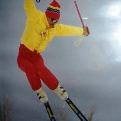
Nice pics Tom, enjoyable write up Denis.
Myself, my buddy Cahil, and the lovely Gisela toured out Friday morning before the snow fell. We took the lift up from Canaan, then spent the next few hours poking around the woods, down to the old hunter's shack by the creek. Coverage was adequate for that but not for my hair brained scheme of hitting Springers from top to bottom on the way back to Canaan.
We worked our way around Baldy and dropped into Upper Springers. Walked a bit because of wind scoured thin conditions. I get this wild hair in a place that doesn't belong and decide to go for a turn or two thinking there was enough snow. A softball sized rock and I had a disagreement and the rock won. The pain and resulting bruise on my leg is probably one of the most painful things of my life. Darn near killed a great weekend of lift served at Snowshoe, but that's a different story.
Steve
Steve,
I've had some arguments with hidden tree stumps out in Colorado

Kinda like rocks, they don't give too much

Fortunatly for me, I just kinda bounced the tails of my skis off of it and did a little arm waving for a few feet

No bruises to mention...
-Warren-
Those are some great pictures. Looks like a great time was had by all. As for catching a rock it could be much worse. You could have been the poor soul at The Canyons who crashed into a bridge and had to be evaced by heli.
Denis:
I read your report. Good stuff and thanks for plugging WV with all those VT types.
The Timberline Trail is a favorite bird walk for me because it passes through some interesting habitats and is a nice way to get to WG (great for Bobolinks) and the Freeland Rd tract of the refuge, which has more bird species than I care to list. With all the darn construction of Twister/Winterhaven/Winterset etc, the trail was taking quite a beating over the Summer--sections near Tline were a real mud bath. Do you think that contributed to your problems? Also, has Timberline re-marked the trail? It looks like it might have to be re-routed around some of the development at one point.
John,
I had never taken this trail before, although I've gone to Whitegrass for 20 yrs. Thought it was time to see where it went. I expected it to come out on Winterset or the new Twister. Instead it just kind of petered out on a road that heads straight toward a wind sock at the end of a field. The kind that small airfields use. I think I've see that down on the Timberline access rd. This didn't sseem worth doing so I turned around and went back. Did I miss a turn? Is there a way to come out on one of T'line's trails? Seems absurd but I have skied from WG to CV dozens of times but never WG to TL. I believe that both of CV and TL could benefit by making better trail connections to WG and publicizing them. In my opinion all 3 areas would benefit.
As to the SkiVT-List. I have become Chip's unofficial VT publicist. My daughter and family live in northern VT and my roots are in Boston where I grew up skiing northern New England. The great thing about the SkiVT-List is the green plaid identifier. I have a swatch of it on my pole strap. If you see someone anywhere wearing or flying green plaid, you are obligated to introduce yourslf and ski together. I have met dozens of great skiers this way and have learned much about the VT backcountry and side country (where a lift ride accesses backcountry).
http://www.uvm.edu/skivt-l/?Page=.%2FFAQs%2Fgreenplaid.html&dir=.%2FFAQs http://www.uvm.edu/skivt-l/France/AlpeDHuez1.jpeg That and the annual Partees at Stowe have cemented my loyalty to this great group.
http://www.uvm.edu/skivt-l/?Page=&dir=./party/goodman http://list.uvm.edu/cgi-bin/wa?A2=ind000....com&P=5791
Denis: From mountain biking, I know of a few connections between Whitegrass and Timberline. The Timberline Trail does indeed connect the two networks. I'm not sure of the exact location of the connection, but there is a small "bridge" - actually a couple planks across a small creek - near a stable past the point where Forest Road 80 begins off Freeland Road. If you cross the bridge and bear to the left you will hook up with the "Big Chain Ring" mountain bike trail that leads through the Winterset community to Timberline.
Alternatively, you can bear left after the bridge and climb gradually uphill on the Sidewinder mountain bike trail. Sidewinder connects to another mountain bike trail called Salamander (not to be confused with the ski slope). Turn left onto this trail. Salamander traverses across the mountain crossing both Twister and Winterset. The main problems with this route are that Sidewinder is probably not well suited to XC skiing - rocky, rooty, twisty, and uphill. Also, Salamander has been devastated by ATVs, horses, and construction - making it a tough slog on my mtb. Skiing it might be pretty frustrating. The construction of Winterhaven and Twister have also impacted the trail. Add that no one maintains the trail.
My guess for the best route between the resorts is across the tops - I believe there is a trail from Whitegrass named "Blackbirds Wing" off of Three Mile. This trail cuts through the refuge and intersects with Forest Road 80 3/4s of the way up Cabin Mountain. I believe it is still open for XC skiing (though it was closed to mountain bikes when the refuge opened). Staying straight on 80 continue to climb gradually with the Sods to your right and the refuge to your left. The road peters out into a rocky jeep trail, pass between a couple large boulders and continue straight along the backside of Timberline. In maybe a mile, you will see a trail branching to the left off the jeep track. This trail leads maybe 100 yards through the woods and onto the Salamander ski trail just above the "s" curves. This is probably the best route between the resorts.
An alternative would be to take the Timberline trail until you reach Forest Road 80, then turn right onto 80 and climb it all the way from the bottom - about 2-2.5 miles.
You can check at Timberline in the ski shop or guest services for a map of the mountain bike network. This shows the connecting trails I mention.
The wind sock you saw sounds like you ended up at the med-evac heli pad just off Timberline Road. Probably made a wrong turn near the Winterset/Yokum Run/Woods End developments - there are some odd little trails through there also.
Quote:
Thanks, Tom. Great Pictures.
I was there on Sun.
http://list.uvm.edu/cgi-bin/wa?A2=ind060...com&P=18888
Denis, was that a Holiday Inn or Comfort Inn you stayed at in Grantsville? Is that the motel right next to and clearly visible from I68 on the south side of the Interstate?
Thanks
I crossed the 2 plank bridge over the stream. It is pretty dicey. The planks bent a lot and I feared they would break. I took off my skis, tossed them across and crawled over the planks. If it broke, I'd rather not be wearing skis on the fall into the rocky creek. One of my greatest fears about being alone out there is a broken femur. I passed a building and some horses and went another 200 yds. or so alongside a road. I'm afraid I'm now more confused than before on how to find one of TL's ski runs from there. Getting the mtn. bike map seems like the best solution.
Jim, it is the Comfort Inn at Grantsville. The exit is 219N, however at the end of the exit ramp you turn S, and it is just on the S side of 68. It is huge and you can always get a room without a reservation, except perhaps on opening day of deer season. I use it all the time when the roads are bad and I don't know how far I can get. It is undistinguished except for this fact.
Edited to add that I'll be at CV with my scout troop this weekend. The boys voted for CV so that's where we'll be. Normally this suits me fine since it is so easy to duck into the backcountry for some powder. The BC is going to be rutted ice this weekend and the skiing is going to depend on the groomers.
I can be recognized by the green plaid swatch hanging from one pole strap and by the red & white Mad River Glen bumper stickers wrapped around the pole shafts.
Sorry Denis, didn't mean to confuse you. All of the development and construction south of Timberline's base has really made the area a jumble of (ski, horse, and bike) trails (some maintained, others not) and access roads. Even during summer, I can get lost down there on my bike - that's a big reason I don't ride there often anymore.