A cold, wet winter for WV this year?
39 posts
10 users
2k+ views
eggraid
October 23, 2014
Member since 02/9/2010 🔗
510 posts

I found this forecast on 'freshy map' on FB, I think I found him originally on this board, but he calls for colder, wetter than normal this winter. -fingers crossed-

http://www.weather5280.com/blog/2014/10/22/winter-outlook-2014-2015-part-one-analogs

"Overall, I think it is safe to say that our analogs produce cooler than normal weather in the south, warmer than normal weather in the north, and generally “normal” temperatures for Colorado. They also produce slightly wetter than normal weather in the South/Southeast, drier than normal weather in the Pacific Northwest and Great Lakes Region. Again, Colorado shows up as having “normal” precipitation. Do I think it will be like this? Not exactly. Whatever type of El Niño episode that develops will likely be weak. That means that some of the traditional signals will be a bit weaker, and possibly displaced. Coming up in a few days, I will post part two of this outlook, which focuses on model data and why I think that ONE particular model has a good handle on the overall forecast.

chaga
October 23, 2014
Member since 11/24/2009 🔗
646 posts

yeah its been cold and wet for weeks with maybe one sunny day a week, and the past few days socked in a dank wet drizzle fog. had we been 15-20 degrees colder and a 10:1 moisture content ratio we would have about 5' of snow right now. 

-cynical hater of cold rain and fog

fishnski
October 23, 2014
Member since 03/27/2005 🔗
3,530 posts
This might change but we are forecast to have a weak to moderate El Nino this winter...we have had the heftiest snowfalls on record with this..ONE...condition. This factor also trends to a slow start but really kicking in the 4 Barrel later on (ole..ole school talk!)...but even with the slow start 2 out of three models still have the late Halloween cold shot that I mentioned a few days ago coming in...of coarse they never hang around long enough or just come too early for. T-Giving...GLTUAll..cheers to a fun Winter!
Blue Don 1982 - DCSki Supporter 
October 23, 2014 (edited October 23, 2014)
Member since 01/13/2008 🔗
1,580 posts

fishnski wrote:

This might change but we are forecast to have a weak to moderate El Nino this winter...we have had the heftiest snowfalls on record with this..ONE...condition. This factor also trends to a slow start but really kicking in the 4 Barrel later on (ole..ole school talk!)...but even with the slow start 2 out of three models still have the late Halloween cold shot that I mentioned a few days ago coming in...of coarse they never hang around long enough or just come too early for. T-Giving...GLTUAll..cheers to a fun Winter!

My brother is a gear head mechanic - I'm hoping that would be a " Holley 4 Barrel " from a 67 Chevelle!  That would be a heck of a snow forecast!


DCSki Sponsor: Past Yonder: A Human's Views on AI
fishnski
October 25, 2014
Member since 03/27/2005 🔗
3,530 posts
67 was a good year for a # of models...I had a 67 impala that was a tank....been watching signs of a late halloween winter shot for a few days now and been cking out the weather guys to see if they thought anything of it....wxrisk just mentioned this..... * ALERT *** MAJOR EAST COAST STORM OCT 31-NOV 2 POSSIBLE... HVY MTN SNOWS ??....PROLONGED 2 to 3 DAY EVENT... *** NOT YET A CERTAIN FORECAST ***
Blue Don 1982 - DCSki Supporter 
October 25, 2014
Member since 01/13/2008 🔗
1,580 posts

fishnski wrote:

67 was a good year for a # of models...I had a 67 impala that was a tank....been watching signs of a late halloween winter shot for a few days now and been cking out the weather guys to see if they thought anything of it....wxrisk just mentioned this..... * ALERT *** MAJOR EAST COAST STORM OCT 31-NOV 2 POSSIBLE... HVY MTN SNOWS ??....PROLONGED 2 to 3 DAY EVENT... *** NOT YET A CERTAIN FORECAST **

I just saw that wxrisk on FB.  I'll be in Snowshoe that week finishing up the condo so that would be awesome if it happens.

fishnski
October 25, 2014
Member since 03/27/2005 🔗
3,530 posts
Taking a look at the latest GFS it looks like upstate NY and Vermont for any potential heavy stuff..but it might be interesting up in the wv alpps!
chaga
October 27, 2014 (edited October 27, 2014)
Member since 11/24/2009 🔗
646 posts

From Bob Leffler:

"Your Fearless Canaan Weatherman sees the possibility of the Canaan's first accumulating snow this coming weekend.  While way-too-early to pinpoint amounts and timing....the possibility is there with the  arrival of sub-freezing temperatures Friday night into Sunday.  Right now, Saturday looks like the most likely day with afternoon readings in the 20's (F) (public forecasts have 40's (F)) combining with upslope moisture being squeezed out as snow flakes as the unstable air is forced to rise over the Alleghenies.  A few inches is possible.

Again, lots can change in 5 days so I will stay in touch as this may be the first accumulation of the season."

eggraid
October 27, 2014
Member since 02/9/2010 🔗
510 posts

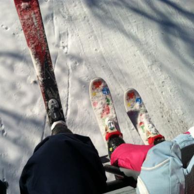
Too early for thanksgiving or not, I'm excited to see some snow! We got to ski on Thxgvg in Snowshoe last year, so fingers crossed for this year too!

fishnski
October 28, 2014
Member since 03/27/2005 🔗
3,530 posts
Eureka, Nunavut -29 °F Clear.....I have noticed over the years that to get any accumulating snows in oct the temp up in Canadien Eskimo country has to be minus 20 or lower...29 below is no joke...cold as a Halloween witches ..... !!
fishnski
October 29, 2014 (edited October 30, 2014)
Member since 03/27/2005 🔗
3,530 posts
From accuwx site....According to AccuWeather Chief Meteorologist Elliot Abrams, "The highest elevations of West Virginia may receive between 1 and 2 feet of snow."....... not going to even touch that fcast!!...it all depends on where the low sets up after the main energy drops down....models are split between going further south and east with the low or just tucked in nice and tight for a nice dump for wv....nws is only saying up to 5 so far...we have doubled thier fcast for the Alpps more times than not...lots of factors of course from snow ratio elevation ect... Could end up like that nice dump shown on utube on this date up in the Dolly Sods in 2011...remember the reactions to the campers when they woke up...priceless!
fishnski
October 29, 2014
Member since 03/27/2005 🔗
3,530 posts
"anaclause" is coming to a town near you...thats the blogged name of this system since a main ingredient is the leftovers of hurricane Ana that formed off of Mexico..traveled across the Pacific..brushed Hawaii then worked back over to canada just north of the us border and is now working its way over to the east coast...if you went with the latest Nam run and loved snow and extreme camping enhanced by Fireball Whiskey...get on up to 5728' Mt Rodgers in Va....word...
chaga
October 29, 2014
Member since 11/24/2009 🔗
646 posts

The latest from the Canaan weatherman....


"I continue to watch the potential for a Saturday snow scenario for the WV/Canaan High Country carefully.  Chances have increased for the potential for a significant snowfall.  There is still a great deal of uncertainty with potential coastal storm development and energy dropping into the cold air for this upcoming event.  How these factors combine will determine the timing and intensity of the snowfall.  I advise back high-country interests to pay attention to this developing situation so they are not caught off-guard.

I continue to anticipate a Friday night rain-changing-to-snow sometime Saturday morning situation.  While still too early to call amounts, right now the potential for 6 inches or more of snowfall exists above 2,500 feet elevation with the largest totals, if it materializes, falling on the Allegheny Front (Eastern Continental Divide, Dolly Sods, Spruce Mountain, Roaring Plains, etc).

Stay tuned....I will continue to advise you on this potential first accumulating snowfall of the season.

Your Fearless Canaan Weatherman"

fishnski
October 29, 2014
Member since 03/27/2005 🔗
3,530 posts
I got tired of giving snowfall predicts just to root on my amount vs a heavier dump..plus it just didnt pay...anyhoot..looking fward to the fearless ones predict but its looking like a very decent event...I did start to notice yest that it seems to be setting up where nc starts the changeover to snow first with SS snowing a couple of hours before Canaan...south to north sounds strange but the way the storm sets up it stunts the cold back from Canaan untill it can move into a place for the snow changover....Canaan can usually make up for lost time during the extended upslope event but that is not set in stone yet...we should have a good feel by the am tomorrow or by aft with the am model runs...wished I lived closer for a pre winter sample ....snow amounts talk!
Antoine
October 29, 2014
Member since 10/20/2014 🔗
275 posts

Here is a little treat from the  guys at ski the east.

http://www.skitheeast.net/ste-snowcast-10-29-14-l-halloween-dreams/


Blue Don 1982 - DCSki Supporter 
October 29, 2014
Member since 01/13/2008 🔗
1,580 posts

Antoine wrote:

Here is a little treat from the  guys at ski the east.

http://www.skitheeast.net/ste-snowcast-10-29-14-l-halloween-dreams/

I will send that dude $$ if Snowshoe gets 1/2 the snow he mentioned.  I'll be there with my  tape measure!  


fishnski
October 29, 2014 (edited October 29, 2014)
Member since 03/27/2005 🔗
3,530 posts
See where he was crunching his fist and then turning it slowly?...that was fcasting in sign language of what I tried to post about the cold stunt for Canaan till it wrapped into place....I love watching and hearing different styles and methods from these talking heads in describing upcoming wx events...this dude was cool..I remember jim Cantore in his early days at the wx channel...he was so enthusiastic and would point out stuff on the map that no one else would or could...
chaga
October 30, 2014 (edited October 30, 2014)
Member since 11/24/2009 🔗
646 posts

According to AccuWeather Chief Meteorologist Elliot Abrams, "The highest elevations of West Virginia may receive between 1 and 2 feet of snow."


not that late october snow is anything out of the ordinary. If you look back over the past 10 years, there has been snow 6 out of the last 10 years and 5 of those were 5" or more.

fishnski
October 30, 2014 (edited October 30, 2014)
Member since 03/27/2005 🔗
3,530 posts
The biggest snowstorm in oct recorded for Canaan was a foot on oct 10th 1979....lesher up at Canaan hgts might have measured that as a 14 inch storm had he been in operation then.....these 1 to 3 foot fcasts are too extreme imho......I posted yest about the possibility of a cold stunt for the northern areas .........here is a little of what was talked about in the nws fcast discussion that covers Tucker and Garrett co's this morning..............What is interesting is that it still appears that the system becomes so wrapped up that the core of the cold air will dip south of the County Warning Area...while relatively warmer air wraps around and spills in from the south and east...especially near the surface. Still foresee some snowflakes mixing in for most areas Friday night into early Saturday. The ridges in the southeast County Warning Area corner have the best chance of going to all snow and perhaps picking up a light accumulation of an inch or two. Elsewhere...temperatures from h925 on down look too warm for accumulation.
chaga
October 30, 2014
Member since 11/24/2009 🔗
646 posts

I dunno about that, I woke up October 30th 2012 to a lot more than a foot! :)  (two years ago today...happy anniversary frankenstorm!)

fishnski wrote:

The biggest snowstorm in oct recorded for Canaan was a foot on oct 10th 1979....lesher up at Canaan hgts might have measured that as a 14 inch storm had he been in operation then..
fishnski
October 30, 2014 (edited October 30, 2014)
Member since 03/27/2005 🔗
3,530 posts
Ur so right Chaga....my book with all the records in it...going back to diaries in the early 1900's and then oficial records starting in the late 40's doesnt have the last few years in it and yeh...we had Sandy in oct....my bad..but just taking a Freak storm out of the pic my point was that we havnt gone over a foot for over a 100 years.......this system had the potential to swoop down and wrap up tight and perfect for a once in a long time event....being this early in year the thinking was that the initial push down of the cold shot was going to only get so far....but what I think shows the strength of whats up north and the winter to come has brought the energy further south and then the main low wrapping up and scooting just a little to far offshore to. Wreck to much havoc for Canaan.....I started tracking this 9 days ago just because I always look for a trick or treat snow...its got a little crazy but its still on track to be another early winter visit for Halloween which happens alot in the land of Canaan....be interested to see if the fearless one jacks this storm up larger than im thinking....im all about a freakin dump though!!!
snowsmith - DCSki Supporter 
October 30, 2014
Member since 03/15/2004 🔗
1,576 posts

How about this from the GFS model”¦

GFS

skimunky
October 30, 2014
Member since 02/27/2007 🔗
15 posts
So this has all probably been covered at some point, but how much snow would have to fall to make Snowshoe or Timberline/White grass skiable? Also, does Snowshoe let you earn your turns if the snow is sufficient? If snowshoe got a couple of feet, I'd love to hit up silver creek.
Droogie
October 30, 2014
Member since 03/22/2012 🔗
76 posts

Thanks for asking that skimunky. I want to know as well for the Canaan Valley areas. There will be zero consolodated base, but the close call on freezing suggests that it will start out wet and gloppy which is good and then dryout towards the end of the system which will also be ideal. 

fishnski
October 30, 2014
Member since 03/27/2005 🔗
3,530 posts

snowsmith wrote:

How about this from the GFS model”¦

GFS

The most impressive thing about the map you posted Mr Smith is the snow down in SC....in Oct...
Antoine
October 30, 2014
Member since 10/20/2014 🔗
275 posts

skimunky wrote:

So this has all probably been covered at some point, but how much snow would have to fall to make Snowshoe or Timberline/White grass skiable? Also, does Snowshoe let you earn your turns if the snow is sufficient? If snowshoe got a couple of feet, I'd love to hit up silver creek.

If im right snowshoe did not let people ski the resort during that freak storm, But I dont typicly ski snowshoe (blue knob) I do remeber last time around the state did not let them open. But im sure you can ski It with over a foot:) rocks skis Or some supper fat skis ( granted you dont weight as much as an elephant) . I have resently seen a video n youtube where some people where skiing blue knob in early november during a  snowfall. They where allrighT. From the map It look like blue knob will get something not as much as snowshoe but something. The benifit of bk is if u know the right trail  it will have noting but grass underneath.

Antoine
October 30, 2014
Member since 10/20/2014 🔗
275 posts

I am curious. Looking at the map it looks like franklin county pa will get snow. And a very good chunk of it. But acording to the model it looks like only 4 inches. Im sure we can all go skiing at the golf course at whitetail in october. If only It went over to liberty then we could do some skiing on a few of their trails:)

Droogie
October 31, 2014
Member since 03/22/2012 🔗
76 posts

I don't think this storm is going to pan out. 

fishnski
October 31, 2014 (edited October 31, 2014)
Member since 03/27/2005 🔗
3,530 posts

Droogie wrote:

I don't think this storm is going to pan out. 

Not in my adopted mountains down here in North carolina....im. Packed up and heading out to camp out under the obs tower at clingmans dome...6644'....im just going to tie off to the support posts to weather the Arctic blasted winds!........here is fcast from NWS...im expecting at least a 14 incher way up there......need a good snowstorm since this is the time I move my operations down to FL....gotta break my endless summer........... Event: snowfall accumulations between 4 and 8 inches are expected for most locations above 2500 feet. Locally higher amounts up to a foot or more will be possible across the highest peaks above 5000 feet. Elevations below 2500 feet should receive between 1 and 4 inches.......
fishnski
October 31, 2014
Member since 03/27/2005 🔗
3,530 posts
Wern't you the one that posted that skunk beer miller lite in the snow last year Blue Don?........well im done doing pinpoint snow predicts but id be willing to bet that if you put the cans down at the start of the snowfall by the time it ends it will close to or over the top of the cans.....have fun Bud!.....get it...Bud.....
Droogie
October 31, 2014
Member since 03/22/2012 🔗
76 posts

I should have specified that I don't think the Canaan Valley is going to get much which I'm defining as enough to ski on. 

David
October 31, 2014
Member since 06/28/2004 🔗
2,444 posts

Snow started about 14:00 today at Snowshoe

https://www.facebook.com/video.php?v=10153326474672907&fref=nf

fishnski
October 31, 2014
Member since 03/27/2005 🔗
3,530 posts
Interesting...SS is at freezing right now...canaan at 3800' is at 34....a little early..not much..but still early for the frzy stuff..stay tuned!
Blue Don 1982 - DCSki Supporter 
October 31, 2014
Member since 01/13/2008 🔗
1,580 posts

Flurries started around 3 PM.  Mixed in with some rain.  Went down to the Fiddlehead for a burger and beers around 5.  Light snow up top, rain at the bottom.

Fish - camera battery dead or I'd do a MIller pic on the balcony.  Less than an inch at 9 PM.  I'll report back in the AM.

Worked like a mule all day here.

We're getting closer boys and girls.

fishnski
November 1, 2014
Member since 03/27/2005 🔗
3,530 posts
2am....23 and snowing good at 5200' NC....30 At 4800' and snowing lightly at SS.....32 at 3800' Canaan and snowing..maybe..even lighter....higher elevation in NC but look how far south they are to have 23 temp...........thats what we do with our investments Blue one...blood sweat and a few beers!......my bartenderes gave me a miller lite by accident this eve when I asked for a Bud light...ugggghhh....how do u all take that skunk aftertaste?....all miller products have it.....anyhoot...sleep tight...BUD....
snowsmith - DCSki Supporter 
November 1, 2014
Member since 03/15/2004 🔗
1,576 posts

Lite beer is either for women or for men who don't like beer and who like to urinate a lot. Yuengling on the other hand tastes excellent, gives you a good buzz and minimizes trips to the porcelain throne.

fishnski
November 1, 2014
Member since 03/27/2005 🔗
3,530 posts
Bud select which has only 99 cal and only 3.2 grams of carbs is barely shy of the Alc content of yeungling...Im a buzzzzzzologist and like to run lean and mean....but that ling sho taste good..fo sho!...........at 7am its 33 degrees on the Canaan vly floor and at the same elevation way..way down south in Boone nc its 29....21 way up top.......just to bring up the point I made a couple of days ago about the upside down cold moving in.....
snowsmith - DCSki Supporter 
November 1, 2014
Member since 03/15/2004 🔗
1,576 posts

I just hope it gets cold and stays cold when and where it really counts. Very strange to have S. Carolina being the snow magnet at the end of October, very strange. Not sure why SS is making snow 3 weeks before opening? Gives us snow junkies something to look forward to.

The Colonel - DCSki Supporter 
November 1, 2014
Member since 03/5/2004 🔗
3,110 posts

SS did it last year every chance the got in Nov and enjoyed a great long season!  If if you are going to do it, then do it right!!!


DCSki Sponsor: Canaan Valley Resort

Ski and Tell

Snowcat got your tongue?

Join the conversation by logging in.

Don't have an account? Create one here.

0.15 seconds