Annual Mt. Hood trip, May 5-8
8 posts
5 users
1k+ views
Denis - DCSki Supporter 
May 10, 2012
Member since 07/12/2004 🔗
2,337 posts
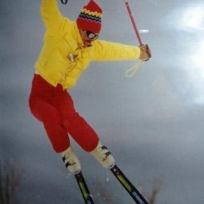
10 years ago I was lucky enough to spot a notice on another Internet ski forum requesting a few more folks to sign up for a backcountry adventure at Mt. Hood, OR, a 2 day stay in the Silcox Hut at 7000 feet on the mountain, an attempt at the 11,200 ft summit and skiing from high above the lifts, which end at 8500 feet. It turned out to be a great adventure, repeated each year in the first week of May, with great people who are now old and good friends. I am the sole eastern representative. The others are all from the Seattle area and most are instructors with the Mountaineers, a Seattle based group that has trained about 3/4 of all Americans who have summited Everest.
http://en.wikipedia.org/wiki/The_Mountaineers_(club)
All trips since that first one have been oversubscribed. Participants are guaranteed a slot for the following year if they turn in their deposit check on the last day of the current trip. The capacity is 20 each year; a few slots for new people open up at the last minute when life's uncertainties force a few reluctant cancellations. Fellowship and tall tales enhanced by drink are as much a part of the trip as mountaineering. Also essential are organizers Ron and Jeanette and Hutmaster Steve, a great host and raconteur.

Hood is a massive mountain, presenting 9000 feet of vertical relief to the moisture laden winds blowing off the close by Pacific. It is one of the Cascade volcanoes, dormant but not extinct; last eruption, a small one in 1907. Hood receives huge annual snowfalls and has North America's only year round lift served skiing.
http://www.timberline-lodge.com/conditions/
These conditions are at 6000 ft. Storms and snow depths increase with great rapidity with elevation. A stay at Timberline Lodge, at the timberline at 6000 feet belongs on the bucket list of every skier, or maybe just everybody period.
http://www.timberlinelodge.com/
Denis - DCSki Supporter 
May 10, 2012
Member since 07/12/2004 🔗
2,337 posts
Please excuse the awkwardness of continuing this as a reply. The combination of an iPad and the design of the web page forced it.

Continued.
Hood can and will throw any kind of weather at you. In my trips we have had more blizzards than summit attempts. Last year we had a white out blizzard with 100 mph winds and all but a few macho men rode the snow cat down to the tree line and skied the lower lifts. My son and 2 others skied down. It took them 2.5 hours fighting vertigo, blowdowns and 50 ft visibility to descend 1000 feet. Getting lost is a real threat. All the Cascade volcanoes are subject to an insidious effect called 'fall line error'. If lost without a compass, and you proceed where your senses tell you is straight downhill, You will be drawn steadily to the southwest where there are big cliffs, deep cut canyons and no roads or civilization for miles.

I arrived early and skied on Sat., 5/5 in a clearing storm that dumped 18" in the previous few days. In the span of 3 hrs. I skied powder in the trees, Cascade concrete, sastrugi, wind crust and even a little rain crust on the upper mountain. I loved it all. Am a big mountain lover and enjoy the challenge and even a little threat, up to a point. The next day on my own and the following 2 with the hut group had fantastic sunny weather and a 2 hour or so window of perfect corn skiing each day. You had to hit the window; earlier was boilerplate and later was mush.

2/3 of the folks climbed this year and all of them summited. In the past I have made 2 summit tries and realized it is not for me. I am a skier. For those who may have the climbing passion, here are the pictures from this year's climb.
https://picasaweb.google.com/ron.jarvis/MtHood#
JimK - DCSki Columnist
May 10, 2012
Member since 01/14/2004 🔗
2,963 posts
Looks beautiful. I recognized you in some of the photos of the interior of the hut doing your best to contribute to the "Fellowship and tall tales enhanced by drink" portion of the experience. grin
Way to get after it with a capital G.
The Colonel - DCSki Supporter 
May 10, 2012
Member since 03/5/2004 🔗
3,110 posts
Denis,
Great story and pictures. The climbing to the top did not look like fun.
Have a great summer.
The Colonel
bob
May 11, 2012
Member since 04/15/2008 🔗
755 posts
Great story and photos Denis. Thanks for sharing.

When trying to summit, does the group summit from the west or south? I presume nobody tries the north as it is much more treacherous.

Also, regarding photo 3, were you above "the nose" looking west -- with the nose in the foreground of the picture? (also on the right side of photo 4)

Also re photo 3 -- is that the Magic Mile or the Palmer lift visible in the distance? After looking at the photo in full screen mode, I can see the bottom terminus of the lift, so it has to be Palmer.

For those unfamiliar with Hood and Timberline, "the nose" is a prominent large bump on the face of the mountain - visible near the top left of the mountain in Denis' first picture.
SCWVA
May 12, 2012
Member since 07/13/2004 🔗
1,052 posts
Denis,

Is there a Mt. Washington trip in the near future?
Denis - DCSki Supporter 
May 14, 2012
Member since 07/12/2004 🔗
2,337 posts
I don't know the term Nose. Let me tell you some about the upper mountain in the terms I know. The skiing and the approach we used is from due south. There is a long mild pitch on which the magic Mile and Palmer lifts sit. Palmer is the highest, ending at 8500 ft. From there it steadily steepens until you reach the crater. In the first pic you see a natural amphitheater of rock with an opening to the south. That is where a past violent eruption blew out sideways. In the middle of the opening is crater rock. To the lookers left is illumination rock and between them illumination saddle. On lookers right is the Steel Cliff. Unseen in front of the steel cliff is the gaping White River Canyon. Between the canyon and crater rock is Triangle Morraine. Above Crater Rock is the Devils Kitchen, the present crater floor of hot steaming mud and volcanic gases. More later. I'm hitting the road now, family visit.
Denis - DCSki Supporter 
May 15, 2012
Member since 07/12/2004 🔗
2,337 posts
Originally Posted By: Denis
I don't know the term Nose. Let me tell you some about the upper mountain in the terms I know. The skiing and the approach we used is from due south. There is a long mild pitch on which the magic Mile and Palmer lifts sit. Palmer is the highest, ending at 8500 ft. From there it steadily steepens until you reach the crater. In the first pic you see a natural amphitheater of rock with an opening to the south. That is where a past violent eruption blew out sideways. In the middle of the opening is crater rock. To the lookers left is illumination rock and between them illumination saddle. On lookers right is the Steel Cliff. Unseen in front of the steel cliff is the gaping White River Canyon. Between the canyon and crater rock is Triangle Morraine. Above Crater Rock is the Devils Kitchen, the present crater floor of hot steaming mud and volcanic gases. More later. I'm hitting the road now, family visit.


Illumination Rock is a slender fin, perhaps 200 ft. high. The side seen in pic 1 faces directly east and catches the morning sun which lights it in brilliant orange glow, hence the name. The Steel Cliff, on the other side of the crater, is a good 500 feet high and the rock has a steel blue cast in places. Triangle Morraine faces southeast and is the first place on the upper mountain to soften in the morning sun. However you never ski it in bad visibility when you can't see the edge of White River Canyon. The prevailing wind build a huge cornice there which can overhang by as much as 30 feet. Breaking through that cornice would make for a bad day. Illumination Saddle offers gradually steepening slopes up to about 45 degrees near the rock itself. However the rock receives early sun and once it goes above freezing the rocks start falling. I have sat there, with my cramponed heels dug in waiting for the boilerplate to soften, and been bombarded by baseball size rocks. Fortunately you can hear them coming, bouncing and skittering on the hard snow, making a kind of buzz that I have heard nowhere else. I decided that day to ski down before it softened, even if it was hard and icy. Falling rock, loosened by the sun, is the reason that climbers like an "alpine start", somewhere between midnight and 4 AM. Ideally they summit as the sun comes up and are down before the rockfall begins. The mountain is neither for you nor against you, but it is very unforgiving of mistakes. Despite all this, Bob is correct that routes on other sides of the mountain, particularly the north side are far tougher.

Ski and Tell

Speak truth to powder.

Join the conversation by logging in.

Don't have an account? Create one here.

0.15 seconds